Home » All prints and maps

 
London, Trinity Church, Cloudesley Sq. & New National Scotch Church, 1831

London, Trinity Church, Cloudesley Sq. & New National Scotch Church, 1831.
"Trinity Church, Cloudesley Square" with "New National Scotch Church, Sidmouth St., Grays Inn Road" engraved by W.Watkins after pictures by T.H.Shepherd, published in London in the Nineteenth Century, 1831. Two steel engraved antique prints on one page, with recent hand colouring. Good condition. Size 15 x 25 cms including title, plus margins. Ref H4835

 
London, New Bethlem Hospital & Penitentiary at Millbank, 1831

London, New Bethlem Hospital & Penitentiary at Millbank, 1831.
"New Bethlem Hospital, St George's Fields" with "Penitentiary, Millbank, Westminster" engraved by J.Tingle after pictures by T.H.Shepherd, published in London in the Nineteenth Century, 1831. Two steel engraved antique prints on one page, with recent hand colouring. Good condition. Size 15 x 24 cms including title, plus margins. Ref H4834

 
London, Salters Hall & The Guild Hall, 1831

London, Salters Hall & The Guild Hall, 1831.
"Salters Hall" with "The Guild Hall" engraved by Robert Acon after pictures by T.H.Shepherd, published in London in the Nineteenth Century, 1831. Two steel engraved antique prints on one page, with recent hand colouring. Good condition. Size 14.5 x 24.5 cms including title, plus margins. Ref H4833


London, Guildhall in Westminster & Pall Mall East, 1831

London, Guildhall in Westminster & Pall Mall East, 1831.
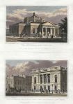
"The Guildhall, Westminster" with "New Buildings Pall-Mall East, and University Club House" engraved by M.Barrenger after pictures by T.H.Shepherd, published in London in the Nineteenth Century, 1831. Two steel engraved antique prints on one page, with recent hand colouring. Good condition. Size 15 x 23 cms including title, plus margins. Ref H4832

 
Countess of Tankerville, 1836

Countess of Tankerville, 1836.
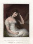
"The Rt. Hon. Corisande Armandine Leonice Sophie, Countess of Tankerville" engraved by J.Cochran after a picture by Mrs.Mee, published in The Portrait and Landscape Gallery, 1836. Steel engraved antique print with recent hand colour, good condition. Size 10 x 15 cms including title, plus margins. Ref H4831

 
Honourable Mrs.Pelham, 1836

Honourable Mrs.Pelham, 1836.
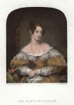
"The Honourable Mrs.Pelham" engraved by J.Cochran after a picture by Mrs.Robertson, published in The Portrait and Landscape Gallery, 1836. Steel engraved antique print with recent hand colour, good condition. Size 9 x 14 cms including title, plus margins. Ref H4830


Lady Graham, 1836

Lady Graham, 1836.
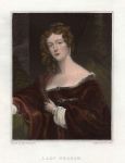
"Lady Graham" engraved by T.A.Dean after a picture by Mrs.Robertson, published in The Portrait and Landscape Gallery, 1836. Steel engraved antique print with recent hand colour, good condition. Size 10 x 14.5 cms including title, plus margins. Ref H4829

 
Mrs. Stanhope, 1836

Mrs. Stanhope, 1836.
"Mrs. Stanhope" engraved by T.Dean after a picture by A.E.Chalon, published on the title page to The Portrait and Landscape Gallery, 1836. Steel engraved antique print with recent hand colour, good condition. Size 12 x 21.5 cms including all text, plus margins. Ref H4828

 
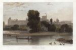
Berkshire, Windsor Castle, 1836

Berkshire, Windsor Castle, 1836.
"Windsor Castle" engraved by J.C.Armytage after a picture by W.Daniell, published in The Portrait and Landscape Gallery, 1836. Steel engraved antique print with recent hand colour, good condition. Size 17 x 11.5 cms, plus margins. Ref H4827


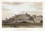
Cheshire, Eaton Hall, 1836

Cheshire, Eaton Hall, 1836.
"Eaton Hall" engraved by J.Redaway after a picture by W.Daniell, published in The Portrait and Landscape Gallery, 1836. Steel engraved antique print with recent hand colour, good condition. Size 18 x 12.5 cms, plus margins. Ref H4826

 
Great Britain, waterways map, 1820

Great Britain, waterways map, 1820.
"Canals, navigations, and Railways, of Great Britain" engraved by Alex Findlay after Arrowsmith, published in Rees's Cyclopedia; or, Universal Dictionary ..., 1820. Copper engraved antique map with recent hand colour, centrefold as published, good condition. Size 25 x 39.5 cms, plus margins. Ref H4825

 
England & Wales map, 1820

England & Wales map, 1820.
"England and Wales" engraved by Hewitt after Arrowsmith, published in Rees's Cyclopedia; or, Universal Dictionary ..., 1820. Copper engraved antique map with recent hand colour, centrefold as published, good condition. Size 25.5 x 40 cms, plus margins. Ref H4824


Ireland map, 1820

Ireland map, 1820.
"Ireland" engraved by Cooper after Arrowsmith, published in Rees's Cyclopedia; or, Universal Dictionary ..., 1820. Copper engraved antique map with recent hand colour, centrefold as published, good condition. Size 25 x 40 cms, plus margins. Ref H4823

 
Scotland map, 1820

Scotland map, 1820.
"Scotland" engraved by Cooper after Arrowsmith, published in Rees's Cyclopedia; or, Universal Dictionary ..., 1820. Copper engraved antique map with recent hand colour, centrefold as published, good condition. Size 25 x 40 cms, plus margins. Ref H4822

 
Scandinavia map, 1820

Scandinavia map, 1820.
"Sweden, Denmark and Norway" engraved by Cooper after Arrowsmith, published in Rees's Cyclopedia; or, Universal Dictionary ..., 1820. Copper engraved antique map with recent hand colour, centrefold as published, good condition. Size 25 x 40 cms, plus margins. Ref H4821


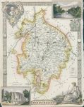
Warwickshire, Moule map, 1850

Warwickshire, Moule map, 1850.
"Warwickshire" by Thomas Moule, published in James Barclay's Complete and Universal Dictionary ..., about 1850. Decorative steel engraved antique map with recent hand colour. The vignettes show Warwick Castle and Kenilworth Castle. Very narrow margins with slight loss, these maps were very often tightly trimmed by the publishers. Size 20.5 x 26.5 cms plus margins. Ref H4820

 
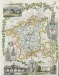
Worcestershire, Moule map, 1850

Worcestershire, Moule map, 1850.
"Worcestershire" by Thomas Moule, published in James Barclay's Complete and Universal Dictionary ..., about 1850. Decorative steel engraved antique map with recent hand colour. The vignettes show Worcester, Great Malvern and Croom Court. Narrow margins, these maps were very often tightly trimmed by the publishers. Size 20.5 x 26.5 cms plus margins. Ref H4819

 
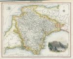
Devonshire, map by J & C Walker, 1831

Devonshire, map by J & C Walker, 1831.
"Devonshire" engraved by J & C Walker, published in Devon & Cornwall Illustrated, dated 1831. Steel engraved county map with recent hand colouring. Vignette view of Babbacombe Bay. Narrow irregular upper margin, otherwise good condition. Size 16 x 11 cms including title, plus margins. Ref H4818

 
« Previous | ...430 | 431 | 432 | 433 | 434 | 435 | 436 | 437 | 438 | 439 | 440... | Next »


© 2003 - 2020 Website copyright Steve Bartrick
Royalty free stock images of antique prints of interest to historians, students and family history researchers