Please see my main site ANTIQUEPRINTS.COM For original antique prints and maps
Charing Cross - 1837
Home » Topographical prints (named places) » England, prints and county maps >>> » All prints and maps
London, View in the Strand, 1810. "View in the Strand ... Westminster" copper engraved print published in The Beauties of England and Wales, 1810. Very slight age browning. Size 14.5 x 11 cms including title, plus margins. Ref F424
London, Old Somerset House & The Savoy, 1810. "Old Somerset House" and "The Savoy, London" copper engraved print published in The Beauties of England and Wales, 1810. Very slight age browning. Size 15 x 12.5 cms including title, plus margins. Ref F423
London, Strand Bridge, 1810. "Strand Bridge" copper engraved print published in The Beauties of England and Wales, 1810. Very slight age browning. Size 15.5 x 11.5 cms including title, plus margins. Ref F422
London, St.Martin's Church, Westminster, 1810. "St. Martin's Church, Westminster" copper engraved print published in The Beauties of England and Wales, 1810. Very slight age browning. Size 10.5 x 17 cms including title, plus margins. Ref F421
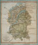
Wiltshire, geological map by W.Smith, 1821 or later. "Geological Map of Wiltshire by W.Smith, Mineral Surveyor". William Smith's geological map based on a large county map by John Cary published in 1821. With full wash hand colour to indicate the different strata and extra engraved text explaining the various layers. Dissected into 15 panels and laid down on old thin green card, trimmed almost to left and right neatlines, some age browning and soiling. Size 48 x 57 cms including title. Ref F341
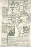
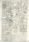
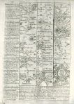
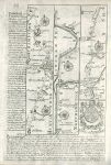
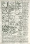
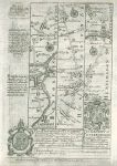
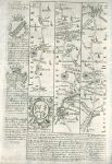
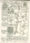
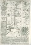
Surrey, route map with London, Wandsworth, Kingston, Cobham, Guildford, 1764. [ Route map with London, Wandsworth, Kingston, Cobham, Guildford and Godalming ] by Emanuel Bowen after the earlier survey by John Ogilby, and published by John Owen in Britannia Depicta ..., 1764. On the verso is part of a description of London. Copper engraved map. Size 12 x 18 cms plus margins. Ref F308
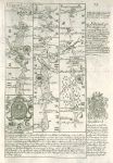
Hampshire, route map with Liphook, Petersfield, Harnden and Portsmouth, 1764. [ Route map with Liphook, Petersfield, Harnden and Portsmouth ] by Emanuel Bowen after the earlier survey by John Ogilby, and published by John Owen in Britannia Depicta ..., 1764. On the verso is part of a description of London. Copper engraved map. Size 12 x 18 cms plus margins. Ref F307
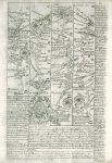
Devon, route map with South Moulton, Barnstable, Torrington and Hatherley, 1764. [ Route map with South Moulton, Barnstable, Torrington and Hatherley ] by Emanuel Bowen after the earlier survey by John Ogilby, and published by John Owen in Britannia Depicta ..., 1764. On the verso is part of a route through Hatherley, Launceston and Camelford. Copper engraved map. Size 12 x 18 cms plus margins. Ref F306
Somerset, route map with Bridgewater and Dulverton, 1764. [ Route map with Bridgewater and Dulverton ] by Emanuel Bowen after the earlier survey by John Ogilby, and published by John Owen in Britannia Depicta ..., 1764. On the verso is part of a route through Bruton and Bridgewater. Copper engraved map. Size 12 x 18 cms plus margins. Ref F305
Hampshire / Wiltshire, route map with Andover, Amesbury and Warminster, 1764. [ Route map with Andover, Amesbury and Warminster ] by Emanuel Bowen after the earlier survey by John Ogilby, and published by John Owen in Britannia Depicta ..., 1764. On the verso is part of a description of London. Copper engraved map. Size 12 x 18 cms plus margins. Ref F304
Huntingdon / Northampton, route map with Stilton, Peterborough, Crowland and Spalding, 1764. [ Route map with Stilton, Peterborough, Crowland and Spalding ] by Emanuel Bowen after the earlier survey by John Ogilby, and published by John Owen in Britannia Depicta ..., 1764. On the verso is part of a description of London. Copper engraved map. Size 12 x 18 cms plus margins. Ref F303
Cornwall, route map with Tregear, Padstow, St.Merryn and Truro, 1764. [ Route map with Tregear, Padstow, St.Colomb (St.Merryn) and Truro ] by Emanuel Bowen after the earlier survey by John Ogilby, and published by John Owen in Britannia Depicta ..., 1764. On the verso is part of a description of London. Copper engraved map. Size 12 x 18 cms plus margins. Ref F302
Lancashire / Westmoreland, route map with Lancaster, Burton and Kendal, 1764. [ Route map with Lancaster, Burton and Kendal ] by Emanuel Bowen after the earlier survey by John Ogilby, and published by John Owen in Britannia Depicta ..., 1764. On the verso is part of a route with Penrith and Carlisle. Copper engraved map. Size 12 x 18 cms plus margins. Ref F301
Lancashire, route map with Warrington, Wigan, Whittle, Preston & Garstang, 1764. [ Route map with Warrington, Wigan, Whittle, Preston & Garstang ] by Emanuel Bowen after the earlier survey by John Ogilby, and published by John Owen in Britannia Depicta ..., 1764. On the verso is part of a route in Staffordshire and Cheshire. Copper engraved map. Size 12 x 18 cms plus margins. Ref F300
Bedford / Huntingdon, route map with Tamesford, St.Neotts, Stilton and Peterborough, 1764. [ Route map with Tamesford, St.Neotts, Stilton and Peterborough ] by Emanuel Bowen after the earlier survey by John Ogilby, and published by John Owen in Britannia Depicta ..., 1764. On the verso is part of a description of London. Copper engraved map. Size 12 x 18 cms plus margins. Ref F299
Leicestershire, route map with Great Glenn, Leicester, Loughborough, Kegworth and Derby, 1764. [ Route map with Great Glenn, Leicester, Loughborough, Kegworth and Derby ] by Emanuel Bowen after the earlier survey by John Ogilby, and published by John Owen in Britannia Depicta ..., 1764. On the verso is part of a route through Stoney Stratford, Northampton and Market Harborough. Copper engraved map. Size 12 x 18 cms plus margins. Ref F298
Cambridgeshire / Norfolk, route map with Ely, Littleport and Kings Lynn, 1764. [ Route map with Ely, Littleport and Kings Lynn ] by Emanuel Bowen after the earlier survey by John Ogilby, and published by John Owen in Britannia Depicta ..., 1764. On the verso is part of a route through Puckeridge and Cambridge. Copper engraved map. Size 12 x 18 cms plus margins. Ref F297
Lincolnshire, route map with Lincoln, Brigg and Barton-Upon-Humber, 1764. [ Route map with Lincoln, Brigg and Barton-Upon-Humber ] by Emanuel Bowen after the earlier survey by John Ogilby, and published by John Owen in Britannia Depicta ..., 1764. On the verso is part of a route through Market Deeping and Sleaford to Lincoln. Copper engraved map. Size 12 x 18 cms plus margins. Ref F296
© 2003 - 2020 Website copyright Steve Bartrick Royalty free stock images of antique prints of interest to historians, students and family history researchers