Please see my main site ANTIQUEPRINTS.COM For original antique prints and maps
Charing Cross - 1837
Home » Topographical prints (named places) » England, prints and county maps >>> » All prints and maps
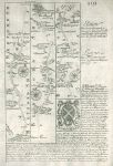
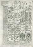
Hertford / Bedfordshire, route map with St.Albans, Bedford and Oakley, 1764. [ Route map with St.Albans, Bedford and Oakley ] by Emanuel Bowen after the earlier survey by John Ogilby, and published by John Owen in Britannia Depicta ..., 1764. On the verso is part of a route through Wellingborough, Kettering, Uppingham to Oakham. Copper engraved map. Size 12 x 18 cms plus margins. Ref F295
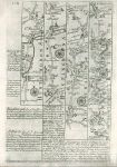
Huntingdon / Northamptonshire, route map with St.Neots, Catworth Magna and Oakham, 1764. [ Route map with Tamesford, St.Neots, Catworth Magna and Oakham ] by Emanuel Bowen after the earlier survey by John Ogilby, and published by John Owen in Britannia Depicta ..., 1764. On the verso is part of a route through High Barnet, Hatfield, Baldock and Biggleswade. Copper engraved map. Size 12 x 18 cms plus margins. Ref F294
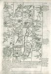
Worcestershire / Shropshire, route map with Tenbury, Ludlow and Montgomery, 1764. [ Route map with Tenbury, Ludlow and Montgomery ] by Emanuel Bowen after the earlier survey by John Ogilby, and published by John Owen in Britannia Depicta ..., 1764. On the verso is part of a description of Bedfordshire. Copper engraved map. Size 12 x 18 cms plus margins. Ref F293
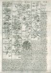
Yorkshire, route map with Barnsley, Halifax and Skipton, 1764. [ Route map with Barnsley, Halifax and Skipton ] by Emanuel Bowen after the earlier survey by John Ogilby, and published by John Owen in Britannia Depicta ..., 1764. On the verso is part of a route through Coniston, Carlton, Middleham and Richmond. Copper engraved map. Size 12 x 18 cms plus margins. Ref F292
Leicestershire & Nottinghamshire, route map with Oakham, Melton Mowbray, Nottingham, Mansfield, 1764. [ Route map with Oakham, Melton Mowbray, Plumtree, Nottingham and Mansfield ] by Emanuel Bowen after the earlier survey by John Ogilby, and published by John Owen in Britannia Depicta ..., 1764. On the verso is part of a route through Aughton, Rotherham and Barnsley. Copper engraved map. Size 12 x 18 cms plus margins. Ref F291
Dorset, route map with Cranbourn, Blandford, Dorchester & Weymouth, 1764. [ Route map with Dunkton, Cranbourn, Mid Gusset (now Gussage), Blandford, Dorchester & Weymouth ] by Emanuel Bowen after the earlier survey by John Ogilby, and published by John Owen in Britannia Depicta ..., 1764. On the verso is part of a route through Basingstoke, Stockbridge and Broughton in Hampshire. Copper engraved map. Size 12 x 18 cms plus margins. Ref F290
Old London Bridge, 1720. "London Bridge" copper engraving published in Stow's Survey of London, 1720. With recent hand colour. Good condition with plate mark and good margins. Size 32.5 x 21 cms plus margins. Ref F181
Bristol, Clifton & Hot Wells area, 1810. "Clifton and the Hot Wells" anonymous engraver, published in Guide to all the Watering and Sea Bathing Places ..., about 1810. Small copper engraved map with recent hand colour. Slight foxing, otherwise good condition with good margins. Size 13 x 8 cms including title, plus margins. Ref F149
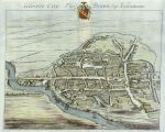
Gloucester City, 1712. "Gloster City Tho. Brown Esq. Alderman" drawn and engraved by J.Kip, published in Robert Atkyns The Ancient and Present State of Gloucestershire, 1712. Copper engraved view type map with recent hand colour, on good quality watermarked paper. Centrefold as published, plate mark and good margins. Size 43 x 35 cms including title, plus margins. Ref F0138
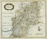
Gloucestershire, 1712. "Glostershire. 1712" anonymous engraver, possibly published in Robert Atkyns The Ancient and Present State of Gloucestershire. Copper engraved map with recent hand colour, on good quality watermarked paper. Centrefold as published, plate mark and good margins. Size 41 x 34 cms plus margins. Ref F0137
Lancashire, 1834. "Lancashire" engraved by Pigot & Sons, published by Pigot & Co. about 1834. Small county map with original hand colour. Some age browning and slight foxing. Size 10.5 x 16.5 cms. Ref F107
Sussex, Eastbourne, 1810. "Eastbourne" anonymous engraver, published in Guide to all the Watering and Sea Bathing Places ..., about 1810. Small copper engraved print. Some foxing. Size 12 x 7.5 cms including title, plus margins. Ref F106
Westmoreland, Windermere, 1810. "Winnandermere" (Windermere) engraved by F.Chesham, published in Guide to all the Watering and Sea Bathing Places ..., about 1810. Small copper engraved print. Slight foxing. Size 12 x 7.5 cms including title, plus margins. Ref F104
Westmoreland, Ullswater, 1810. "Ullswater" engraved by Neele, published in Guide to all the Watering and Sea Bathing Places ..., about 1810. Small copper engraved print. Slight foxing. Size 12 x 7.5 cms including title, plus margins. Ref F103
Dorset, Portland from Weymouth, 1810. "Portland from Weymouth" engraved after a picture by J.Nixon, published in Guide to all the Watering and Sea Bathing Places ..., about 1810. Small copper engraved print. Slight foxing. Size 12 x 7.5 cms including title, plus margins. Ref F102
Dorset, Weymouth, 1810. "The Esplanade at Weymouth" engraved after a picture by J.Nixon, published in Guide to all the Watering and Sea Bathing Places ..., about 1810. Small copper engraved print. Slight foxing. Size 12 x 7.5 cms including title, plus margins. Ref F101
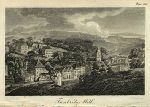
Kent, Tunbridge Wells, 1810. "Tunbridge Wells" engraved by Isaac Taylor, published in Guide to all the Watering and Sea Bathing Places ..., about 1810. Small copper engraved print. Slight foxing. Size 12 x 7.5 cms including title, plus margins. Ref F100
Kent, Tunbridge Wells, 1810. "Tunbridge Wells" anonymous engraver, published in Guide to all the Watering and Sea Bathing Places ..., about 1810. Small copper engraved print. Slight foxing. Size 12 x 7.5 cms including title, plus margins. Ref F99
© 2003 - 2020 Website copyright Steve Bartrick Royalty free stock images of antique prints of interest to historians, students and family history researchers