Home » Antique maps » Europe maps >>> » France, antique maps

 
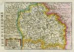
France, Bourbon, about 1637

France, Bourbon, about 1637.
" Borbonium Ducatus " (Bourbonne) by Mercator / Jansson, published in an edition of the Atlas Minor, about 1637. Copper engraved map with old hand colour. English text on reverse. Letterpress text page heading overprinted on left side of map, otherwise good condition. Size 23.5 x 16.5 cms. Ref E300

 
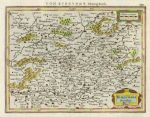
France, Burgundy, about 1610

France, Burgundy, about 1610.
" Burgundia Ducatus " (Burgundy) by Mercator / Jansson, published in an edition of the Atlas Minor, 1610 or later. Copper engraved map with old hand colour. German text on reverse. Good condition. Size 19.5 x 14.5 cms. Ref E295

 
France in Provinces, Ostells New General Atlas, 1813

France in Provinces, Ostells New General Atlas, 1813.
" France in Provinces " drawn and engraved by J.C.Russell, published in Ostell's New General Atlas, 1813. Copper engraved map with original hand colour. Detail showing part of the map. Slightly soiled, plate mark and good margins. Size 21.5 x 18.5 cms. Ref D6795


France, Garonne Basin, Atlas Universel, 1877

France, Garonne Basin, Atlas Universel, 1877.
" La France Historique, Bassin de la Garonne " engraved by Erhard after Vuillemin, published in Atlas Universel D'Histoire et de Geographie, Paris, 1877. Lithographic map with recent hand colour. Centre-fold as published. Size 26 x 20 cms. Ref D6669

 
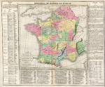
France, with Battles marked, Lavoisne 3rd edn, 1821

France, with Battles marked, Lavoisne 3rd edn, 1821.
" Geographical and Statistical Map of France ", "divided into Governments indicating the places rendered celebrated by Battles or Sieges " by C.Gross, engraved by J.Yeager, published by M.Carey & Son in A Complete Genealogical, Historical, Chronological and Geographical Atlas .. by M.Lavoisne, third American (Philadelphia) edition, 1821. Various notes and statistics around and below the map. Key to the marked battle and siege sites below the map itself. Detail showing part of the map. Copper engraving with full original hand colour, centre-fold as published. Some browning down centre-fold and slight soiling. Margins of 1 cms or more. Overall size 51 x 41.5 cms. Ref D6116

 
France, Atlas Modern Geography, 1853

France, Atlas Modern Geography, 1853.
" France " engraved by Sidney Hall and published in Butler's Atlas of Modern Geography, 1853. Steel engraved map with original hand colour. Centrefold as published, some soiling. Size 26 x 20 cms. Ref D5998


France, Ecclesiastical, Atlas Universel, 1877

France, Ecclesiastical, Atlas Universel, 1877.
" La France Divisee par Provinces Ecclesiastiques " engraved by Erhard after Vuillemin, published in Atlas Universel D'Histoire et de Geographie, Paris, 1877. Lithographic map with original hand colour. Centre-fold as published. Size 26 x 19.5 cms. Ref D4509

 
France, Judiciary, Atlas Universel, 1877

France, Judiciary, Atlas Universel, 1877.
" La France Judiciaire " engraved by Erhard after Vuillemin, published in Atlas Universel D'Histoire et de Geographie, Paris, 1877. Lithographic map with original hand colour. Centre-fold as published. Size 26 x 19.5 cms. Ref D4508

 
France, Universities, 18 Academies, Atlas Universel, 1877

France, Universities, 18 Academies, Atlas Universel, 1877.
" La France Universitaire, Divisee en 18 Academies " engraved by Erhard after Vuillemin, published in Atlas Universel D'Histoire et de Geographie, Paris, 1877. Lithographic map with original hand colour. Centre-fold as published. Size 26 x 19.5 cms. Ref D4507


France, Agriculture & Industry, (2 sheets) Atlas Universel, 1877

France, Agriculture & Industry, (2 sheets) Atlas Universel, 1877.
" France, Agricole, Industrielle et Commerciale " engraved by Erhard after Vuillemin, published in Atlas Universel D'Histoire et de Geographie, Paris, 1877. Pair of lithographic maps with original hand colour. Centre-folds as published. Size 26 x 20 cms each. Ref D4505

 
France in 511, 567, 628 & 714, Atlas Universel, 1877

France in 511, 567, 628 & 714, Atlas Universel, 1877.
[ France, 4 maps showing France in 511, 567, 628-38 and 714 AD ] engraved by Erhard after Vuillemin, published in Atlas Universel D'Histoire et de Geographie, Paris, 1877. Lithographic map with original hand colour, centre fold as published. Size 26.5 x 20 cms. Ref D4492

 
France, Charlemagne Empire in 814, Atlas Universel, 1877

France, Charlemagne Empire in 814, Atlas Universel, 1877.
" Empire de Charlemagne en 814 ... " engraved by Erhard after Vuillemin, published in Atlas Universel D'Histoire et de Geographie, Paris, 1877. Lithographic map with original hand colour. Centre-fold as published. Size 26.5 x 20 cms. Ref D4489


France in 1483, Atlas Universel, 1877

France in 1483, Atlas Universel, 1877.
" France en 1483 a la morte de Louis XI " engraved by Erhard after Vuillemin, published in Atlas Universel D'Histoire et de Geographie, Paris, 1877. Lithographic map with original hand colour. Size 17 x 12.5 cms. Ref D4488

 
Roman France on 2 sheets, Atlas Universel, 1877

Roman France on 2 sheets, Atlas Universel, 1877.
" Gallia a C.J.Caesaris Tempore Usque as Theodosii Magni tempus ... " pair of maps engraved by Erhard after Vuillemin, published in Atlas Universel D'Histoire et de Geographie, Paris, 1877. Lithographic map with original hand colour. Centre-folds as published. Size each 26.5 x 20 cms. Ref D4435

 
France, Merovingian Gaul, 1877

France, Merovingian Gaul, 1877.
" Gaule pendant L'Epoque Merovingienne " engraved by Erhard after Vuillemin, published in Atlas Universel D'Histoire et de Geographie, Paris, 1877. Lithographic map with original hand colour. Centre-fold as published. Size 26.5 x 20 cms. Ref D4430


France (ancient), 1811

France (ancient), 1811.
" La Gaule " drawn by Herisson, engraved by Glot and published in Nouvel Atlas Portatif by Desray, Paris, 1811. Copper engraved map with original outline hand colour. Detail showing the Paris area. Good condition with good margins. Size 23.5 x 18.5 cms. Ref D3373

 
France in Provinces, Smith's New General Atlas, 1824

France in Provinces, Smith's New General Atlas, 1824.
" France in Provinces " engraved by E.Jones and published in Smith's New General Atlas, 1824 (map dated 1820). Copper engraved map with original hand colour. Detail showing the Paris area. Very slightly soiled. Size 33.5 x 26 cms. Ref D3228

 
France since 1815, published 1821

France since 1815, published 1821.
" Geographical and Statistical Map of France " by J.Aspin, engraved by Kneass, Young & Co., published by M.Carey & Son in A Complete Genealogical, Historical, Chronological and Geographical Atlas .. by M.Lavoisne, third American (Philadelphia) edition, 1821. Various notes and statistics around and below the map. Detail showing key to the small flags on the map. Copper engraving with full original hand colour, centre-fold as published. Slight browning down centre-fold and slight soiling. Margins of 1 cms or more. Overall size 51 x 41.5 cms. Ref C8941

 
« Previous | ...10 | 11 | Next »


© 2003 - 2020 Website copyright Steve Bartrick
Royalty free stock images of antique prints of interest to historians, students and family history researchers