Home » All prints and maps

 
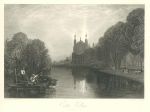
Berkshire, Eton College, 1838

Berkshire, Eton College, 1838.
"Eaton College, Berkshire" (Eton) drawn by J.M.W.Turner, engraved by W.Radclyffe and published in Picturesque Views in England and Wales .. Engraved under the superintendance of Charles Heath, 1838 (print is dated 1831.) Steel engraved antique print. Partial plate mark and wide margins. Size 24 x 18.5 cms including title, plus margins. Ref F4792

 
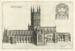
Gloucester Cathedral, Daniel King, 1673

Gloucester Cathedral, Daniel King, 1673.
"Ecclesiae conventualis Glouc: facies australis" (Gloucester Cathedral south view) engraved by Daniel King and published in William Dugdale's Monasticon Anglicanum..., about 1673. Copper engraved print, centrefold as published, plate mark and good margins. Closed tear to upper few cms of centrefold, otherwise good condition. Size 31 x 20.5 cms plus margins. Ref F4791

 
Germany, Island of Rugen, booklet with two views, 1807

Germany, Island of Rugen, booklet with two views, 1807.
"A Tour through the Island of Rugen, in the Baltic, During the year 1805, in a series of Letters" by a 'Temporary Inhabitant'. Small 64 page booklet measuring 13 x 21 cms, containing a detailed description of the island, along with two aquatint plates with original hand colour. Click here to see the second smaller plate showing a cottage near the lake of Hiddon. Both plates good condition, booklet has no covers and was possibly once bound up as part of a larger volume. Size of larger folding plate 22 x 15.5 cms plus good margins. Ref F4790


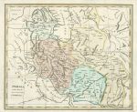
Persia (Iran & Iraq), about 1820

Persia (Iran & Iraq), about 1820.
"Persia Drawn from the most respectable Authorities" anonymous copper engraved map with original hand colouring, published about 1820. Several (flattened) folds as published, lower right corner close cropped and augmented, not affecting the map area. Size 26 x 21.5 cms. Ref F4789

 
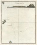
Japan, Volcanic Islands, Cook's Voyages, 1785

Japan, Volcanic Islands, Cook's Voyages, 1785.
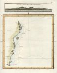
"View of Sulphur Island bearing ENE" with a map of three islands off Japan. Engraved by W.Harrison after a survey possibly by Bligh, with a view possibly by Ellis, published in Cook's A Voyage to the Pacific Ocean ..., 1785. Copper engraved map with recent hand colour, good condition. Size 21 x 26 cms plus good margins with plate mark. Ref F4788

 
Japan, Cook's Voyages, 1785

Japan, Cook's Voyages, 1785.
"View of the coast of Japan when we first saw it. The Hill A. bearing West 3 miles distant" engraved by W.Harrison after a survey possibly by Bligh, with a view by Webber, published in Cook's A Voyage to the Pacific Ocean ..., 1785. Copper engraved map with recent hand colour, good condition. Size 19 x 25 cms plus good margins with plate mark. Ref F4787


Italy on 2 sheets, Thomas Kitchin, 1762

Italy on 2 sheets, Thomas Kitchin, 1762.
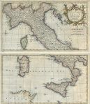
"A New and Accurate Map of Italy, for Busching's Geography; Drawn from the Best Authorities by T. Kitchin Geogr" pair of copper engraved maps by Kitchin published in Busching's A New System of Geography, 1762. Recent hand colour. Both maps have small repaired holes to upper right corner, otherwise good condition and very decorative. Size 27.5 x 22 cms each, plus margins. Ref F4786

 
England & Wales on 2 sheets, Thomas Kitchin, 1762

England & Wales on 2 sheets, Thomas Kitchin, 1762.
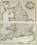
"A Map of England and Wales Divided into Counties; for Busching's Geography: Drawn from the Best Authorities by T. Kitchin Geogr" pair of copper engraved maps by Kitchin published in Busching's A New System of Geography, 1762. Recent hand colour. Upper map has torn and reapired upper right corner, otherwise good condition. Size 27.5 x 22 cms plus margins. Ref F4785

 
Russia in Europe on two sheets, 1796

Russia in Europe on two sheets, 1796.
"Northern Part of Russia, or Muscovy in Europe" and "Southern ..." pair of copper engraved maps published in A New Geographical .. Grammer, 1796. Recent hand colouring. Some creasing and slight soiling. Size 21.5 x 18.5 cms each, plus margins. Ref F4756


London, House of the Hospitallers of St.John in Clerkenwell, 1820

London, House of the Hospitallers of St.John in Clerkenwell, 1820.
"South Gate of the House of Hospitallers of St.John of Jerusalem", with "Remains of the Western Front of the Chapel of the House of Hospitallers of St.John of Jerusalem" and "House of Hospitallers of St.John of Jerusalem, Clerkenwell, taken from the South East" copper engraving after Hollar, published about 1820. Centrefold as published, plate mark and good margins. Size 37.5 x 28 cms including title, plus margins. Ref F4755

 
Derbyshire, Peak Cavern Entrance at Castleton, 1817

Derbyshire, Peak Cavern Entrance at Castleton, 1817.
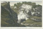
"Entrance of the Great Cavern at Castleton" drawn by J.Farington and engraved by Letitia Byrne, published by T.Cadel in Magna Britannia; ...Topographical Account of the Several Counties of Great Britain, 1817. Copper engraved print with recent hand colour. Two folds as published, lower margin trimmed along lower edge of title inscription. Size 37.5 x 25.5 cms. Ref F4754

 
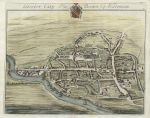
Gloucester City, 1712

Gloucester City, 1712.
"Gloster City Tho. Brown Esq. Alderman" drawn and engraved by J.Kip, published in Robert Atkyns The Ancient and Present State of Gloucestershire, 1712. Copper engraved view type map with recent hand colour, on watermarked paper. Centrefold as published, plate mark and good margins. Closed tears to upper and lower parts of the centrefold, the lower tear extending almost half-way up the fold. The reapirs are visible but this map still makes an interesting decorative item. Size 43 x 35 cms including title, plus margins. Ref F4753


Evolution of the Earth's Crust (geology) by Thomas Webster, 1855

Evolution of the Earth's Crust (geology) by Thomas Webster, 1855.
"Idealer Durchschnitt van der Bildung der Erdrinde" engraved after Thomas Webster and published in Dr. Heinrich Berghaus' Physikalischer Atlas, Gotha, 1855 (map dated 1850.) Fine steel engraved chart with original hand colour, showing a cross section of the crust with stratification and volcanic processes. In the upper part are illustrations of plants and animals from early fossils up to recent times, classified by strata. Several folds as published. This is a large and fascinating plate. Size 81 x 32.5 cms plus margins. Ref F4752

 
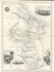
British Guayana, Tallis, 1850

British Guayana, Tallis, 1850.
"British Guayana" drawn and engraved by J.Rapkin, published about 1850. Classic steel engraved Tallis map with original outline hand colour. The vignettes show Georgetown, Christmas cataract, New Amsterdam and Ataraipu. Centre-fold as published, upper and lower margins trimmed with loss of decorative borders. Size 25 x 34.5 cms. Ref F4751

 
Oxfordshire, Blenheim House, cu, 1790

Oxfordshire, Blenheim House, cu, 1790.
"Blenheim House. Built at the expence of the Public and Settled on the Duke of Marlborough & his Posterity" engraved by Prattent and published about 1790. Copper engraved print with recent hand colour. Upper margin trimmed to image edge. Size 39 x 24 cms including title, plus margins. Ref F4750


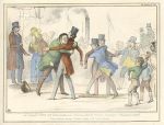
Leaf out of Nicholas Nickleby... John Doyle, HB Sketches, 1839

Leaf out of Nicholas Nickleby... John Doyle, HB Sketches, 1839.
"A Leaf out of Nicholas Nickleby with slight Variations. Nicholas quits the Company - Theatrical emotion of Mr. Vincent Crummles" political caricature by John Doyle, published in his series of HB Sketches, in 1839. Stone lithograph with recent hand colour. Size 35 x 26.5 cms including title, plus margins. Ref F4749

 
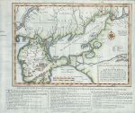
Ukraine, Crimea and Sea of Azov, 1739

Ukraine, Crimea and Sea of Azov, 1739.
"An Exact Map of the Crim (Formerly Taurica Chersonesus), Part of Lesser Tartary, the Sea of Asoph, and the adjacent Country of the Kuban Tartars; as laid down by the Czarina's Geographers; exhibiting the March of the Russian Armies against the Crim Tartars, in the War began with the Turks 1736, and continued the present year 1739" wood engraved map published in The Gentleman's Magazine, 1739. Recent hand colour. Several folds as published. Size 34 x 29 cms including explanation, plus margins. Ref F4748

 
Ukraine, to the east of the Dnieper River, 1739

Ukraine, to the east of the Dnieper River, 1739.
[ Untitled map of part of Ukraine between the rivers Dnieper (Dnipro) and Don ] copper engraved map by E.Bowen published in The Gentleman's Magazine, 1739. Recent hand colour. Lower margin close trimmed to neatline. Size 33 x 19.5 cms plus narrow margins. Ref F4747

 
« Previous | ...1530 | 1531 | 1532 | 1533 | 1534 | 1535 | 1536 | 1537 | 1538 | 1539 | 1540... | Next »


© 2003 - 2020 Website copyright Steve Bartrick
Royalty free stock images of antique prints of interest to historians, students and family history researchers