Home » All prints and maps

 
Mexico, Slaves presented to Cortes in Tabasco (in 1519), 1814

Mexico, Slaves presented to Cortes in Tabasco (in 1519), 1814.
"Donna Marianna & other Female slaves presented to Cortes by the Caique of Tobasco" engraved by J.Martyn, copper engraved antique print published in The World Displayed, 1814. Size 8 x 14 cms, plus margins. Ref F4599

 
Mexico, Meeting between Cortes and Inhabitants of Cozumel (in 1519), 1814

Mexico, Meeting between Cortes and Inhabitants of Cozumel (in 1519), 1814.
"The Meeting between Cortes & the Principal Caique & Inhabitants of Cozumel" engraved by J.Martyn, copper engraved antique print published in The World Displayed, 1814. Size 8 x 14 cms, plus margins. Ref F4598

 
Mexico, Inhabitants of Huiva (in 1502), 1814

Mexico, Inhabitants of Huiva (in 1502), 1814.
"The Inhabitants of Huiva on the Continent of America" engraved by Maguire, copper engraved antique print published in The World Displayed, 1814. Size 8 x 14 cms, plus margins. Ref F4597


Mexico, battle between the natives of Tabasco and the Spanish (in 1519), 1814

Mexico, battle between the natives of Tabasco and the Spanish (in 1519), 1814.
"The Engagement between the Spaniards and the People of Tobasco" engraved by Maguire, copper engraved antique print published in The World Displayed, 1814. Size 8 x 14 cms, plus margins. Ref F4596

 
West Indies or Mexico?, Indians Frightened by a Cannon Shot, 1814

West Indies or Mexico?, Indians Frightened by a Cannon Shot, 1814.
"The Indians flying in Confusion at a Shot discharged from the Ship" engraved by Maguire, copper engraved antique print published in The World Displayed, 1814. Size 8 x 14 cms, plus margins. Ref F4595

 
Armenia, Commemoration of the Dead, 1760

Armenia, Commemoration of the Dead, 1760.
"The Commemoration of the Dead among the Armenians" anonymous engraver, copper engraved antique print published in The Universe Displayed, about 1760. Recent hand colour. Size 16 x 10.5 cms including title, plus margins. Ref F4594


Madagascar, Funeral ceremony, 1760

Madagascar, Funeral ceremony, 1760.
"The Manner of Burying in the Island of Madagascar" anonymous engraver, copper engraved antique print published in The Universe Displayed, about 1760. Recent hand colour. Size 16 x 10.5 cms including title, plus margins. Ref F4593

 
Russia, a Muscovite Funeral, 1760

Russia, a Muscovite Funeral, 1760.
"A Muscovite Funeral" anonymous engraver, copper engraved antique print published in The Universe Displayed, about 1760. Recent hand colour. Size 16 x 10.5 cms including title, plus margins. Ref F4592

 
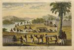
Africa, Ceremony of a Negro Funeral, 1760

Africa, Ceremony of a Negro Funeral, 1760.
"The Ceremony of a Negro Funeral" anonymous engraver, copper engraved antique print published in The Universe Displayed, about 1760. Recent hand colour. Size 16 x 10.5 cms including title, plus margins. Ref F4591


Greece, Women Mourning at Rama, 1760

Greece, Women Mourning at Rama, 1760.
"The Mourning of the Greek Women at Rama" anonymous engraver, copper engraved antique print published in The Universe Displayed, about 1760. Recent hand colour. Size 16 x 10.5 cms including title, plus margins. Ref F4590

 
Ireland, route map with Moatagrenoge, Athlone and Ballinasloe, 1783

Ireland, route map with Moatagrenoge, Athlone and Ballinasloe, 1783.
[ Part of the Dublin to Galway route, including Moatagrenoge, Athlone and Galway ] engraved by G.Terry and published in Taylor and Skinner's Maps of the Roads of Ireland, (2nd edition), 1783. On the verso is part of the same route, including Kilconnel, Athenry and Galway. Copper engraved map. Size 12 x 21.5 cms plus good margins. Ref F4589

 
Ireland, route map with Kinnegad, Kilbride Pass, Terrilspass & Kilbeggan, 1783

Ireland, route map with Kinnegad, Kilbride Pass, Terrilspass & Kilbeggan, 1783.
[ Part of the Dublin to Galway route, including Kinnegad, Kilbride Pass, Terrilspass & Kilbeggan ] engraved by G.Terry and published in Taylor and Skinner's Maps of the Roads of Ireland, (2nd edition), 1783. On the verso is part of the Dublin to Castlebar route, including Ballyhaunis, Clare, Ball & Castlebar. Copper engraved map. Size 12 x 21.5 cms plus good margins. Ref F4588


Ireland, route map with Elphin, Boyle, Lanesboro and Roscommon, 1783

Ireland, route map with Elphin, Boyle, Lanesboro and Roscommon, 1783.
[ Part of the Roscommon & Boyle route, including Elphin, Boyle, Lanesboro and Roscommon ] engraved by G.Terry and published in Taylor and Skinner's Maps of the Roads of Ireland, (2nd edition), 1783. On the verso is part of the Dublin to Castlebar route, including Tulsk, Strokestown & Castlereagh. Copper engraved map. Size 12 x 21.5 cms plus good margins. Ref F4587

 
Ireland, route map with Tulsk, Belanag, Ballaghadirreen & Ballaghy, 1783

Ireland, route map with Tulsk, Belanag, Ballaghadirreen & Ballaghy, 1783.
[ Part of the Killala, Roscommon & Boyle route, including Tulsk, Belanag, Ballaghadirreen & Ballaghy ] engraved by G.Terry and published in Taylor and Skinner's Maps of the Roads of Ireland, (2nd edition), 1783. On the verso is the end of the Dublin to Killala route, including Swineford, Foxford, Ballina & Killala. Copper engraved map. Size 12 x 21.5 cms plus good margins. Ref F4586

 
Ireland, route map with Kenagh, Ballymahon and Tenelick, 1783

Ireland, route map with Kenagh, Ballymahon and Tenelick, 1783.
[ Part of the Dublin to Killala route, including Kenagh, Ballymahon and Tenelick and the surrounding area ] engraved by G.Terry and published in Taylor and Skinner's Maps of the Roads of Ireland, (2nd edition), 1783. On the verso is the continuation of this route, including Killashee, Lanesborough and Strokestown. Copper engraved map. Size 12 x 21.5 cms plus good margins. Ref F4585


Ireland, route map with Mullingar and country to the west, 1783

Ireland, route map with Mullingar and country to the west, 1783.
[ Part of the Dublin to Killala and Roscommon route, including Mullingar and the country to the west ] engraved by G.Terry and published in Taylor and Skinner's Maps of the Roads of Ireland, (2nd edition), 1783. On the verso is part of a route from Dublin to Sligo, including Coloony and Sligo. Copper engraved map. Size 12 x 21.5 cms plus good margins. Ref F4584

 
Ireland, route map with Ballinalack, Edgeworthstown and Longford, 1783

Ireland, route map with Ballinalack, Edgeworthstown and Longford, 1783.
[ Part of the Dublin to Sligo route, including Ballinalack, Edgeworthstown, Ruskybridge and Longford ] engraved by G.Terry and published in Taylor and Skinner's Maps of the Roads of Ireland, (2nd edition), 1783. On the verso is part of a route from Dublin, including Jamestown, Boyle and Carrick on the Shannon. Copper engraved map. Size 12 x 21.5 cms plus good margins. Ref F4583

 
Ireland, route map with Kinnegad, Cloncurry and Mullingar, 1783

Ireland, route map with Kinnegad, Cloncurry and Mullingar, 1783.
[ Part of the Dublin to Sligo route, including Kinnegad, Cloncurry and Mullingar ] engraved by G.Terry and published in Taylor and Skinner's Maps of the Roads of Ireland, (2nd edition), 1783. On the verso is part of a route from Dublin to Sligo, including Dublin, Leixlip, Maynooth and Killcock. Copper engraved map. Size 12 x 21.5 cms plus good margins. Ref F4582

 
« Previous | 1540 | 1541 | 1542 | 1543 | 1544 | 1545 | 1546 | 1547 | 1548 | 1549 | 1550... | Next »


© 2003 - 2020 Website copyright Steve Bartrick
Royalty free stock images of antique prints of interest to historians, students and family history researchers