Please see my main site ANTIQUEPRINTS.COM For original antique prints and maps
Charing Cross - 1837
Home » All prints and maps
Ireland, route map with Sligo and Manor-Hamilton, 1783. [ Part of the Dublin to Sligo route, including Sligo and Manor-Hamilton ] engraved by G.Terry and published in Taylor and Skinner's Maps of the Roads of Ireland, (2nd edition), 1783. On the verso is part of a route including Ballyconnel and Swanlinbar. Copper engraved map. Size 12 x 21.5 cms plus good margins. Ref F4581
Ireland, route map with Killesandra, Cavan & Ballinanaght, 1783. [ Part of the Dublin to Sligo route, including Killesandra, Cavan & Ballinanaght ] engraved by G.Terry and published in Taylor and Skinner's Maps of the Roads of Ireland, (2nd edition), 1783. On the verso is part of a route to Granard, including Lough Sheallin, Finae and Old Castle. Copper engraved map. Size 12 x 21.5 cms plus good margins. Ref F4580
Ireland, route map with Trim and Athboy, 1783. [ Part of the Dublin to Sligo route, including Trim and Athboy ] engraved by G.Terry and published in Taylor and Skinner's Maps of the Roads of Ireland, (2nd edition), 1783. On the verso is part of a route from Dublin to Sligo, including Dublin and area to the north-west. Copper engraved map. Size 12 x 21.5 cms plus good margins. Ref F4579
Ireland, route map with Cavan, Belturbet and Killynick, 1783. [ Part of the Dublin to Enniskillen route, including Cavan, Belturbet and Killynick ] engraved by G.Terry and published in Taylor and Skinner's Maps of the Roads of Ireland, (2nd edition), 1783. On the verso is part of a route from Dublin to Enniskillen including Enniskillen and area to the west. Copper engraved map. Size 12 x 21.5 cms plus good margins. Ref F4578
Ireland, route map with Drum, Cootehill, Carrickmacross and Clones, 1783. [ Part of the Dublin to Clones route, including Drum and Cootehill, also parts of two other routes with Carrickmacross and Clones ] engraved by G.Terry and published in Taylor and Skinner's Maps of the Roads of Ireland, (2nd edition), 1783. On the verso is part of a route from Dublin to Clones including Bailieboro, Shirecock and Kingscourt. Copper engraved map. Size 12 x 21.5 cms plus good margins. Ref F4577
Ireland, route map with Kells, Nobber and Navan, 1783. [ Part of the Dublin to Clones route, including Kells, Nobber and Navan ] engraved by G.Terry and published in Taylor and Skinner's Maps of the Roads of Ireland, (2nd edition), 1783. On the verso is part of a route from Donegal to Killybeggs including Mount Charles and Killybeggs. Copper engraved map. Size 12 x 21.5 cms plus good margins. Ref F4576
Ireland, route map with Ballyshannon, Belleektown and Donegall, 1783. [ Part of the Dublin to Ballyshannon route, including Ballyshannon, Belleektown, Ballintra and Donegall ] engraved by G.Terry and published in Taylor and Skinner's Maps of the Roads of Ireland, (2nd edition), 1783. On the verso is part of a route from Donegal to Killybeggs including Magwire's Bridge, Enniskillen and Church Hill. Copper engraved map. Size 12 x 21.5 cms plus good margins. Ref F4575
Ireland, route map with Navan, Virginia and Kells, 1783. [ Part of the Donegall to Killybeggs route, including Navan, Virginia and Kells ] engraved by G.Terry and published in Taylor and Skinner's Maps of the Roads of Ireland, (2nd edition), 1783. On the verso is part of a route from Dublin to Ballyshannon including Cavan, Bally James Duff, Newtown Butler & Butlersbridge. Copper engraved map. Size 12 x 21.5 cms plus good margins. Ref F4574
Ireland, route map with Dublin and the country to the north-west, 1783. [ Route map, including Dublin and the country to the north-west ] engraved by G.Terry and published in Taylor and Skinner's Maps of the Roads of Ireland, (2nd edition), 1783. On the verso is part of a route from Dublin to Ballyshannon including Dunshaghlin and Ratoath. Copper engraved map. Size 12 x 21.5 cms plus good margins. Ref F4573
Ireland, route map with Ardee, Collon, Naul & Drogheda, 1783. [ Route map, including Ardee, Collon, Naul & Drogheda ] engraved by G.Terry and published in Taylor and Skinner's Maps of the Roads of Ireland, (2nd edition), 1783. On the verso is part of a route including Drogheda, Slane, Duleek and Creekstown. Copper engraved map. Size 12 x 21.5 cms plus good margins. Ref F4572
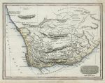
South Africa, Cape Colony, 1828. "Colony of Good Hope &c." engraved by A.Findlay, copper engraved map published in Kelly's New System of Universal Geography, 1828. Recent hand colouring. Size 24 x 18.5 cms plus margins. Ref F4571
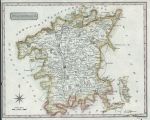
Worcestershire, 1819. "Worcestershire" engraved by Neele, published in The New British Traveller, 1819. Copper engraved map with recent hand colour. Left margin close trimmed, almost to neatline. Size 24.5 x 20 cms plus margins. Ref F4570
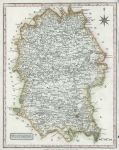
Wiltshire, 1819. "Wiltshire" engraved by Neele, published in The New British Traveller, 1819. Copper engraved map with recent hand colour. Right margin close trimmed, with small tear just to neatline. Size 19.5 x 25 cms plus margins. Ref F4569
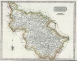
Yorkshire, West Riding, 1819. "West Riding of Yorkshire" engraved by Neele, published in The New British Traveller, 1819. Copper engraved map with recent hand colour. Lower margin close trimmed to just outside neatline. Size 24.5 x 19.5 cms plus margins. Ref F4568
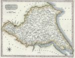
Yorkshire, East Riding, 1819. "East Riding of Yorkshire" engraved by Neele, published in The New British Traveller, 1819. Copper engraved map with recent hand colour. Upper margin close trimmed to just outside neatline. Size 25 x 20 cms plus margins. Ref F4567
London, Whitehall, 1874. "The New Government Offices, Whitehall" wood engraving published in The Graphic, 1874, with recent hand colour. Letterpress text on the reverse, slight age browning and closed tear lower left, not affecting the image. Size 30.5 x 23 cms including title, plus margins. Ref F4566
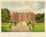
Yorkshire, Burton-Agnes Hall, 1880. "Burton-Agnes Hall" colour woodblock print published in Morris's County Seats ..., about 1880. Good condition. Size 19.5 x 16 cms plus title and margins. Ref F4565
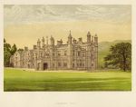
Wales, Glanusk Park, 1880. "Glanusk Park" colour woodblock print published in Morris's County Seats ..., about 1880. Good condition. Size 19.5 x 16 cms plus title and margins. Ref F4564
© 2003 - 2020 Website copyright Steve Bartrick Royalty free stock images of antique prints of interest to historians, students and family history researchers