Home » All prints and maps

 
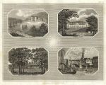
Bear Place in Berks, Woburn Abbey, Frogmore & Bedford, 1819

Bear Place in Berks, Woburn Abbey, Frogmore & Bedford, 1819.
"Bear Place - Berkshire. Woburn Abbey. Her Majesty's Lodge at Frogmore. The town of Bedford" engraved by Owen, published in The New British Traveller, 1819. Copper engraved multi-view print. Size 21.5 x 16.5 cms including title, plus margins. Ref F4545

 
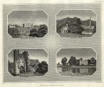
Burley House, Halesowen, Mettingham Castle & Kew Palace, 1819

Burley House, Halesowen, Mettingham Castle & Kew Palace, 1819.
"Burley House. Halesowen. Mettingham Castle. Kew Palace" engraved by Owen, published in The New British Traveller, 1819. Copper engraved multi-view print. Size 21.5 x 16.5 cms including title, plus margins. Ref F4544

 
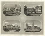
Oxford, Blenheim and Litchfield, 1819

Oxford, Blenheim and Litchfield, 1819.
"Oxford. Theatre &c. Oxford. Blenheim, Oxfordshire. Litchfield Cathedral" engraved by Owen, published in The New British Traveller, 1819. Copper engraved multi-view print. Size 21.5 x 16.5 cms including title, plus margins. Ref F4543


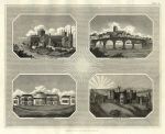
Peterborough, Worcester, Brighton & Alnwick Castle, 1819

Peterborough, Worcester, Brighton & Alnwick Castle, 1819.
"Peterborough Cathedral. Worcester Cathedral. Pavilion, Brighton. Alnwick Castle" engraved by Owen, published in The New British Traveller, 1819. Copper engraved multi-view print. Size 21.5 x 16.5 cms including title, plus margins. Ref F4542

 
Stockport, Truro, St.Michael's Mount & Carlisle, 1819

Stockport, Truro, St.Michael's Mount & Carlisle, 1819.
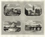
"Stockport, Cheshire. Truro, Cornwall. St.Michael's Mount, Cornwall. Carlisle, Cumberland" engraved by Owen, published in The New British Traveller, 1819. Copper engraved multi-view print. Size 21.5 x 16.5 cms including title, plus margins. Ref F4541

 
London, Lambeth Palace Interior, 1819

London, Lambeth Palace Interior, 1819.
"SInterior of the Hall of Lambeth Palace, Surry" engraved by J.Greig after a picture by I.Wichillo, published in The New British Traveller, 1819. Copper engraved print. Size 14.5 x 20.5 cms including title, plus margins. Ref F4540


Ireland, route map with Dublin and area to the north, 1783

Ireland, route map with Dublin and area to the north, 1783.
[ Route map - Dublin and area to the north ] engraved by G.Terry and published in Taylor and Skinner's Maps of the Roads of Ireland, (2nd edition), 1783. On the verso is part of a route including Monaghan, Carrickmacross and Dunleer. Copper engraved map. Size 12 x 21.5 cms plus good margins. Ref F4539

 
Ireland, route map with Londonderry, St.Johnstown, Lifford & Raphoe, 1783

Ireland, route map with Londonderry, St.Johnstown, Lifford & Raphoe, 1783.
[ Route map - Londonderry, St.Johnstown, Lifford, Letterkenny & Raphoe ] engraved by G.Terry and published in Taylor and Skinner's Maps of the Roads of Ireland, (2nd edition), 1783. On the verso is part of a route including Carrickmacross, Ardee & Ballybay. Copper engraved map. Size 12 x 21.5 cms plus good margins. Ref F4538

 
Ireland, route map with Drogheda, Collon and Ardee, 1783

Ireland, route map with Drogheda, Collon and Ardee, 1783.
[ Route map - Drogheda, Collon and Ardee ] engraved by G.Terry and published in Taylor and Skinner's Maps of the Roads of Ireland, (2nd edition), 1783. On the verso is part of a route including Castle Blayney, Castle Shane & Monaghan. Copper engraved map. Size 12 x 21.5 cms plus good margins. Ref F4537


Ireland, route map with Londonderry, Clady, Newtown-Limavady & Dungiven, 1783

Ireland, route map with Londonderry, Clady, Newtown-Limavady & Dungiven, 1783.
[ Route map - Londonderry, Clady, Newtown-Limavady & Dungiven ] engraved by G.Terry and published in Taylor and Skinner's Maps of the Roads of Ireland, (2nd edition), 1783. On the verso is part of a route including Cookstown and Dungiven. Copper engraved map. Size 12 x 21.5 cms plus good margins. Ref F4536

 
Ireland, route map with Moneymore, Cookstown, Tullyhog & Coalisland, 1783

Ireland, route map with Moneymore, Cookstown, Tullyhog & Coalisland, 1783.
[ Route map - Moneymore, Cookstown, Tullyhog & Coalisland ] engraved by G.Terry and published in Taylor and Skinner's Maps of the Roads of Ireland, (2nd edition), 1783. On the verso is part of a route including Maghera, Desart-martin, Fort William & Magherafelt. Copper engraved map. Size 12 x 21.5 cms plus good margins. Ref F4535

 
Ireland, route map with Armagh, Charlemont & Dungannon, 1783

Ireland, route map with Armagh, Charlemont & Dungannon, 1783.
[ Route map - Armagh, Charlemont, Loughgall & Dungannon ] engraved by G.Terry and published in Taylor and Skinner's Maps of the Roads of Ireland, (2nd edition), 1783. On the verso is part of a route including Fews Barrack, Newtown-hamilton and Markethill. Copper engraved map. Size 12 x 21.5 cms plus good margins. Ref F4534


Ireland, route map with Stewarts-town, Portadown and Lurgan, 1783

Ireland, route map with Stewarts-town, Portadown and Lurgan, 1783.
[ Route map - Stewarts-town, Portadown and Lurgan in Tyrone & Armagh Counties ] engraved by G.Terry and published in Taylor and Skinner's Maps of the Roads of Ireland, (2nd edition), 1783. On the verso is part of a route including Dundalk & Forkill. Copper engraved map. Size 12 x 21.5 cms plus good margins. Ref F4533

 
Ireland, route map with Newry, Market Hill and Clare, 1783

Ireland, route map with Newry, Market Hill and Clare, 1783.
[ Route map - Newry, Market Hill and Clare in Armagh County ] engraved by G.Terry and published in Taylor and Skinner's Maps of the Roads of Ireland, (2nd edition), 1783. On the verso is part of a route including Broughshane, Glenarm, Clogh & Newtownglens. Copper engraved map. Size 12 x 21.5 cms plus good margins. Ref F4532

 
Ireland, route map with Ballymena, Clogh & Ballycastle, 1783

Ireland, route map with Ballymena, Clogh & Ballycastle, 1783.
[ Route map - Ballymena, Clogh & Ballycastle in Antrim County ] engraved by G.Terry and published in Taylor and Skinner's Maps of the Roads of Ireland, (2nd edition), 1783. On the verso is part of a route including Colerain and Ballymoney. Copper engraved map. Size 12 x 21.5 cms plus good margins. Ref F4531


Ireland, route map with Antrim, Randalstown & Kells, 1783

Ireland, route map with Antrim, Randalstown & Kells, 1783.
[ Route map - Antrim, Randalstown & Kells ] engraved by G.Terry and published in Taylor and Skinner's Maps of the Roads of Ireland, (2nd edition), 1783. On the verso is part of a route including Kilrea, Portglenone and Ballymena. Copper engraved map. Size 12 x 21.5 cms plus good margins. Ref F4530

 
Ireland, route map with Lurgan, Moira, Ballinderry, Glanevy & Crumlin, 1783

Ireland, route map with Lurgan, Moira, Ballinderry, Glanevy & Crumlin, 1783.
[ Route map - Lurgan, Moira, Ballinderry, Glanevy & Crumlin ] engraved by G.Terry and published in Taylor and Skinner's Maps of the Roads of Ireland, (2nd edition), 1783. On the verso is part of a route including Banbridge, Gillford and Warringstown. Copper engraved map. Size 12 x 21.5 cms plus good margins. Ref F4529

 
Ireland, route map with Carlingford, Dundalk, Rosstrevor & Newry, 1783

Ireland, route map with Carlingford, Dundalk, Rosstrevor & Newry, 1783.
[ Route map - Carlingford, Dundalk, Rosstrevor & Newry in County Down ] engraved by G.Terry and published in Taylor and Skinner's Maps of the Roads of Ireland, (2nd edition), 1783. On the verso is part of a route including Kilkeele, Dundrum & Clough. Copper engraved map. Size 12 x 21.5 cms plus good margins. Ref F4528

 
« Previous | ...1540 | 1541 | 1542 | 1543 | 1544 | 1545 | 1546 | 1547 | 1548 | 1549 | 1550... | Next »


© 2003 - 2020 Website copyright Steve Bartrick
Royalty free stock images of antique prints of interest to historians, students and family history researchers