Home » All prints and maps

 
Egypt, Luxor Mosque, 1880

Egypt, Luxor Mosque, 1880.
"The Mosque of Luxor" wood engraved print published in Picturesque Palestine, about 1880. With recent hand colour. Letterpress text on the reverse. Size 11.5 x 25 cms including title, plus margins. Ref F205

 
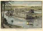
Egypt, Philae, general view, 1880

Egypt, Philae, general view, 1880.
"General view of Philae, taken from Bibbeh" wood engraved print published in Picturesque Palestine, about 1880. With recent hand colour. Letterpress text on the reverse. Size 17 x 25 cms including title, plus margins. Ref F204

 
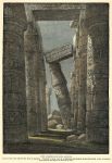
Egypt, Karnak, Leaning Column, 1880

Egypt, Karnak, Leaning Column, 1880.
"The Leaning Column at Karnak" wood engraved print published in Picturesque Palestine, about 1880. With recent hand colour. Letterpress text on the reverse. Size 17 x 25 cms including title, plus margins. Ref F203


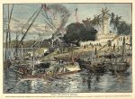
Egypt, view at Aswan, 1880

Egypt, view at Aswan, 1880.
"Aswan, the Syene of Juvenal" wood engraved print published in Picturesque Palestine, about 1880. With recent hand colour. Letterpress text on the reverse. Size 24 x 18 cms including title, plus margins. Ref F202

 
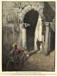
Egypt, Luxor, Niche in ancient Christian Church, 1880

Egypt, Luxor, Niche in ancient Christian Church, 1880.
"Niche in an ancient Christian Church, Luxor" wood engraved print published in Picturesque Palestine, about 1880. With recent hand colour. Letterpress text on the reverse. Size 17 x 22.5 cms including title, plus margins. Ref F201

 
Syria, Shrine of Neby Yunas at El Meshhad, 1880

Syria, Shrine of Neby Yunas at El Meshhad, 1880.
"Shrine of Neby Yunas, at El Meshhad" wood engraved print published in Picturesque Palestine, about 1880. With recent hand colour. Letterpress text on the reverse. Size 16.5 x 13.5 cms including title, plus margins. Ref F200


Syria, taking Coffee on the Heights of Subeibeh, 1880

Syria, taking Coffee on the Heights of Subeibeh, 1880.
"A Cup of Coffee on the Heights of Subeibeh" wood engraved print published in Picturesque Palestine, about 1880. With recent hand colour. Letterpress text on the reverse. Size 17 x 14 cms including title, plus margins. Ref F199

 
Syria, Damascus, 1880

Syria, Damascus, 1880.
"Entrance to Damascus" wood engraved print published in Picturesque Palestine, about 1880. With recent hand colour. Letterpress text on the reverse. Size 16.5 x 14.5 cms including title, plus margins. Ref F198

 
Tomb of Edward IV, published 1732

Tomb of Edward IV, published 1732.
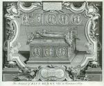
"The Monument of King Edward IV in the Royal Chapel of Windsor" engraved by Cl du Bose after a picture by Gravelot, published in The History of England, 1732. Copper engraved antique print. Two vertical folds as published, full plate mark and good margins. Size 44 x 37 cms including title, plus margins. Ref F197


King Henry VII, published 1732

King Henry VII, published 1732.
"King Henry VII" drawn and engraved by George Vertue after a painting, published in The History of England, 1732. Copper engraved antique print. Full plate mark and good margins. Size 18 x 28 cms plus margins. Ref F196

 
Tomb of Henry VII, published 1732

Tomb of Henry VII, published 1732.
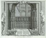
"The Monument of King Henry VII in Westminster Abbey" engraved by Cl du Bose after a picture by Gravelot, published in The History of England, 1732. Copper engraved antique print. Two vertical folds as published (slight foxing on one fold), full plate mark and good margins. Size 44 x 37 cms including title, plus margins. Ref F195

 
Henry VIII, published 1732

Henry VIII, published 1732.
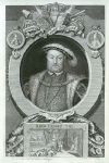
"King Henry VIII" drawn and engraved by George Vertue after a painting, published in The History of England, 1732. Copper engraved antique print. Full plate mark and good margins. Size 18 x 28.5 cms plus margins. Ref F194


America, north & south, 1822

America, north & south, 1822.
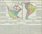
"Geographical, statistical, and historical map of America" engraved by Young & Delleker, published in Philadelphia by Carey & Lea, 1822. Copper engraved map with full original hand colouring. Centrefold as published, very good condition. Size 53 x 42 cms plus good margins. Ref F193

 
Scotland, Crichton Castle (signed Creswick), Scotland Delin, 1854

Scotland, Crichton Castle (signed Creswick), Scotland Delin, 1854.
"Crighton Castle" lithographed by Thomas Creswick, signed in pencil lower right by Creswick. Scarce stone lithograph printed by by Day and Son and published in Scotland Delineated in a Series of Views... by John Parker Lawson, M.A., published by E.Gambart in London and Edinburgh, 1849 - 1854. Slight foxing and age browning. Printed on a very large (elephant) folio sheet measuring 24 x 17 inches (61 x 43 cms), actual image size is 46 x 30 cms (18 x 11.75 inches). (NOTE - the vertical line visible in my image is a result of the scanning process and does not exist on the print.) Ref F192

 
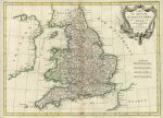
England & Wales, 1771

England & Wales, 1771.
"Carte du Royaume D'Angleterre" by Rigobert Bonne, published in Atlas Moderne ..., 1771 or later. Copper engraved map with original outline hand colouring. centrefold as published. Slight age browning down the fold. Size 42 x 30 cms plus good margins with full plate mark. Ref F191


The World in Hemispheres, 1854

The World in Hemispheres, 1854.
"Mappemonde par A.Vuillemin. Publiee par Combette, Editeur" published in Victor Levasseur's Atlas National Illustre de la France, 1854. Very large lithographic double hemisphere world map, with original full hand colouring. Small chart of the Solar System lower centre. Two vertical and one horizontal fold as published. Slight age browning on folds (not as noticeable in real like as in my image.) Pinprick holes on the fold intersections. Size 74 x 44 cms plus margins. (Please note this is a digital camera image - there is some tonal variation due to uneven lighting.) Ref F189

 
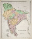
India (Hindoostan), 1850

India (Hindoostan), 1850.
"Hindoostan" anonymous engraver, published by B.F.Lloyd & Co., Edinburgh, about 1850. Scarce large lithographic map with full original hand colouring, coded to indicate British Territories (red), Territories under British Protection (yellow) and Independant States (green.) Very slight soiling, otherwise good condition. Size 43.5 x 60 cms plus good margins. (Please note this is a digital camera image - there is some tonal variation due to uneven lighting.) Ref F188

 
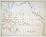
Pacific Ocean, Arrowsmith, 1832

Pacific Ocean, Arrowsmith, 1832.
"Pacific Ocean" by John Arrowsmith, published in The London Atlas of Universal Geography, about 1840. Large and detailed steel engraved map with original hand colouring. Good condition with very slight age browning. Size 60 x 48 cms plus good margins. (Please note this is a digital camera image - there is some tonal variation due to uneven lighting.) Ref F187

 
« Previous | ...1780 | 1781 | 1782 | 1783 | 1784 | 1785 | 1786 | 1787 | 1788 | 1789 | 1790... | Next »


© 2003 - 2020 Website copyright Steve Bartrick
Royalty free stock images of antique prints of interest to historians, students and family history researchers