Home » All prints and maps

 
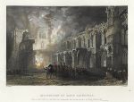
Scotland, Destruction of Elgin Cathedral, 1840

Scotland, Destruction of Elgin Cathedral, 1840.
"Destruction of Elgin Cathedral (Burnt in A.D. 1390 by the 'Wolf of Bedenoch' the ferocious son of King Robert II)" engraved by R.Sands after a picture by T.Allom, published in Scotland Illustrated, 1837. Steel engraved antique print, with recent hand colouring. Small stain in lower margin, otherwise good condition. Size 17 x 13.5 cms including title, plus margins. Ref H45

 
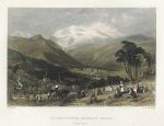
Scotland, Strathpeffer Mineral Wells, 1840

Scotland, Strathpeffer Mineral Wells, 1840.
"Strathpeffer Mineral Wells" engraved by J.C.Armytage after a picture by T.Allom, published in Scotland Illustrated, 1837. Steel engraved antique print, with recent hand colouring. Good condition. Size 17.5 x 14 cms including title, plus margins. Ref H44

 
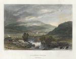
Scotland, Braemar Castle, 1840

Scotland, Braemar Castle, 1840.
"Braemar Castle, Aberdeenshire" engraved by R.Wallis after a picture by G.Campion, published in Scotland Illustrated, 1837. Steel engraved antique print, with recent hand colouring. Good condition. Size 17 x 13.5 cms including title, plus margins. Ref H43


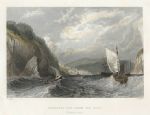
Scotland, Cromarty Bay, from the East, 1840

Scotland, Cromarty Bay, from the East, 1840.
"Cromarty Bay, from the East" engraved by S.Fisher after a picture by T.Allom, published in Scotland Illustrated, 1837. Steel engraved antique print, with recent hand colouring. Good condition. Size 18 x 14 cms including title, plus margins. Ref H42

 
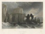
Scotland, Cape Wrath, 1840

Scotland, Cape Wrath, 1840.
"Cape Wrath" engraved by J.T.Willmore after a picture by W.H.Bartlett, published in Scotland Illustrated, 1837. Steel engraved antique print, with recent hand colouring. Good condition. Size 17.5 x 13.5 cms including title, plus margins. Ref H41

 
London, The Bank, Highgate, 1832

London, The Bank, Highgate, 1832.
"The Bank, Highgate" engraved by E.Finden after a picture by W.Westall, published in Great Britain Illustrated, 1832. Steel engraving with recent hand colour. Good condition. Size 14.5 x 10 cms including title, plus margins. Ref H40


Dutch Guayana map, 1886

Dutch Guayana map, 1886.
"Colonised Portions of Dutch Guayana or Surinam ..." by J.Bartholomew, published by the Royal Geographical Society in Gazetteer of the World, 1886. Colour lithographic map. Good condition. Size 23 x 14 cms plus margins. Ref H39

 
USA, New York Harbour chart, 1886

USA, New York Harbour chart, 1886.
"New York Harbour and Vicinity" by J.Bartholomew, published by the Royal Geographical Society in Gazetteer of the World, 1886. Colour lithographic map. Good condition. Size 14 x 23.5 cms plus margins. Ref H38

 
Africa, Morocco, Liberia and Mauritius maps, 1886

Africa, Morocco, Liberia and Mauritius maps, 1886.
"Morocco" with "Liberia ... West Africa" and "Mauritius" by J.Bartholomew, published by the Royal Geographical Society in Gazetteer of the World, 1886. Colour lithographic map. Good condition. Size 14.5 x 23.5 cms plus margins. Ref H37


Wales, Milford Haven chart, 1886

Wales, Milford Haven chart, 1886.
"Milford Haven" by J.Bartholomew, published by the Royal Geographical Society in Gazetteer of the World, 1886. Colour lithographic map. Good condition. Size 23.5 x 14 cms plus margins. Ref H36

 
Australia, Environs of Melbourne, 1886

Australia, Environs of Melbourne, 1886.
"Environs of Melbourne" by J.Bartholomew, published by the Royal Geographical Society in Gazetteer of the World, 1886. Colour lithographic map. Good condition. Size 24 x 15 cms plus margins. Ref H35

 
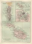
Gibraltar, Malta & Heligoland maps, 1886

Gibraltar, Malta & Heligoland maps, 1886.
"Gibraltar" with "Maltese Islands" and "Malta Harbour" and "Heligoland" by J.Bartholomew, published by the Royal Geographical Society in Gazetteer of the World, 1886. Colour lithographic map. Good condition. Size 14.5 x 21 cms plus margins. Ref H34


Island of Madeira map, 1886

Island of Madeira map, 1886.
"Island of Madeira" published by the Royal Geographical Society in Gazetteer of the World, 1886. Colour lithographic map. Good condition. Size 24 x 14 cms plus margins. Ref H33

 
Environs of Liverpool, estuaries of the Mersey & Dee, 1886

Environs of Liverpool, estuaries of the Mersey & Dee, 1886.
"Environs of Liverpool and the Estuaries of the Mersey & Dee" by J.Bartholomew, published by the Royal Geographical Society in Gazetteer of the World, 1886. Colour lithographic map. Good condition. Size 24 x 14.5 cms plus margins. Ref H32

 
Mississippi Delta & Leeward Islands map, 1886

Mississippi Delta & Leeward Islands map, 1886.
"Delta of the Mississippi & Environs of New Orleans" with "Leeward Islands" by J.Bartholomew, published by the Royal Geographical Society in Gazetteer of the World, 1886. Colour lithographic map. Good condition. Size 24.5 x 14.5 cms plus margins. Ref H31


Kamchatka map, 1886

Kamchatka map, 1886.
"Kamchatka" by A.Petermann, published by the Royal Geographical Society in Gazetteer of the World, 1886. Colour lithographic map. Good condition. Size 14 x 24 cms plus margins. Ref H30

 
Java map, 1886

Java map, 1886.
"Java" by A.Petermann, published by the Royal Geographical Society in Gazetteer of the World, 1886. Colour lithographic map. Good condition. Size 25 x 14 cms plus margins. Ref H29

 
Japan map, 1886

Japan map, 1886.
"Japan" published by the Royal Geographical Society in Gazetteer of the World, 1886. Colour lithographic map. Good condition. Size 14.5 x 25 cms plus margins. Ref H28

 
« Previous | ...690 | 691 | 692 | 693 | 694 | 695 | 696 | 697 | 698 | 699 | 700... | Next »


© 2003 - 2020 Website copyright Steve Bartrick
Royalty free stock images of antique prints of interest to historians, students and family history researchers