Please see my main site ANTIQUEPRINTS.COM For original antique prints and maps
Charing Cross - 1837
Home » Antique maps » All prints and maps
The Caucasus, 1895. "The Caucasus" colour lithographic map published in The Times Atlas, 1895. Size 37 x 24 cms plus margins. Ref F569
Southern Scandinavia, 1895. "Southern Scandinavia" colour lithographic map published in The Times Atlas, 1895. Small inset map of the Stockholm area. Size 23 x 37 cms plus margins. Ref F568
Norway & Sweden, 1895. "Norway and Sweden" colour lithographic map published in The Times Atlas, 1895. Size 23 x 37 cms plus margins. Ref F567
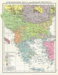
Balkan Peninsula Ethnographic Map, 1895. "Ethnographic Map of the Balkan Peninsula" colour lithographic map published in The Times Atlas, 1895. Size 18.5 x 24 cms plus margins. Ref F566
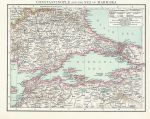
Turkey, Constantinople & Sea of Marmara, 1895. "Constantinople and the Sea of Marmara" colour lithographic map published in The Times Atlas, 1895. Size 23 x 18.5 cms plus margins. Ref F565
North Italy, 1895. "Italy, North" colour lithographic map published in The Times Atlas, 1895. Size 38 x 24 cms plus margins. Ref F564
Eastern Mediterranean Sea, 1895. "Eastern Mediterranean Sea" colour lithographic map published in The Times Atlas, 1895. Inset map of the Nile Delta and Suez Canal. Size 37 x 24 cms plus margins. Ref F563
Western Mediterranean Sea, 1895. "Western Mediterranean Sea" colour lithographic map published in The Times Atlas, 1895. Inset map of the Strait of Gibraltar. Size 37 x 24 cms plus margins. Ref F562
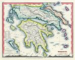
Greece, 1855. "Greece" drawn and engraved by J Dower, published by Orr & Co., about 1855. Steel engraved map with recent hand colour. Good condition. Size 26 x 20.5 cms plus good margins with plate mark. Ref F561
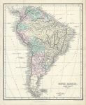
South America, 1855. "South America" drawn and engraved by Alex. Findlay, published by W.Tegg & Co., about 1855. Lithographic map with full original hand colour. Centrefold as published, slight soiling to lower part of map. Size 22 x 27 cms plus margins. Ref F551
The World in Hemispheres, 1842. "The Western Hemisphere" and "The Eastern Hemisphere" engraved and published by G.F.Cruchley in Cruchley's Improved Atlas for Schools and Families, 1841. Pair of lithographic maps with full original hand colouring. Centrefolds as published, slight foxing and some age browning to fold areas. Close trimmed to lower margin, almost to image edge. Size 35.5 x 36 cms each, plus margins. Ref F471
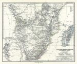
Southern Africa & Madagascar, 1879. "Sud-Afrika & Madagaskar" (Southern Africa & Madagascar) published in Adolf Stieler's Hand Atlas Uber Alle Theile Der Erde ..., 1879. Very detailed steel engraved map with original hand colour, centrefold as published. Inset map of the Table Bay and False Bay area. Good condition. Size 41 x 33.5 cms, plus margins. Ref F414
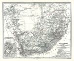
South Africa, 1879. "Das Capland" (South Africa) published in Adolf Stieler's Hand Atlas Uber Alle Theile Der Erde ..., 1879. Very detailed steel engraved map with original hand colour, centrefold as published. Inset plan of Cape Town area. Good condition. Size 40.5 x 33.5 cms, plus margins. Ref F413
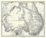
Australia, 1879. "Australien" (Australia) published in Adolf Stieler's Hand Atlas Uber Alle Theile Der Erde ..., 1879. Very detailed steel engraved map with original hand colour, centrefold as published. Inset plan of Sydney and Port Jackson. Good condition. Size 41 x 33.5 cms, plus margins. Ref F412
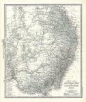
South East Australia, 1879. "Sud-Ost Australien" (Australia) published in Adolf Stieler's Hand Atlas Uber Alle Theile Der Erde ..., 1879. Extremely detailed steel engraved map with original hand colour, centrefold as published. Very good condition. Size 34.5 x 41cms, plus margins. Ref F411
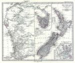
New Zealand & Western Australia, 1879. "Neu-Seeland" and "West-Australien" published in Adolf Stieler's Hand Atlas Uber Alle Theile Der Erde ..., 1879. Extremely detailed steel engraved map with original hand colour, centrefold as published. Insets showing Tasmania and Isthmus of Auckland. Very good condition. Size 41 x 34 cms, plus margins. Ref F410
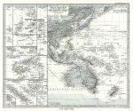
Pacific Ocean (Western half), 1879. "Polynesien und der Grosse Ocean ..." published in Adolf Stieler's Hand Atlas Uber Alle Theile Der Erde ..., 1879. Extremely detailed steel engraved map with original hand colour, centrefold as published. Many insets showing Pacific Islands including Samoa, Fiji, New Caledonia etc. Very good condition. Size 40.5 x 33 cms, plus margins. Ref F409
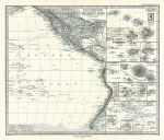
Pacific Ocean (Eastern half), 1879. "Polynesien und der Grosse Ocean" published in Adolf Stieler's Hand Atlas Uber Alle Theile Der Erde ..., 1879. Detailed steel engraved map with original hand colour. Many insets showing Pacific Islands including Tahiti, Hawaii, Galapagos etc. Centrefold as published, good condition with plate mark and good margins. Size 40 x 33.5 cms plus margins. Ref F408
© 2003 - 2020 Website copyright Steve Bartrick Royalty free stock images of antique prints of interest to historians, students and family history researchers