Please see my main site ANTIQUEPRINTS.COM For original antique prints and maps
Charing Cross - 1837
Home » Antique maps » All prints and maps
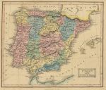
Spain & Portugal map, 1847. "Spain and Portugal" lithographic map with original hand colouring, published by Oliver & Boyd in Ewing's New General Atlas, about 1847. Slight soiling and some age browning. Size 21.5 x 18.5 cms, including title, plus margins. Ref G401
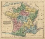
France in Departments map, 1847. "France in departments" lithographic map with original hand colouring, published by Oliver & Boyd in Ewing's New General Atlas, about 1847. Slight soiling and age browning. Size 21.5 x 18.5 cms, including title, plus margins. Ref G400
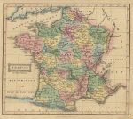
France in Provinces map, 1847. "France in Provinces" lithographic map with original hand colouring, published by Oliver & Boyd in Ewing's New General Atlas, about 1847. Slight soiling and age browning. Size 21.5 x 18.5 cms, including title, plus margins. Ref G399
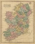
Ireland map, 1847. "Ireland" lithographic map with original hand colouring, published by Oliver & Boyd in Ewing's New General Atlas, about 1847. Slight soiling and age browning. Size 19 x 24 cms, including title, plus margins. Ref G398
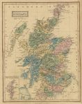
Scotland map, 1847. "Scotland" lithographic map with original hand colouring, published by Oliver & Boyd in Ewing's New General Atlas, about 1847. Some soiling and age browning. Size 19 x 24 cms, including title, plus margins. Ref G397
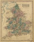
England & Wales map, 1847. "England" lithographic map with original hand colouring, published by Oliver & Boyd in Ewing's New General Atlas, about 1847. Noticeable soiling and age browning. Size 19 x 24 cms, including title, plus margins. Ref G396
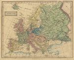
Europe map, 1847. "Europe" lithographic map with original hand colouring, published by Oliver & Boyd in Ewing's New General Atlas, about 1847. Some soiling and age browning. Size 22.5 x 18 cms, including title, plus margins. Ref G395
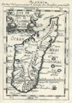
Madagascar map, Mallet, 1683. "Isle de Madagascar dite de St.Laurens ou Isle Daufine" copper engraved map published in Allain Manesson Mallet's Description de l'univers, about 1683. Fault - medium (4mm x 25mm) hole centre top with old professional reapir, otherwise good condition. Size 10 x 15 cms including title, plus good margins. Ref G382
Roman Empire on two sheets, Thomas Kitchin, 1781. "A Map of the Western Part of the Roman Empire" and "A Map of the Eastern Part of the Roman Empire", both by Thomas Kitchin, published in .. Decline and Fall of the Roman Empire, about 1781. Pair of nicely detailed copper engraved maps, with recent hand colouring. FAULTS - several (flattened) folds, each is very close trimmed to lower left margin, also some edge chipping and the Western map has a closed tear of 10 cms into map area (no loss.) Otherwise very interesting and decorative. Size 48 x 41 cms (Western) and 44 x 41 cms (Eastern), plus margins. Ref G266
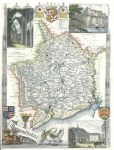
Monmouthshire, Moule, c1850. "Monmouthshire" by Thomas Moule, published in James Barclay's Complete and Universal Dictionary ..., about 1850. Decorative steel engraved antique map with recent hand colour. The vignettes show Chepstow Castle, Tintern Abbey and Monmouth Town Hall. Close trimmed to lower and left margins, no loss (these maps were very often tightly trimmed by the publishers). Size 20 x 27 cms, plus margins. Ref G262
The World, Physical, 1847. "Physical Chart of the Globe" lithographic map with original hand colouring, published by Oliver & Boyd in Ewing's New General Atlas, 1847. Shows mountain chains, isotherms, currents, trade winds etc. centrefold as published, slight soiling and some age browning. Size 36.5 x 23.5 cms, plus margins. Ref G258
World map in hemispheres, 1847. "World" lithographic map with original hand colouring, published by Oliver & Boyd in Ewing's New General Atlas, 1847. Centrefold as published, slight soiling and some age browning. Size 36.5 x 21 cms, including title, plus margins. Ref G257
World map, 1818. "Chart of the World, from the best Authorities" copper engraved map with original hand colour, published in An Atlas to Guthrie's Geographical Grammar, 1818. Three vertical folds as published, good condition. Size 30 x 19 cms including, plus margins. Ref G195
West Indies map, 1818. "West Indies, from the best Authorities" copper engraved map with original hand colour, published in An Atlas to Guthrie's Geographical Grammar, 1818. Three vertical folds as published, good condition. Size 32 x 19 cms including, plus margins. Ref G194
Russian Empire map, 1818. "Russian Empire, from the best Authorities" copper engraved map with original hand colour, published in An Atlas to Guthrie's Geographical Grammar, 1818. Three vertical folds as published, good condition. Size 32.5 x 19 cms including, plus margins. Ref G193
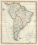
South America map, 1818. "South America, from the best Authorities" copper engraved map with original hand colour, published in An Atlas to Guthrie's Geographical Grammar, 1818. Centrefold as published, good condition. Size 18 x 22 cms including, plus margins. Ref G192
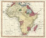
Africa map, 1818. "Africa, from the best Authorities" copper engraved map with original hand colour, published in An Atlas to Guthrie's Geographical Grammar, 1818. Centrefold as published, slight soiling from old pencil annotations. Size 22 x 19 cms including, plus margins. Ref G191
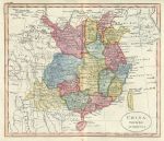
China map, 1818. "China, from the best Authorities" copper engraved map with original hand colour, published in An Atlas to Guthrie's Geographical Grammar, 1818. Centrefold as published, good condition. Size 22 x 19 cms including, plus margins. Ref G190
© 2003 - 2020 Website copyright Steve Bartrick Royalty free stock images of antique prints of interest to historians, students and family history researchers