Home » Antique maps » All prints and maps

 
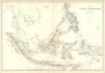
East Indies, large map, 1898

East Indies, large map, 1898.
"The Indian Archipelago" (East Indies) large colour lithographic map published by Adam & Charles Black in Black's General Atlas of the World, 1898. Centrefold as published, good condition. Size 50 x 35 cms, plus good margins. Ref F9664

 
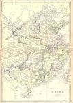
China, large map, 1898

China, large map, 1898.
"China" large colour lithographic map published by Adam & Charles Black in Black's General Atlas of the World, 1898. Centrefold as published, good condition. Size 35 x 50 cms, plus good margins. Ref F9663

 
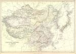
China & Japan, large map, 1898

China & Japan, large map, 1898.
"The Chinese Empire and Japan" large colour lithographic map published by Adam & Charles Black in Black's General Atlas of the World, 1898. Centrefold as published, good condition. Size 50 x 35 cms, plus good margins. Ref F9662


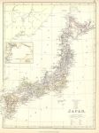
Japan map, 1898

Japan map, 1898.
"Japan" colour lithographic map published by Adam & Charles Black in Black's General Atlas of the World, 1898. Good condition. Size 25.5 x 34.5 cms, plus good margins. Ref F9661

 
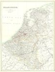
Holland & Belgium, large map, 1898

Holland & Belgium, large map, 1898.
"Holland & Belgium" large colour lithographic map published by Adam & Charles Black in Black's General Atlas of the World, 1898. Centrefold as published, good condition. Size 41 x 55 cms, plus good margins. Ref F9588

 
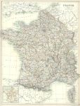
France, large map, 1898

France, large map, 1898.
"France" large colour lithographic map published by Adam & Charles Black in Black's General Atlas of the World, 1898. Centrefold as published, good condition. Size 42 x 55 cms, plus good margins. Ref F9587


USA, Oregon & California map, 1856

USA, Oregon & California map, 1856.
"Oregon and California" engraved by G.H.Swanston, published by A. Fullarton & Co. in Gazetteer of the World, 1856. Steel engraved map, with original hand colour. Size 15 x 23.5 cms plus margins. Ref F9584

 
Madeira map, 1856

Madeira map, 1856.
"Island of Madeira" engraved by G.H.Swanston, published by A. Fullarton & Co. in Gazetteer of the World, 1856. Steel engraved map, with original hand colour. Size 24 x 14 cms plus margins. Ref F9583

 
Peru-Bolivian Tablelands map, 1856

Peru-Bolivian Tablelands map, 1856.
"Peru-Bolivian Tablelands" engraved by G.H.Swanston after A.Petermann, published by A. Fullarton & Co. in Gazetteer of the World, 1856. Steel engraved map, with original hand colour. Size 14 x 23.5 cms plus margins. Ref F9582


Canada, Wellington Channel, 1856

Canada, Wellington Channel, 1856.
"Wellington Channel" drawn and engraved from an Admiralty chart, published by A. Fullarton & Co. in Gazetteer of the World, 1856. Steel engraved map, with original hand colour. Size 23.5 x 11 cms plus margins. Ref F9581

 
Italy, Rome & environs map, 1856

Italy, Rome & environs map, 1856.
"Rome with it's Environs, according to the surveys of Baron Moltke in 1845 & 1846" engraved by A.Petermann, published by A. Fullarton & Co. in Gazetteer of the World, 1856. Steel engraved map, with original hand colour. Size 14 x 23.5 cms plus margins. Ref F9580

 
Brazil, Province of Rio de Janeiro map, 1856

Brazil, Province of Rio de Janeiro map, 1856.
"Province of Rio de Janeiro" engraved by G.Swanston, published by A. Fullarton & Co. in Gazetteer of the World, 1856. Steel engraved map, with original hand colour. Lower left corner missing and repaired some time in the distant past. Size 23.5 x 14 cms plus margins. Ref F9579


Wales, Milford Haven chart, 1856

Wales, Milford Haven chart, 1856.
"Milford Haven" engraved by J.Bartholomew, published by A. Fullarton & Co. in Gazetteer of the World, 1856. Small inset plan of Pembroke Dock. Lithographic map, with original hand colour. Size 23.5 x 14 cms plus margins. Ref F9577

 
England, Ports on the south east coast, 1856

England, Ports on the south east coast, 1856.
"Ports and Harbours on the South East coast of England" with Ramsgate, Margate, Dover, Southampton & Folkestone. Engraved by G.H.Swanston, published by A. Fullarton & Co. in Gazetteer of the World, 1856. Steel engraved map. Size 14 x 24 cms plus margins. Ref F9576

 
Scotland, Ports on the West coast, 1856

Scotland, Ports on the West coast, 1856.
"Ports and Harbours on the West coast of Scotland" with Ayr, Loch Ryan, Kirkcudbright, Port Patrick, Dumfries & Annan. Engraved by G.H.Swanston, published by A. Fullarton & Co. in Gazetteer of the World, 1856. Steel engraved map. Size 13 x 23 cms plus margins. Ref F9575


Scotland, Ports on the North East coast, 1856

Scotland, Ports on the North East coast, 1856.
"Ports and Harbours on the North East coast of Scotland" with Burghead, Nairn, Fraserburgh, Lossiemouth & Banff and Macduff. Engraved by G.H.Swanston, published by A. Fullarton & Co. in Gazetteer of the World, 1856. Steel engraved map. Size 13 x 23 cms plus margins. Ref F9574

 
Ireland, Ports on the east coast St.Georges Channel, 1856

Ireland, Ports on the east coast St.Georges Channel, 1856.
"Ports in Ireland East Coast St.Georges Channel" with Kingstown, Howth, Dublin, Wexford and Waterford. Engraved by G.H.Swanston, published by A. Fullarton & Co. in Gazetteer of the World, 1856. Steel engraved map. Very slight soiling. Size 13.5 x 23 cms plus margins. Ref F9573

 
Ireland, Ports on the north & west coasts, 1856

Ireland, Ports on the north & west coasts, 1856.
"Ports in Ireland North and West Coasts" with Portrush, Mullaghmore, Galway, Londonderry and Sligo. Engraved by G.H.Swanston, published by A. Fullarton & Co. in Gazetteer of the World, 1856. Steel engraved map. Size 13.5 x 23 cms plus margins. Ref F9572

 
« Previous | ...80 | 81 | 82 | 83 | 84 | 85 | 86 | 87 | 88 | 89 | 90... | Next »


© 2003 - 2020 Website copyright Steve Bartrick
Royalty free stock images of antique prints of interest to historians, students and family history researchers