Please see my main site ANTIQUEPRINTS.COM For original antique prints and maps
Charing Cross - 1837
Home » Antique maps » Europe maps >>> » All prints and maps
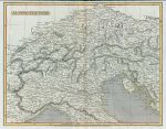
North Italy & The Alps map, 1820. "Alpine Country" engraved by J.Russell after Arrowsmith, published in Rees's Cyclopedia; or, Universal Dictionary ..., 1820. Copper engraved antique map with recent hand colouring, centrefold as published, narrow upper margin, otherwise good condition. Size 32.5 x 25.5 cms, plus margins. Ref H6141
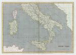
Southern Italy map, 1820. "South Italy" engraved by Sidney Hall after Arrowsmith, published in Rees's Cyclopedia; or, Universal Dictionary ..., 1820. Copper engraved antique map with recent hand colouring, centrefold as published, good condition. Size 33.5 x 24 cms, plus margins. Ref H6140
Spain & Portugal map, 1820. "Spain and Portugal" engraved by J.Bye after Arrowsmith, published in Rees's Cyclopedia; or, Universal Dictionary ..., 1820. Copper engraved antique map with recent hand colouring, centrefold as published, good condition. Size 40 x 25.5 cms, plus margins. Ref H6139
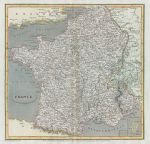
France map, 1820. "France" engraved by Edward Jones after Arrowsmith, published in Rees's Cyclopedia; or, Universal Dictionary ..., 1820. Copper engraved antique map with recent hand colouring, centrefold as published, good condition. Size 26 x 25 cms, plus margins. Ref H6138
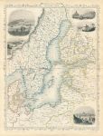
Baltic Sea, Tallis/Rapkin map, 1860. "Baltic Sea" classic decorative Tallis/Rapkin map published by The London Printing and Publishing Company, about 1860. Steel engraved map with original outline hand colour. The decorative vignettes show Kronstadt, Revel, St.Petersburg, Abo and Helsingfors. Centrefold as published, good condition. Size 25 x 33 cms including decorative border, plus margins. Ref H6087
Germany, Mainz, plan of defenses (Nine Years' War), c1701. [ Mainz, Germany. Plan of fortifications, Nine Year's War ] by Herman Moll(?), published in an edition of Timothy Childe's A System of Geography ..., about 1701. Copper engraved plan of the fortifications set in a page of text, and with text on the reverse. Good condition for the age with full plate mark to plan. Scarce. Size of plan 16.5 x 13.5 cms, size of page 20 x 32 cms. Ref H6036
Germany, Freiburg and Brisach plans of defenses (Nine Years' War), c1701. [ Freiburg and Brisach, Germany. Plans of fortifications, Nine Year's War ] by Herman Moll(?), published in an edition of Timothy Childe's A System of Geography ..., about 1701. Pair of copper engraved plans of the fortifications set in a page of text, and with text on the reverse. Good condition for the age with full plate mark to plan. Scarce. Size of each plan about 13.5 x 9.5 cms, size of page 20 x 32 cms. Ref H6035
Germany, Saarlouis, plan of defenses (Nine Years' War), c1701. [ Saarlouis, Germany. Plan of fortifications, Nine Year's War ] by Herman Moll(?), published in an edition of Timothy Childe's A System of Geography ..., about 1701. Copper engraved plan of the fortifications set in a page of text, and with text on the reverse. Good condition for the age with full plate mark to plan. Scarce. Size of plan 13.5 x 9 cms, size of page 20 x 32 cms. Ref H6034
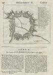
Belgium, Ath, plan of defenses (Nine Years' War), c1701. [ Ath (Aeth), Belgium. Plan of fortifications, Nine Year's War ] by Herman Moll(?), published in an edition of Timothy Childe's A System of Geography ..., about 1701. Copper engraved plan of the fortifications set in a page of text, and with text on the reverse. Good condition for the age with full plate mark to plan. Scarce. Size of plan 16.5 x 14 cms, size of page 20 x 32 cms. Ref H6033
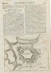
Belgium, Charleroi, plan of defenses (Nine Years' War), c1701. [ Charleroi, Belgium. Plan of fortifications, Nine Year's War ] by Herman Moll(?), published in an edition of Timothy Childe's A System of Geography ..., about 1701. Copper engraved plan of the fortifications set in a page of text, and with text on the reverse. Good condition for the age with full plate mark to plan. Scarce. Size of plan 16.5 x 14 cms, size of page 20 x 32 cms. Ref H6032
Germany, Cologne, plan of defenses (Nine Years' War), c1701. [ Cologne, Germany. Plan of fortifications, Nine Year's War ] by Herman Moll(?), published in an edition of Timothy Childe's A System of Geography ..., about 1701. Copper engraved plan of the fortifications set in a page of text, and with text and a similar plan of Bonne on the reverse. Good condition for the age with full plate mark to plan. Scarce. Size of plan 13.5 x 9 cms, size of page 20 x 32 cms. Ref H6031
Germany, Trier, plan of defenses (Nine Years' War), c1701. [ Trier, Germany. Plan of fortifications, Nine Year's War ] by Herman Moll(?), published in an edition of Timothy Childe's A System of Geography ..., about 1701. Copper engraved plan of the fortifications set in a page of text, and with text and a similar plan of Rheineberk on the reverse. Good condition for the age with full plate mark to plan. Scarce. Size of plan 13.5 x 9 cms, size of page 20 x 32 cms. Ref H6030
Holland & the Netherlands (Belgium), 1825. "Holland and the Netherlands" engraved by R.Scott, published by E.Khull & Co. of Glasgow in The Glasgow Geography, 1825. Copper engraved map with recent hand colour. Two (flattened) folds as published. Size 17.5 x 24 cms plus margins. Ref H5829
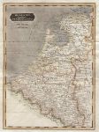
Netherlands map, 1820. "The Seven United Provinces" engraved by Cooper after Arrowsmith, published in Rees's Cyclopedia; or, Universal Dictionary ..., 1820. Copper engraved antique map with recent hand colouring, centrefold as published, good condition. Size 39 x 25 cms, plus margins. Ref H5771
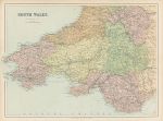
South Wales map, c1867. "South Wales" by J.Bartholomew, published by George Philip & Son in a county atlas, about 1867. Early colour lithographic map with centrefold as published, very slight soiling, otherwise good condition. Size 46 x 33 cms plus margins. Ref H5763
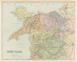
North Wales map, c1867. "North Wales" by J.Bartholomew, published by George Philip & Son in a county atlas, about 1867. Early colour lithographic map with centrefold as published, very slight soiling, otherwise good condition. Size 41.5 x 33.5 cms plus margins. Ref H5762
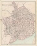
Monmouthshire map, c1867. "Monmouthshire" by Edward Weller, published by George Philip & Son in a county atlas, about 1867. Early colour lithographic map with centrefold as published, very slight soiling and the reverse has several pasted down descriptions of WW2 aircraft, this not affecting the map as it is on thick paper. Size 33.5 x 42 cms plus margins. Ref H5746
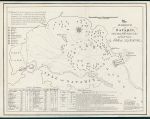
Greece, Battle of Navarino, 1828. "The Harbour of Navarin, with a Plan of the Battle on the 20th Oct. 1827 ..." (Greek War of Independence) engraved by W.Read after a map by J.H.Boteler, published by Henry Colburn in 1828. Copper engraved antique plan.Narrow margins and very slight offsetting, otherwise good condition. Overall size 28.5 x 21.5 cms. Ref H5250
© 2003 - 2020 Website copyright Steve Bartrick Royalty free stock images of antique prints of interest to historians, students and family history researchers