Home » Antique maps » Europe maps >>> » All prints and maps

 
Great Britain, waterways map, 1820

Great Britain, waterways map, 1820.
"Canals, navigations, and Railways, of Great Britain" engraved by Alex Findlay after Arrowsmith, published in Rees's Cyclopedia; or, Universal Dictionary ..., 1820. Copper engraved antique map with recent hand colour, centrefold as published, good condition. Size 25 x 39.5 cms, plus margins. Ref H4825

 
England & Wales map, 1820

England & Wales map, 1820.
"England and Wales" engraved by Hewitt after Arrowsmith, published in Rees's Cyclopedia; or, Universal Dictionary ..., 1820. Copper engraved antique map with recent hand colour, centrefold as published, good condition. Size 25.5 x 40 cms, plus margins. Ref H4824

 
Ireland map, 1820

Ireland map, 1820.
"Ireland" engraved by Cooper after Arrowsmith, published in Rees's Cyclopedia; or, Universal Dictionary ..., 1820. Copper engraved antique map with recent hand colour, centrefold as published, good condition. Size 25 x 40 cms, plus margins. Ref H4823


Scotland map, 1820

Scotland map, 1820.
"Scotland" engraved by Cooper after Arrowsmith, published in Rees's Cyclopedia; or, Universal Dictionary ..., 1820. Copper engraved antique map with recent hand colour, centrefold as published, good condition. Size 25 x 40 cms, plus margins. Ref H4822

 
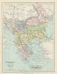
Balkans map, 1875

Balkans map, 1875.
"Turkey in Europe, Greece, Roumania, Servia, Bulgaria &c." chromolithographic map published by George Philip & Son in Philip's Library Atlas, about 1875. Good condition. Size 23 x 30.5 cms plus margins. Ref H4364

 
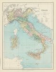
Italy map, 1875

Italy map, 1875.
"Italy" chromolithographic map published by George Philip & Son in Philip's Library Atlas, about 1875. Good condition. Size 23 x 30.5 cms plus margins. Ref H4363


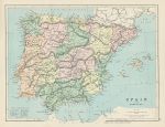
Spain & Portugal map, 1875

Spain & Portugal map, 1875.
"Spain and Portugal" chromolithographic map published by George Philip & Son in Philip's Library Atlas, about 1875. Good condition. Size 30 x 23 cms plus margins. Ref H4362

 
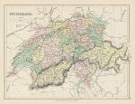
Switzerland map, 1875

Switzerland map, 1875.
"Switzerland" chromolithographic map published by George Philip & Son in Philip's Library Atlas, about 1875. Good condition. Size 30 x 22.5 cms plus margins. Ref H4361

 
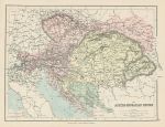
Austro-Hungarian Empire map, 1875

Austro-Hungarian Empire map, 1875.
"The Austro-Hungarian Empire" chromolithographic map published by George Philip & Son in Philip's Library Atlas, about 1875. Good condition. Size 31 x 23 cms plus margins. Ref H4360


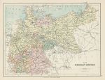
German Empire map, 1875

German Empire map, 1875.
"The German Empire" chromolithographic map published by George Philip & Son in Philip's Library Atlas, about 1875. Good condition. Size 30 x 23 cms plus margins. Ref H4359

 
British Isles map, 1820

British Isles map, 1820.
"British Isles" engraved by Cooper after Arrowsmith, published in Rees's Cyclopedia; or, Universal Dictionary ..., 1820. Copper engraved antique map with recent hand colour, centrefold as published, good condition. Size 25 x 40 cms, plus margins. Ref H4203

 
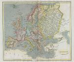
Europe map, 1820

Europe map, 1820.
"Europe" engraved by B.Smith after Arrowsmith, published in Rees's Cyclopedia; or, Universal Dictionary ..., 1820. Copper engraved antique map with recent hand colour, centrefold as published, good condition. Size 29 x 25.5 cms, plus margins. Ref H4202


Ireland, Ulster map, 1784

Ireland, Ulster map, 1784.
"A New & Correct Map of the Province of Ulster, drawn from the Latest & Best Authorities" published in Walpoole's New and Complete British Traveller, about 1784. Copper engraved map with recent hand colouring. Upper margin close trimmed with slight loss of decorative border, otherwise good condition. Size 35 x 22.5 cms, plus margins. Ref H3795

 
North Scotland, Orkney & Shetland Isles map, 1784

North Scotland, Orkney & Shetland Isles map, 1784.
"A New Map of the Counties of Orkney, Cathness, Sutherland, Ross & Cromarty, drawn from the Best Authorities" (with the Shetlands) published in Walpoole's New and Complete British Traveller, about 1784. Copper engraved map with recent hand colouring. Upper margin close trimmed, otherwise good condition. Map size 32.5 x 20.5 cms, plus margins. Ref H3794

 
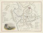
Italy, Rome plan (ancient & modern), 1850

Italy, Rome plan (ancient & modern), 1850.
"Plan of Rome, exhibiting a comparative view of the Ancient & Modern Sites" drawn and engraved by W.Hughes, published in The Life and Epistles of St. Paul, about 1850. Steel engraved map with recent hand colouring, centrefold as published, good condition. Size 28 x 22 cms. Ref H3642


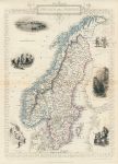
Sweden and Norway, Tallis/Rapkin map, 1853

Sweden and Norway, Tallis/Rapkin map, 1853.
"Sweden and Norway" classic decorative Tallis/Rapkin map published in Tallis's The Illustrated Atlas ..., about 1853. Steel engraved map with original outline hand colour. The decorative vignettes include Stockholm, Norwegian Peasants, Iron Mine in Upsala, Norwegian Skate Runners (skiing). Centrefold as published, noticeable soiling in the form of scribbles over figures upper right. Size 24 x 35 cms including decorative border, plus margins. Ref H3641

 
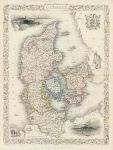
Denmark, Tallis/Rapkin map, 1853

Denmark, Tallis/Rapkin map, 1853.
"Denmark" classic decorative Tallis/Rapkin map published in Tallis's The Illustrated Atlas ..., about 1853. Steel engraved map with original outline hand colour. The decorative vignettes include Copenhagen and Sleswig. Centrefold as published, noticeable soiling in the form of scribbles over figures centre right. Size 25 x 34 cms including decorative border, plus margins. Ref H3640

 
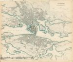
Sweden, Stockholm plan, SDUK, 1836

Sweden, Stockholm plan, SDUK, 1836.
"Stockholm" engraved by B.R.Davies after W.B.Clarke, published by The Society for the Diffusion of Useful Knowledge (SDUK), 1844 (map dated 1836.) Steel engraved map with original hand colour. Narrow ragged upper margin, otherwise very good condition. Size 40 x 33 cms plus margins. Ref H3638

 
« Previous | ...10 | 11 | 12 | 13 | 14 | 15 | 16 | 17 | 18 | 19 | 20... | Next »


© 2003 - 2020 Website copyright Steve Bartrick
Royalty free stock images of antique prints of interest to historians, students and family history researchers