Please see my main site ANTIQUEPRINTS.COM For original antique prints and maps
Charing Cross - 1837
Home » Antique maps » Europe maps >>> » All prints and maps
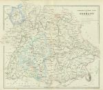
Germany, southern, 1865. "Independent Southern States of Germany" by G.H.Swanston, published in A Gazetteer of the World ..., 1856. Lithographic antique map, with original hand colouring and centrefold, as published. Very weak colouring, otherwise good condition. Size 28 x 24.5 cms including title, plus good margins. Ref G8082
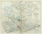
Germany, north & central, 1865. "The Northern & Central parts of Germany" by Augustus Perermann, published in A Gazetteer of the World ..., 1856. Lithographic antique map, with original hand colouring and centrefold, as published. Good condition. Size 29.5 x 23.5 cms including title, plus good margins. Ref G8081
France, Cherbourg, Dieppe & Boulogne, 1865. "Ports and Harbours on the coast of France" with Cherbourg, Dieppe & Boulogne, drawn and engraved by G.H.Swanston, published in A Gazetteer of the World ..., 1856. Lithographic antique map, with original hand colouring. Good condition. Size 14 x 23.5 cms including title, plus good margins. Ref G8076
Scotland, plans of ports & harbours, 1865. "Ports and Harbours on the West coast of Scotland" with Rothesay, Largs, Ardrossan, Irvive, Troon and Campbelltown Bay & Harbour, engraved by G.H.Swanston, published in A Gazetteer of the World ..., 1856. Lithographic antique map, good condition. Size 13 x 23 cms including title, plus good margins. Ref G8069
Glasgow plan, 1865. "Glasgow" engraved by G.H.Swanston, published in A Gazetteer of the World ..., 1856. Lithographic antique map, with original hand colouring. Slight sloling lower left, otherwise good condition. Size 22.5 x 14 cms including title, plus good margins. Ref G8068
Iceland map, 1865. "Iceland" engraved by G.H.Swanston after a map by Augustus Petermann and Gunnlaugsson, published in A Gazetteer of the World ..., 1856. Lithographic antique map, with original hand colouring. Good condition. Size 23 x 14 cms including title, plus good margins. Ref G8066
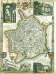
Monmouthshire, Moule, 1850. "Monmouthshire" by Thomas Moule, published in James Barclay's Complete and Universal Dictionary ..., about 1850. Decorative steel engraved antique map with recent hand colour. The vignettes show Chepstow Castle, Tintern Abbey and Monmouth Town Hall. Close trimmed to lower and left margins, with slight loss (these maps were very often tightly trimmed by the publishers). Size 20 x 27 cms, plus margins. Ref G7888
Monmouthshire, Owen/Bowen, c1736. "Monmouthshire" by Emanuel Bowen published by John Owen between 1720 and 1764. Details of the road from Monmouth to Lanbeder are contained in the cartouche above the map. The reverse shows a route from Monmouth through Abervagenny. Copper engraved map with recent hand colour. Size 12 x 18.5 cms plus margins. Ref G7887
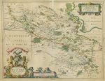
Scotland, Stirlingshire, Blaeu, 1672. "Sterlinensis Praefectura. Sterlin-Shyr / Auct. Timoth. Pont." (Stirlingshire) by Joan Blaeu, after a manuscript map by Timothy Pont, published about 1672. Impressive copper engraved map with original hand colouring. Centrefold as published, with slight damage to paper surface to upper part of fold area, very slight age browning. Spanish text on reverse, full plate mark and wide margins. Size 52 x 41 cms plus margins. Ref G7774
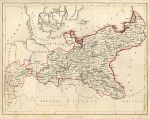
Prussia map, 1855. "Prussia" anonymous artist/engraver, published in an atlas, about 1855. Steel engraved map with simple original outline hand colour. Slightly soiled. Size 26 x 20 cms, plus margins. Ref G7700
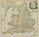
England & Wales map, 1784. "A New most Accurate & Complete Map of all the Direct and the Principal Cross Roads in England and Wales, Carefully corrected from Late Surveys: with the Distances by the Mile Stones and other most exact Admensurations between Town and Town" by Thomas Conder, published in Walpoole's New and Complete British Traveller, about 1784. Copper engraved map, with recent hand colouring. Centrefold as published, faults - sharp crease to lower right and slight foxing. Size 34.5 x 34 cms, plus margins. Ref G7495
South Wales map, 1784. "A New Map of South Wales, Drawn from the latest Authorities" by Thomas Conder, published in Walpoole's New and Complete British Traveller, about 1784. Copper engraved map, with recent hand colouring. Upper border close trimmed, otherwise good condition. Size 34.5 x 22 cms including title, plus margins. Ref G7477
North Wales map, 1784. "A New & Correct Map of North Wales, Drawn from the Best Authorities" by Thomas Conder, published in Walpoole's New and Complete British Traveller, about 1784. Copper engraved map, with recent hand colouring. Good condition. Size 34.5 x 22 cms including title, plus margins. Ref G7476
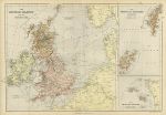
British Isles and North Sea map, 1882. "The British Islands and North Sea" together with "The Orkney and Shetland Islands" and "The Channel Islands" drawn and engraved by Edward Weller, published in Blackie's The Comprehensive Atlas & Geography of the World, 1882. Colour lithographic map, centrefold as published, good condition. Size 51 x 35 cms plus margins. Ref G7423
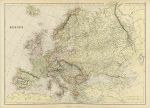
Europe map, 1882. "Europe" published in Blackie's The Comprehensive Atlas & Geography of the World, 1882. Colour lithographic map, centrefold as published, good condition. Size 48 x 35 cms plus margins. Ref G7422
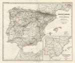
Spain & Portugal, historical Church map, Spruner's Histor' Atlas, 1846. "Iberische Halbinsel nach ihrer kirchlichen Eintheilung seit der Maurischen Zeit" (Iberian peninsula after its division by the Church after the Moorish times) published in Spruner's Historisch-Geographischer hand-Atlas, 1846. Detailed steel engraved map with original hand colouring. Centrefold as published, good condition with partial plate mark. Size 40 x 33.5 cms plus margins. Ref G7306
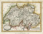
Switzerland map, 1807. "Switzerland with its subjects & allies from the Best Authorities" engraved by J.Barlow, published in A General View of the World, 1807. Copper engraved antique map with recent hand colour. Good condition. Size 22.5 x 17 cms including title, plus margins. Ref G6754
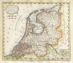
Netherlands (Holland) map, 1807. "The Seven United Provinces from the Best Authorities" engraved by J.Barlow, published in A General View of the World, 1807. Copper engraved antique map with recent hand colour. Good condition. Size 21.5 x 19.5 cms including title, plus margins. Ref G6753
© 2003 - 2020 Website copyright Steve Bartrick Royalty free stock images of antique prints of interest to historians, students and family history researchers