Please see my main site ANTIQUEPRINTS.COM For original antique prints and maps
Charing Cross - 1837
Home » Antique maps » Europe maps >>> » All prints and maps
Wales, Milford Haven chart, 1856. "Milford Haven" engraved by J.Bartholomew, published by A. Fullarton & Co. in Gazetteer of the World, 1856. Small inset plan of Pembroke Dock. Lithographic map, with original hand colour. Size 23.5 x 14 cms plus margins. Ref F9577
England, Ports on the south east coast, 1856. "Ports and Harbours on the South East coast of England" with Ramsgate, Margate, Dover, Southampton & Folkestone. Engraved by G.H.Swanston, published by A. Fullarton & Co. in Gazetteer of the World, 1856. Steel engraved map. Size 14 x 24 cms plus margins. Ref F9576
Scotland, Ports on the West coast, 1856. "Ports and Harbours on the West coast of Scotland" with Ayr, Loch Ryan, Kirkcudbright, Port Patrick, Dumfries & Annan. Engraved by G.H.Swanston, published by A. Fullarton & Co. in Gazetteer of the World, 1856. Steel engraved map. Size 13 x 23 cms plus margins. Ref F9575
Scotland, Ports on the North East coast, 1856. "Ports and Harbours on the North East coast of Scotland" with Burghead, Nairn, Fraserburgh, Lossiemouth & Banff and Macduff. Engraved by G.H.Swanston, published by A. Fullarton & Co. in Gazetteer of the World, 1856. Steel engraved map. Size 13 x 23 cms plus margins. Ref F9574
Ireland, Ports on the east coast St.Georges Channel, 1856. "Ports in Ireland East Coast St.Georges Channel" with Kingstown, Howth, Dublin, Wexford and Waterford. Engraved by G.H.Swanston, published by A. Fullarton & Co. in Gazetteer of the World, 1856. Steel engraved map. Very slight soiling. Size 13.5 x 23 cms plus margins. Ref F9573
Ireland, Ports on the north & west coasts, 1856. "Ports in Ireland North and West Coasts" with Portrush, Mullaghmore, Galway, Londonderry and Sligo. Engraved by G.H.Swanston, published by A. Fullarton & Co. in Gazetteer of the World, 1856. Steel engraved map. Size 13.5 x 23 cms plus margins. Ref F9572
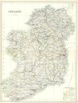
Ireland, large map, 1898. "Ireland" large colour lithographic map published by Adam & Charles Black in Black's General Atlas of the World, 1898. Good condition. Size 42 x 56 cms, plus good margins. Ref F9557
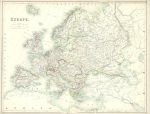
Europe, large map, 1898. "Europe" large colour lithographic map published by Adam & Charles Black in Black's General Atlas of the World, 1898. Very slight soiling in the margins, otherwise good condition. Size about 55 x 42 cms, plus good margins. Ref F9556
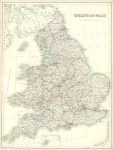
England & Wales, large map, 1898. "England and Wales" large colour lithographic map published by Adam & Charles Black in Black's General Atlas of the World, 1898. Good condition. Size 42 x 56 cms plus good margins. Ref F9555
Germany, Panoramic Map of the Rhine, 1832. "Panoramic Map of the Rhine, from Cologne to Mayence" long narrow steel engraved view style map, published in Tombleson's Views of the Rhine, 1832. Joined from two sections and several (flattened) folds, as published, otherwise good condition. Note - the join is not straight so the map has a slight 'turn' in the centre. Size about 16 x 115 cms including title, plus margins. Ref F9425
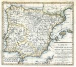
Spain map, 1780. "Carte de L'Espagne Ancienne, divisee par Auguste ..." anonymous engraver, published in Histoire Universelle ..., about 1780. Copper engraved antique map with recent hand colouring. Several folds as published, partial plate mark and good margins. Several patched wormholes along upper edge, just within neatline. Size 25.5 x 22.5 cms, plus margins. Ref F9326
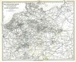
Germany and surrounds - communications (railways etc.), 1877. "Das Deutsche Reich und Seine Nachbarlander. Zur Ubersicht der Eisenbahnen und Dampfschiffahrten" by C.Vogel, published in Adolf Stieler's Hand Atlas Uber Alle Theile Der Erde ..., 1877. Detailed steel engraved antique map with original hand colour. Centrefold as published. Good condition. Size 40 x 34 cms, plus margins. Ref F9286
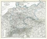
Germany and surrounds, political map, 1877. "Deutschland Ubersicht des Deutschen Reichs" published in Adolf Stieler's Hand Atlas Uber Alle Theile Der Erde ..., 1877. Very detailed steel engraved map with original hand colour, centrefold as published. Good condition. Size 41 x 34 cms, plus margins. Ref F9285
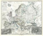
Europe, 1877. "Europa" published in Adolf Stieler's Hand Atlas Uber Alle Theile Der Erde ..., 1877. Extremely detailed steel engraved map with original hand colour, centrefold as published. Inset maps showing Mont Blanc and Kasbec in the Caucasus mountians. Good condition with good margins. Size 40 x 34 cms, plus margins. Ref F9283
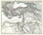
Eastern Mediterranean Sea, Egypt, Turkey & Middle East, 1877. "Das Mittellandische Meer und Nord-Afrika ... (Ostliches Blatt)" published in Adolf Stieler's Hand Atlas Uber Alle Theile Der Erde ..., 1877. Extremely detailed steel engraved map with original hand colour, centrefold as published. Large inset map showing the Nile Delta. Good condition with good margins. Size 40.5 x 33 cms, plus margins. Ref F9282
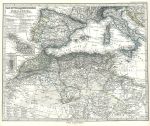
Western Mediterranean Sea & North Africa, 1877. "Das Mittellandische Meer und Nord-Afrika ..." published in Adolf Stieler's Hand Atlas Uber Alle Theile Der Erde ..., 1877. Extremely detailed steel engraved map with original hand colour, centrefold as published. Two small inset maps showing Gibraltar and Malta. Good condition with good margins. Size 38 x 33.5 cms, plus margins. Ref F9281
Germany, Stamm-Burg in Nassau, 1837. "Die Stamm-Burg Nassau" published in Meyer's Universum ..., 1837. Steel engraved print. Good condition. Size 16 x 11.5 cms including title, plus margins. Ref F9223
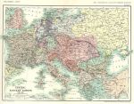
Europe map, 1863-1897, published 1897. "Central and Eastern Europe 1863-1897" published by W. & A.K.Johnston Ltd. as a 'Specimen Copy' from their Historical Atlas of Modern Europe, 1897. Colour lithographic map, centrefold as published, slight creasing to the two lower corners. Highlights border changes mainly relating to Germany and the Balkans. Size 33 x 24 cms, plus margins. Ref F9049
© 2003 - 2020 Website copyright Steve Bartrick Royalty free stock images of antique prints of interest to historians, students and family history researchers