Please see my main site ANTIQUEPRINTS.COM For original antique prints and maps
Charing Cross - 1837
Home » Antique maps » Europe maps >>> » All prints and maps
France in Provinces, Ostells New General Atlas, 1813. " France in Provinces " drawn and engraved by J.C.Russell, published in Ostell's New General Atlas, 1813. Copper engraved map with original hand colour. Detail showing part of the map. Slightly soiled, plate mark and good margins. Size 21.5 x 18.5 cms. Ref D6795
Germany, Ostells New General Atlas, 1813. " Germany " drawn and engraved by J.C.Russell, published in Ostell's New General Atlas, 1813. Copper engraved map with original hand colour. Detail showing part of the map. Slightly grubby and ink blot upper left, plate mark and good margins. Size 22.5 x 19 cms. Ref D6793
Sweden & Norway map, 1813. " Sweden and Norway " drawn and engraved by J.C.Russell, published in Ostell's New General Atlas, 1813. Copper engraved map with original hand colour. Detail showing part of the map. Some staining lower right, plate mark and good margins. Size 18.5 x 22 cms. Ref D6791
Denmark map, 1813. " Denmark " drawn and engraved by J.C.Russell, published in Ostell's New General Atlas, 1813. Copper engraved map with original hand colour. Detail showing part of the map. Good condition, plate mark and good margins. Size 18.5 x 22 cms. Ref D6790
Europe, Ostells New General Atlas, 1813. " Europe " drawn and engraved by J.C.Russell, published in Ostell's New General Atlas, 1813. Copper engraved map with original hand colour. Detail showing part of the map. Some soiling, partial plate mark and good margins. Size 22.5 x 19 cms. Ref D6782
France, Garonne Basin, Atlas Universel, 1877. " La France Historique, Bassin de la Garonne " engraved by Erhard after Vuillemin, published in Atlas Universel D'Histoire et de Geographie, Paris, 1877. Lithographic map with recent hand colour. Centre-fold as published. Size 26 x 20 cms. Ref D6669
Spain & Portugal, historical map, 711-1028 AD, 1880. " Iberische Halbinsel von der Ankunft der Araber bis zum Untergangeder Omaijaden 711 bis 1028 " (arrival of the Arabs up to 1028 AD) by Spruner and Menke, published in the Spruner-Menke Hand-Atlas, Gotha, 1880. Finely detailed steel engraved map with original hand colouring. Inset map showing the period up to 1086 AD. Good condition with plate mark and good margins. Centrefold as published. Size 40 x 33.5 cms. Ref D6513
Netherlands, Belgium & Denmark, 1863. " Belgium and the Netherlands " and " Denmark " by A.K.Johnston, colour lithographic map published by William Blackwood in Johnston's School Atlas of General & Descriptive Geography, 1863. Centrefold as published. Size 32 x 25 cms. Ref D6427
Spain & Portugal, 1863. " Spain & Portugal " by A.K.Johnston, colour lithographic map published by William Blackwood in Johnston's School Atlas of General & Descriptive Geography, 1863. Centrefold as published with closed tear of 1.5 cms to lower part of fold, just into neatline. Size 24.5 x 30.5 cms. Ref D6423
Scandinavia map, 1863. " Sweden & Norway " by A.K.Johnston, colour lithographic map published by William Blackwood in Johnston's School Atlas of General & Descriptive Geography, 1863. Centrefold as published. Size 23.5 x 30.5 cms. Ref D6422
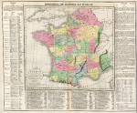
France, with Battles marked, Lavoisne 3rd edn, 1821. " Geographical and Statistical Map of France ", "divided into Governments indicating the places rendered celebrated by Battles or Sieges " by C.Gross, engraved by J.Yeager, published by M.Carey & Son in A Complete Genealogical, Historical, Chronological and Geographical Atlas .. by M.Lavoisne, third American (Philadelphia) edition, 1821. Various notes and statistics around and below the map. Key to the marked battle and siege sites below the map itself. Detail showing part of the map. Copper engraving with full original hand colour, centre-fold as published. Some browning down centre-fold and slight soiling. Margins of 1 cms or more. Overall size 51 x 41.5 cms. Ref D6116
Sweden & Norway map, 1858. " Sweden and Norway with Russian Finland by G.H.Swanston Edinr. " engraved by G.H.Swanston and published by A.Fullarton & Co. in The Companion Atlas to The Gazetteer of the World, about 1858. Steel engraved map with original hand colour in delicate pastel shades. On thick paper, with plate mark and good margins. Small inset map showing the environs of Stockholm. Detail showing part of the map. Centre-fold as published, good condition. Size 40 x 50 cms. Ref D6034
Europe, Railways, Swanston/Fullarton, c1858. " Central Europe with the Railways ... by J. Bartholomew Jun. " published by A.Fullarton & Co. in The Companion Atlas to The Gazetteer of the World, about 1858. Lithographic map with original hand colour. On thick paper, with good margins. Showing all railways completed or in progress, colour coded to according to country. Detail showing part of the main map. Centre-fold as published, good condition. Size 51 x 41 cms. Ref D6031
France, Atlas Modern Geography, 1853. " France " engraved by Sidney Hall and published in Butler's Atlas of Modern Geography, 1853. Steel engraved map with original hand colour. Centrefold as published, some soiling. Size 26 x 20 cms. Ref D5998
Holland & Belgium, Atlas of Modern Geography, 1853. " Holland & Belgium " engraved by Sidney Hall and published in Butler's Atlas of Modern Geography, 1853. Steel engraved map with original hand colour. Centrefold as published, slight soiling and age browning. Size 20.5 x 26 cms. Ref D5990
Sweden & Norway map, 1853. " Sweden & Norway " engraved by Sidney Hall and published in Butler's Atlas of Modern Geography, 1853. Steel engraved map with original hand colour. Centrefold as published, slight soiling. Size 20 x 26 cms. Ref D5988
Germany map, 1842. " Allemagne " published in Dufour and Picquet's Atlas Classique et Universal de Geographie, Paris, 1842. Detail showing part of the map. Steel engraved map with intricate original hand colour to show all the states, centrefold as published and good margins. Size 37 x 30.5 cms. Ref D5788
Belgium, Neele, 1808. " Belgium or the Netherlands divided into Departments " engraved by Neele and published by Longman & Co. 1808. Copper engraved map with original outline hand colour. Detail showing the Brussels area. Slight but uniform age browning.Plate mark and wide margins. Size 39 x 34 cms. Ref D5556
© 2003 - 2020 Website copyright Steve Bartrick Royalty free stock images of antique prints of interest to historians, students and family history researchers