Home » Antique maps » Europe maps >>> » All prints and maps

 
Spain & Portugal, 1877

Spain & Portugal, 1877.
" Espagne et Portugal " engraved by Erhard after Vuillemin, published in Atlas Universel D'Histoire et de Geographie, Paris, 1877. Lithographic map with original hand colour. Centre-fold as published. Size 26.5 x 20 cms. Ref D4581

 
France, Ecclesiastical, Atlas Universel, 1877

France, Ecclesiastical, Atlas Universel, 1877.
" La France Divisee par Provinces Ecclesiastiques " engraved by Erhard after Vuillemin, published in Atlas Universel D'Histoire et de Geographie, Paris, 1877. Lithographic map with original hand colour. Centre-fold as published. Size 26 x 19.5 cms. Ref D4509

 
France, Judiciary, Atlas Universel, 1877

France, Judiciary, Atlas Universel, 1877.
" La France Judiciaire " engraved by Erhard after Vuillemin, published in Atlas Universel D'Histoire et de Geographie, Paris, 1877. Lithographic map with original hand colour. Centre-fold as published. Size 26 x 19.5 cms. Ref D4508


France, Universities, 18 Academies, Atlas Universel, 1877

France, Universities, 18 Academies, Atlas Universel, 1877.
" La France Universitaire, Divisee en 18 Academies " engraved by Erhard after Vuillemin, published in Atlas Universel D'Histoire et de Geographie, Paris, 1877. Lithographic map with original hand colour. Centre-fold as published. Size 26 x 19.5 cms. Ref D4507

 
France, Agriculture & Industry, (2 sheets) Atlas Universel, 1877

France, Agriculture & Industry, (2 sheets) Atlas Universel, 1877.
" France, Agricole, Industrielle et Commerciale " engraved by Erhard after Vuillemin, published in Atlas Universel D'Histoire et de Geographie, Paris, 1877. Pair of lithographic maps with original hand colour. Centre-folds as published. Size 26 x 20 cms each. Ref D4505

 
France in 511, 567, 628 & 714, Atlas Universel, 1877

France in 511, 567, 628 & 714, Atlas Universel, 1877.
[ France, 4 maps showing France in 511, 567, 628-38 and 714 AD ] engraved by Erhard after Vuillemin, published in Atlas Universel D'Histoire et de Geographie, Paris, 1877. Lithographic map with original hand colour, centre fold as published. Size 26.5 x 20 cms. Ref D4492


France, Charlemagne Empire in 814, Atlas Universel, 1877

France, Charlemagne Empire in 814, Atlas Universel, 1877.
" Empire de Charlemagne en 814 ... " engraved by Erhard after Vuillemin, published in Atlas Universel D'Histoire et de Geographie, Paris, 1877. Lithographic map with original hand colour. Centre-fold as published. Size 26.5 x 20 cms. Ref D4489

 
France in 1483, Atlas Universel, 1877

France in 1483, Atlas Universel, 1877.
" France en 1483 a la morte de Louis XI " engraved by Erhard after Vuillemin, published in Atlas Universel D'Histoire et de Geographie, Paris, 1877. Lithographic map with original hand colour. Size 17 x 12.5 cms. Ref D4488

 
Roman France on 2 sheets, Atlas Universel, 1877

Roman France on 2 sheets, Atlas Universel, 1877.
" Gallia a C.J.Caesaris Tempore Usque as Theodosii Magni tempus ... " pair of maps engraved by Erhard after Vuillemin, published in Atlas Universel D'Histoire et de Geographie, Paris, 1877. Lithographic map with original hand colour. Centre-folds as published. Size each 26.5 x 20 cms. Ref D4435


France, Merovingian Gaul, 1877

France, Merovingian Gaul, 1877.
" Gaule pendant L'Epoque Merovingienne " engraved by Erhard after Vuillemin, published in Atlas Universel D'Histoire et de Geographie, Paris, 1877. Lithographic map with original hand colour. Centre-fold as published. Size 26.5 x 20 cms. Ref D4430

 
Italy (Roman) on 2 maps, 1877

Italy (Roman) on 2 maps, 1877.
" Italia Superior " and " Italia Inferior " (Roman period) engraved by Erhard after Vuillemain, published in Atlas Universel D'Histoire et de Geographie, Paris, 1877. Lithographic maps with original hand colour. Both have centre-folds as published. Size 26.5 x 20 cms each. Ref D4378

 
Germany map on 2 sheets, 1824

Germany map on 2 sheets, 1824.
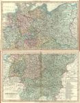
"Germany" anonymous engraver, published in Smith's New General Atlas, 1824 (maps dated 1820). Pair of large (double page) copper engraved maps with original hand colour, designed such that they will fit together to form one large map. Detail showing the Hamburg area. Very slightly soiled and each map has a closed split to the lower few cms of the centrefold (without loss). Size of each map 58 x 36 cms. (Note - the browning down the centrefold of the lower map is much less noticeable than it appears in my scan.) Ref D3517


France (ancient), 1811

France (ancient), 1811.
" La Gaule " drawn by Herisson, engraved by Glot and published in Nouvel Atlas Portatif by Desray, Paris, 1811. Copper engraved map with original outline hand colour. Detail showing the Paris area. Good condition with good margins. Size 23.5 x 18.5 cms. Ref D3373

 
France in Provinces, Smith's New General Atlas, 1824

France in Provinces, Smith's New General Atlas, 1824.
" France in Provinces " engraved by E.Jones and published in Smith's New General Atlas, 1824 (map dated 1820). Copper engraved map with original hand colour. Detail showing the Paris area. Very slightly soiled. Size 33.5 x 26 cms. Ref D3228

 
Wales, Milford Haven chart, 1856

Wales, Milford Haven chart, 1856.
" Milford Haven " drawn and engraved by J.Bartholomew, published by A. Fullarton & Co. in a gazetteer, about 1856. Lithographic map with original hand colour. Size 23 x 14 cms. Ref D2808


Netherlands (Belgium), Assheton/Teg, 1830

Netherlands (Belgium), Assheton/Teg, 1830.
" Netherlands " (Belgium) drawn by J.Assheton, engraved by J.Shury and published by Thomas Tegg, London, about 1830. Steel engraved map with original hand colour. Detail showing the Ghent - Brussels area. Centre-fold as published. Good margins. Size 26 x 20 cms. Ref D2456

 
Spain & Portugal, 1817

Spain & Portugal, 1817.
" Spain and Portugal " engraved by A.Findlay, published in History of the Revolution..., by T.Kelly, London, 1817. Copper engraved map with original hand colour. Slight soiling in margins. Size 24.5 x 18.5 cms. Ref D936

 
Holland & Belgium, miniature map, 1862

Holland & Belgium, miniature map, 1862.
" Kingdoms of Holland & Belgium " published by Bell & Daldy in Henry Bohn's Pictorial Handbook of Modern Geography, 1862. Miniature steel engraved map with original hand colour. Slightly age browned. Size 9 x 14 cms. Ref D805

 
« Previous | ...90 | 91 | 92 | 93 | 94 | 95 | 96 | 97 | 98 | 99 | Next »


© 2003 - 2020 Website copyright Steve Bartrick
Royalty free stock images of antique prints of interest to historians, students and family history researchers