Home » Antique maps » Historical and classical maps

 
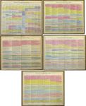
Historical Timelines on 5 charts, 1830

Historical Timelines on 5 charts, 1830.
"Chronological Map of Universal History" published in Lavoisne's Complete ... Geographical Atlas, 1830. Set of five charts with timelines for various epochs and countries (mainly European) from The Flood up to 1829. With original hand colouring. All have a centrefold as published. Size 52 x 42 cms each, plus margins. Ref H6446

 
Ancient France (Gallia or Gaul), 1820

Ancient France (Gallia or Gaul), 1820.
"Galliae, sicut ab Augusto divisae pars septentrionalis" with inset map "Gallia, qualis suit ineunte seculo quinto aerae Christianae, in 17 provincias dispertita" engraved by J.Russell after D.Mcpherson, published in Rees's Cyclopedia; or, Universal Dictionary ..., 1820. Copper engraved antique map with recent hand colouring, centrefold as published, good condition. Size 40 x 26 cms, plus margins. Ref H5770

 
Rhaetia and Noricum (Roman period), 1820

Rhaetia and Noricum (Roman period), 1820.
"Rhaetia et Noricum, Provinciae Romanorum" engraved by Cooper after D.Mcpherson, published in Rees's Cyclopedia; or, Universal Dictionary ..., 1820. Copper engraved antique map with recent hand colouring, centrefold as published, good condition. Size 40.5 x 25.5 cms, plus margins. Ref H5769


Germania Magna (Roman period), 1820

Germania Magna (Roman period), 1820.
"Germania Magna quoe ninquam Romanis paruit" engraved by Cooper after W.W.Mcpherson, published in Rees's Cyclopedia; or, Universal Dictionary ..., 1820. Copper engraved antique map with recent hand colouring, centrefold as published, good condition. Size 40 x 25.5 cms, plus margins. Ref H5768

 
Ancient Judea (Israel/Palestine), 1820

Ancient Judea (Israel/Palestine), 1820.
"Judaea et Regiones Finitimae circiter initium Aerae Christianae" and "Terra Filiorum Israelis, antequam in duo regna dispertita fuit, cum Terra Philistaeorum, parte Phoenices &c." engraved by J.Russell after Arrowsmith, published in Rees's Cyclopedia; or, Universal Dictionary ..., 1820. Copper engraved antique map, centrefold as published, good condition. Size 40 x 26 cms, plus margins. Ref H5765

 
Roman Empire map, published 1745

Roman Empire map, published 1745.
"A General Map of the Roman Empire shewing the situation of all it's Provinces & seats of ye Barbarous Nations on their Frontiers" engraved by J.Basire, published in the Universal History ..., about 1745. Copper engraved antique map with recent hand colour. Several (flattened) folds as published, left and right margins very close trimmed with some loss to left side, otherwise good condition. Size 50.5 x 25.5 cms, plus margins. Ref H5373


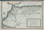
Ancient Mauritania, Numidia etc., 1745

Ancient Mauritania, Numidia etc., 1745.
"Mauritania, Numidia, Gaetulia &c." engraved by J.Basire, published in the Universal History ..., about 1745. Copper engraved antique map with recent hand colour. Several (flattened) vertical folds as published, upper margin close trimmed, otherwise good condition. Size 30.5 x 20.5 cms, plus margins. Ref H4397

 
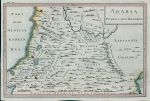
Ancient Palestine and Syria etc., 1745

Ancient Palestine and Syria etc., 1745.
"Arabia Petraea and Deserta" anonymous engraver, published in the Universal History ..., about 1745. Copper engraved antique map with recent hand colour. Several (flattened) vertical folds as published, good condition. Size 30 x 20 cms, plus margins. Ref H4396

 
Ancient Carthage, 1745

Ancient Carthage, 1745.
[ Carthage ] engraved by J.Basire, published in the Universal History ..., about 1745. Copper engraved antique map with recent hand colour. Several (flattened) horizontal folds as published, good condition. Size 17.5 x 29.5 cms, plus margins. Ref H4395


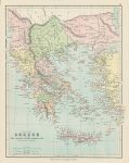
Ancient Greece, 1875

Ancient Greece, 1875.
"Ancient Greece with the Islands of the Aegean Sea ..." chromolithographic map published by George Philip & Son in Philip's Library Atlas, about 1875. Good condition. Size 23 x 30 cms plus margins. Ref H4387

 
Roman Empire map (2 sheets), 1875

Roman Empire map (2 sheets), 1875.
"The Roman Empire ..." pair of chromolithographic maps published by George Philip & Son in Philip's Library Atlas, about 1875. Good condition. Size 24 x 30 cms each, plus margins. Ref H4386

 
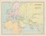
Map of the World as known to the Ancients, 1875

Map of the World as known to the Ancients, 1875.
"The World as known to the Ancients" chromolithographic map published by George Philip & Son in Philip's Library Atlas, about 1875. Good condition. Size 30 x 23.5 cms plus margins. Ref H4385


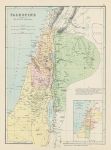
Ancient Palestine map, 1875

Ancient Palestine map, 1875.
"Palestine according to it's Ancient Divisions" chromolithographic map published by George Philip & Son in Philip's Library Atlas, about 1875. Good condition. Size 22 x 31 cms plus margins. Ref H4384

 
Roman South Italy, 1820

Roman South Italy, 1820.
"Italiae Ulterior, cujus pars australis Magna Graecia, ob Graecorum colonias, dicta, ante divisionem ab Augusto factam" engraved by Cooper after W.W.MacPherson, published in Rees's Cyclopedia; or, Universal Dictionary ..., 1820. Copper engraved antique map, centrefold as published, good condition. Size 40 x 26 cms, plus margins. Ref H4199

 
Roman Middle Italy, 1820

Roman Middle Italy, 1820.
"Italiae Media, vet Italiae Propriae pars Borealis, ante divisionem ab Augusto factam" engraved by Cooper after W.W.MacPherson, published in Rees's Cyclopedia; or, Universal Dictionary ..., 1820. Copper engraved antique map, centrefold as published, good condition. Size 40.5 x 26 cms, plus margins. Ref H4198


Roman North Italy, 1820

Roman North Italy, 1820.
"Italiae Regio Alpina, quae vulgo, sed minus reete, dicitue Gallia Cisalpina" engraved by Cooper after W.W.MacPherson, published in Rees's Cyclopedia; or, Universal Dictionary ..., 1820. Copper engraved antique map, centrefold as published, good condition. Size 40 x 26 cms, plus margins. Ref H4197

 
Roman France, 1820

Roman France, 1820.
"Galliae, sicut ab Augusto divisae, pars meridionalis" engraved by J.Russell after W.W.MacPherson, published in Rees's Cyclopedia; or, Universal Dictionary ..., 1820. Copper engraved antique map, centrefold as published, good condition. Size 40 x 26 cms, plus margins. Ref H4196

 
Roman Britain, 1820

Roman Britain, 1820.
"Britannia Romana cum Hibernia et Insulis adjacentibus" engraved by J.Russell after W.W.MacPherson, published in Rees's Cyclopedia; or, Universal Dictionary ..., 1820. Copper engraved antique map with recent hand colour. Centrefold as published, good condition. Size 25 x 41 cms including title, plus margins. Ref H3934

 
« Previous | 1 | 2 | 3 | 4 | 5 | 6 | 7 | 8 | 9 | 10... | Next »


© 2003 - 2020 Website copyright Steve Bartrick
Royalty free stock images of antique prints of interest to historians, students and family history researchers