Home » Antique maps » Historical and classical maps

 
Asia Minor in the time of Strabo, 1820

Asia Minor in the time of Strabo, 1820.
"Asia Peninsularis cum Insulis Adjacentibus praecipue ad mentem Strabonis ..." engraved by J.Russell after W.W.MacPherson, published in Rees's Cyclopedia; or, Universal Dictionary ..., 1820. Copper engraved antique map with recent hand colour. Centrefold as published, good condition. Size 40.5 x 26 cms including title, plus margins. Ref H3933

 
Roman Greece, Thessaly and Epirus, 1820

Roman Greece, Thessaly and Epirus, 1820.
"Hellas sive Graecia Propria, Thessalia, et Epirus, antiquam Romanae ditionis suerunt" engraved by J.Russell after W.W.MacPherson, published in Rees's Cyclopedia; or, Universal Dictionary ..., 1820. Copper engraved antique map with recent hand colour. Centrefold as published, good condition. Size 40.5 x 26 cms including title, plus margins. Ref H3932

 
Roman Macedonia and Thrace, 1820

Roman Macedonia and Thrace, 1820.
"Macedonia et Thracia, antequam Romanae ditionis fuerunt" engraved by Cooper after W.W.MacPherson, published in Rees's Cyclopedia; or, Universal Dictionary ..., 1820. Copper engraved antique map with recent hand colour. Centrefold as published, good condition. Size 40 x 25.5 cms including title, plus margins. Ref H3931


Homer's Greece, Thrace and Asia Minor, 1820

Homer's Greece, Thrace and Asia Minor, 1820.
"Populi, Urbes &c. in Graecia, Thracia, et Asia, quorum meminit Homerus ..." engraved by J.Russell after W.W.MacPherson, published in Rees's Cyclopedia; or, Universal Dictionary ..., 1820. Copper engraved antique map with recent hand colour. Centrefold as published, good condition. Size 40.5 x 26 cms including title, plus margins. Ref H3930

 
Roman Greece, 1820

Roman Greece, 1820.
"Peloponnesus, (que antea Apia, Pelasgia, et Argos) antequam Romanae ditionis suit ..." engraved by J.Russell after W.W.MacPherson, published in Rees's Cyclopedia; or, Universal Dictionary ..., 1820. Copper engraved antique map with recent hand colour. Centrefold as published, damage to centrefold with some loss (holes in sea area.) Size 40 x 26 cms including title, plus margins. Ref H3929

 
The Ancient World, 1820

The Ancient World, 1820.
"Orbis Veteribus Cognitus" engraved by Alex Findlay after Alex MacPherson, published in Rees's Cyclopedia; or, Universal Dictionary ..., 1820. Copper engraved antique map with recent hand colour. Centrefold as published, good condition. Size 40.5 x 26 cms including title, plus margins. Ref H3928


Ancient Egypt, 1820

Ancient Egypt, 1820.
"Aegyptus, Provincia Romana Imperialis" (Roman Egypt) engraved by Cooper after W.W.MacPherson, published in Rees's Cyclopedia; or, Universal Dictionary ..., 1820. Copper engraved antique map with recent hand colour. Centrefold as published, good condition. Size 40 x 26 cms including title, plus margins. Ref H3927

 
Ancient North Africa, 1820

Ancient North Africa, 1820.
"Libyae, vel Africae ora borealis" engraved by J.Russell after W.W.MacPherson, published in Rees's Cyclopedia; or, Universal Dictionary ..., 1820. Copper engraved antique map. Centrefold as published, good condition. Size 40 x 26 cms including title, plus margins. Ref H3926

 
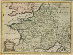
Ancient Gaul, 1745

Ancient Gaul, 1745.
"Ancient Gaul" anonymous engraver, published in the Universal History ..., about 1745. Copper engraved antique map with recent hand colour. Several vertical folds as published, upper margin close trimmed and stain to lower left corner, otherwise good condition. Size 27.5 x 20.5 cms, plus margins. Ref H3803


Ancient Armenia and Georgia, 1745

Ancient Armenia and Georgia, 1745.
"Bosporus, Maeotis, Iberia, Albania and Asiatic Sarmatia" anonymous engraver, published in the Universal History ..., about 1745. Copper engraved antique map with recent hand colour. Several vertical folds as published, left margin close trimmed, otherwise good condition. Size 30 x 19.5 cms, plus margins. Ref H3802

 
Roman Empire, 1820

Roman Empire, 1820.
"Imperium Romanum" engraved by Alexander Findlay after Alexander MacPherson, published in Rees's Cyclopedia; or, Universal Dictionary ..., 1820. Copper engraved antique map with recent hand colour. Centrefold as published, good condition. Size 40.5 x 26 cms including title, plus margins. Ref H3636

 
Roman Sicily (Sicilia), 1820

Roman Sicily (Sicilia), 1820.
"Sicilia, Provincia Romanorum ..." engraved by Cooper after W.H.MacPherson, published in Rees's Cyclopedia; or, Universal Dictionary ..., 1820. Copper engraved antique map with recent hand colour. Centrefold as published, good condition. Size 40 x 26 cms including title, plus margins. Ref H3635


Roman Italy (Italia), 1820

Roman Italy (Italia), 1820.
"Italia in Regiones Undecim ab Augusto descripta ..." engraved by Cooper after W.H.MacPherson, published in Rees's Cyclopedia; or, Universal Dictionary ..., 1820. Copper engraved antique map with recent hand colour. Centrefold as published, good condition. Size 40.5 x 26 cms including title, plus margins. Ref H3634

 
Roman Spain (Hispania), 1820

Roman Spain (Hispania), 1820.
"Hispania Romana" engraved by J.Russell after W.H.MacPherson, published in Rees's Cyclopedia; or, Universal Dictionary ..., 1820. Copper engraved antique map with recent hand colour. Centrefold as published, good condition. Size 40 x 25.5 cms including title, plus margins. Ref H3633

 
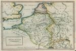
Ancient Belgic or Lower Germany, 1745

Ancient Belgic or Lower Germany, 1745.
"Belgic or Lower Germany" engraved by J.Basire, published in the Universal History ..., about 1745. Copper engraved antique map with recent hand colour. Several folds as published, lower right corner margin close cropped and repaired, otherwise good condition. Size 30.5 x 20 cms, plus margins. Ref H3498


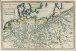
Ancient Germany, 1745

Ancient Germany, 1745.
"Antient Germany" engraved by J.Basire, published in the Universal History ..., about 1745. Copper engraved antique map with recent hand colour. Several folds as published, lower right corner margin close cropped and repaired, otherwise good condition. Size 30.5 x 20 cms, plus margins. Ref H3497

 
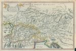
Ancient Vindelicia, Rhaetia & Noricum, 1745

Ancient Vindelicia, Rhaetia & Noricum, 1745.
"The Countries of Vindelicia, Rhaetia & Noricum" engraved by J.Blundell, published in the Universal History ..., about 1745. Copper engraved antique map with recent hand colour. Several folds as published, lower right corner margin close cropped and repaired, otherwise good condition. Size 30 x 20 cms, plus margins. Ref H3496

 
The World as known to the Ancients (2 maps), 1864

The World as known to the Ancients (2 maps), 1864.
"The World as known to the Ancients" by J.Bartholomew, published in The Gallery of Geography, 1864. Pair of colour lithographic maps. Centrefolds as published, slight age browning, otherwise good condition. Size 22.5 x 26 cms each, plus margins. Ref H3195

 
« Previous | 1 | 2 | 3 | 4 | 5 | 6 | 7 | 8 | 9 | 10... | Next »


© 2003 - 2020 Website copyright Steve Bartrick
Royalty free stock images of antique prints of interest to historians, students and family history researchers