Please see my main site ANTIQUEPRINTS.COM For original antique prints and maps
Charing Cross - 1837
Home » Antique maps » Europe maps >>> » Ireland antique maps
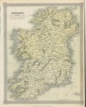
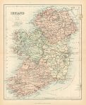
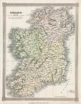
Ireland map, 1843. "Ireland" drawn and engraved by Alex Findlay, published by Thomas Kelly in A New and Universal English Dictionary, 1843. Steel engraved map with old hand colouring. Good condition. Size 19.5 x 24.5 cms, plus margins. Ref i2838
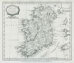
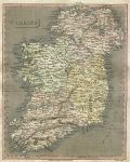
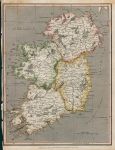
Ireland map, 1807. "Ireland from the Best Authorities" published in A General View of the World, 1807. Copper engraved map, good condition. Size 22 x 19 cms, plus margins. Ref i2814
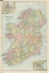
Ireland (on three sheets), 1901. "Ireland", published in Bacon's Popular Atlas of the British Isles, 1901. Set of 3 large colour lithographic maps, for north, central and south Ireland. Centrefolds as published, slight age browning on folds, otherwise good condition. Size about 46 x 32 cms each, plus margins. Ref I1248
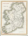
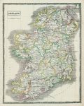
Ireland map, 1841. "Ireland" engraved by W.Hughes, published in The Scenery and Antiquities of Ireland, about 1841. Steel engraved antique map, with recent hand colour. Good condition. Size 19 x 25 cms including title, plus margins. Ref I1158
Ireland map, 1901. "Ireland", published in Bacon's Popular Atlas of the British Isles, 1901. Large colour lithographic map. Centrefold as published, slight age browning on fold, otherwise good condition. Size 31 x 47 cms, plus margins. Ref I1120
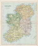
Ireland map, 1896. "Ireland" published in The Gallery of Geography, about 1896. Colour lithographic map, centrefold as published, very good condition. Size 23.5 x 28.5 cms, plus margins. Ref H8918
Ireland map, 1817. "Ireland" engraved by T.Clerk, published in A New and Complete System of Modern Geography, 1817. Copper engraved antique map, good condition. Size 19 x 24.5 cms including title, plus margins. Ref H7084
Ireland map, 1820. "Ireland" engraved by Cooper after Arrowsmith, published in Rees's Cyclopedia; or, Universal Dictionary ..., 1820. Copper engraved antique map with recent hand colour, centrefold as published, good condition. Size 25 x 40 cms, plus margins. Ref H4823
Ireland, Ulster map, 1784. "A New & Correct Map of the Province of Ulster, drawn from the Latest & Best Authorities" published in Walpoole's New and Complete British Traveller, about 1784. Copper engraved map with recent hand colouring. Upper margin close trimmed with slight loss of decorative border, otherwise good condition. Size 35 x 22.5 cms, plus margins. Ref H3795
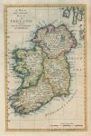
Ireland map, published 1781. "A New and Accurate Map of Ireland, drawn from the Best Authorities, by Thos. Bowen" published by W.Russel in A New and Authentic History of England, London, 1781. Copper engraved antique map with recent hand colour, good condition with full plate mark. Size 19 x 29.5 cms plus margins. Ref H3499
Ireland, Ports on the east coast St.Georges Channel, 1856. "Ports in Ireland East Coast St.Georges Channel" with Kingstown, Howth, Dublin, Wexford and Waterford. Engraved by G.H.Swanston, published by A. Fullarton & Co. in Gazetteer of the World, 1856. Steel engraved map, good condition. Size 13.5 x 23 cms plus margins. Ref H3453
Ireland map, 1864. "Ireland" by J.Bartholomew, published in The Gallery of Geography, 1864. Colour lithographic map. Centrefold as published, slight age browning, otherwise good condition. Size 21.5 x 26 cms, plus margins. Ref H3187
Ireland map, 1844. "Ireland" published in the New Edinburgh General Atlas, 1844. Lithographic antique map with original hand colouring. Very slight soiling, otherwise good condition. Size 28 x 35.5 cms, plus margins. Ref H898
Ireland map, 1811. "Ireland" drawn and engraved by Cooper, published in A System of Modern Geography, 1811. Copper engraved antique map with recent hand colouring. Close trimmed (with slight loss) and creasing to left margin, otherwise good condition. Size 19 x 24.5 cms including title, plus margins. Ref H570
Dublin environs map, 1886. "Environs of Dublin" by J.Bartholomew, published by the Royal Geographical Society in Gazetteer of the World, 1886. Colour lithographic map. Good condition. Size 23 x 13.5 cms plus margins. Ref G9705
Belfast & Cork maps, 1886. "Belfast & Environs" with "Cork Harbour & Environs" by J.Bartholomew, published by the Royal Geographical Society in Gazetteer of the World, 1886. Colour lithographic map. Good condition. Size 14 x 23.5 cms plus margins. Ref G9704
Ireland map, 1836. "Ireland" drawn and engraved by Alexander Findlay, published by Thomas Kelly about 1836. Steel engraved antique map with recent hand colour. Good condition. Size 19.5 x 25 cms. Ref G9453
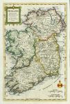
Ireland map, 1773. "Ireland, Divided into Provinces & Counties, by Thos. Kitchin, Geogr." copper engraved antique map by G.Rollos, published in Fenning's A New System of Geography ..., 1773. Good condition with full plate mark. Recent hand colouring. Size 18.5 x 29 cms, plus margins. Ref G8346
© 2003 - 2020 Website copyright Steve Bartrick Royalty free stock images of antique prints of interest to historians, students and family history researchers