Home » All prints and maps

 
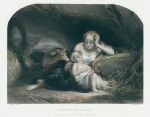
Geneviève of Brabant, after Wappers, 1856

Geneviève of Brabant, after Wappers, 1856.
"Geneviève of Brabant" engraved by J.C.Armytage after a picture by Gustave Wappers, published in The Art Journal, 1856. Steel engraved antique print, with recent hand colouring. Good condition. Size 27 x 22 cms including title, plus margins. Ref H5773

 
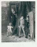
The Wolf and the Lamb (bullying), 1856

The Wolf and the Lamb (bullying), 1856.
"The Wolf and the Lamb" engraved by C.W.Sharpe after a picture by W.Mulready, published in The Art Journal, 1856. Steel engraved print, good condition. Size 21 x 26.5 cms including title, plus margins. Ref H5772

 
Netherlands map, 1820

Netherlands map, 1820.
"The Seven United Provinces" engraved by Cooper after Arrowsmith, published in Rees's Cyclopedia; or, Universal Dictionary ..., 1820. Copper engraved antique map with recent hand colouring, centrefold as published, good condition. Size 39 x 25 cms, plus margins. Ref H5771


Ancient France (Gallia or Gaul), 1820

Ancient France (Gallia or Gaul), 1820.
"Galliae, sicut ab Augusto divisae pars septentrionalis" with inset map "Gallia, qualis suit ineunte seculo quinto aerae Christianae, in 17 provincias dispertita" engraved by J.Russell after D.Mcpherson, published in Rees's Cyclopedia; or, Universal Dictionary ..., 1820. Copper engraved antique map with recent hand colouring, centrefold as published, good condition. Size 40 x 26 cms, plus margins. Ref H5770

 
Rhaetia and Noricum (Roman period), 1820

Rhaetia and Noricum (Roman period), 1820.
"Rhaetia et Noricum, Provinciae Romanorum" engraved by Cooper after D.Mcpherson, published in Rees's Cyclopedia; or, Universal Dictionary ..., 1820. Copper engraved antique map with recent hand colouring, centrefold as published, good condition. Size 40.5 x 25.5 cms, plus margins. Ref H5769

 
Germania Magna (Roman period), 1820

Germania Magna (Roman period), 1820.
"Germania Magna quoe ninquam Romanis paruit" engraved by Cooper after W.W.Mcpherson, published in Rees's Cyclopedia; or, Universal Dictionary ..., 1820. Copper engraved antique map with recent hand colouring, centrefold as published, good condition. Size 40 x 25.5 cms, plus margins. Ref H5768


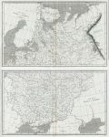
Russia in Europe, on 2 maps, 1820

Russia in Europe, on 2 maps, 1820.
"... Russia in Europe" engraved by Cooper after Arrowsmith, published in Rees's Cyclopedia; or, Universal Dictionary ..., 1820. Pair of copper engraved antique maps, with centrefolds as published, good condition. Size of each 40 x 24.5 cms, plus margins. Ref H5767

 
Russian Empire (Russia in Asia), 1820

Russian Empire (Russia in Asia), 1820.
"Russian Empire" engraved by Cooper after Arrowsmith, published in Rees's Cyclopedia; or, Universal Dictionary ..., 1820. Copper engraved antique map, centrefold as published, good condition. Size 40.5 x 24.5 cms, plus margins. Ref H5766

 
Ancient Judea (Israel/Palestine), 1820

Ancient Judea (Israel/Palestine), 1820.
"Judaea et Regiones Finitimae circiter initium Aerae Christianae" and "Terra Filiorum Israelis, antequam in duo regna dispertita fuit, cum Terra Philistaeorum, parte Phoenices &c." engraved by J.Russell after Arrowsmith, published in Rees's Cyclopedia; or, Universal Dictionary ..., 1820. Copper engraved antique map, centrefold as published, good condition. Size 40 x 26 cms, plus margins. Ref H5765


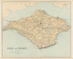
Isle of Wight map, c1867

Isle of Wight map, c1867.
"Isle of Wight" by Edward Weller, published by George Philip & Son in a county atlas, about 1867. Early colour lithographic map with centrefold as published, very slight soiling, otherwise good condition. Size 41.5 x 34 cms plus margins. Ref H5764

 
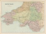
South Wales map, c1867

South Wales map, c1867.
"South Wales" by J.Bartholomew, published by George Philip & Son in a county atlas, about 1867. Early colour lithographic map with centrefold as published, very slight soiling, otherwise good condition. Size 46 x 33 cms plus margins. Ref H5763

 
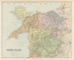
North Wales map, c1867

North Wales map, c1867.
"North Wales" by J.Bartholomew, published by George Philip & Son in a county atlas, about 1867. Early colour lithographic map with centrefold as published, very slight soiling, otherwise good condition. Size 41.5 x 33.5 cms plus margins. Ref H5762


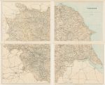
Yorkshire map, on four sheets, c1867

Yorkshire map, on four sheets, c1867.
"Yorkshire" by Edward Weller, published by George Philip & Son in a county atlas, about 1867. Set of four early colour lithographic maps, each with centrefold as published, very slight soiling and the reverse has several pasted down descriptions of WW2 aircraft, this not affecting the maps as they are on thick paper. Printed such that they would join to make one very large map. Size of each map 40.5 x 33.5 cms, plus margins. Ref H5761

 
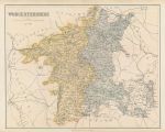
Worcestershire map, c1867

Worcestershire map, c1867.
"Worcestershire" by Edward Weller, published by George Philip & Son in a county atlas, about 1867. Early colour lithographic map with centrefold as published, very slight soiling and the reverse has several pasted down descriptions of WW2 aircraft, this not affecting the map as it is on thick paper. Size 42.5 x 34 cms plus margins. Ref H5760

 
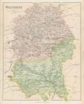
Wiltshire map, c1867

Wiltshire map, c1867.
"Wiltshire" by Edward Weller, published by George Philip & Son in a county atlas, about 1867. Early colour lithographic map with centrefold as published, very slight soiling and the reverse has several pasted down descriptions of WW2 aircraft, this not affecting the map as it is on thick paper. Size 34 x 43 cms plus margins. Ref H5759


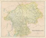
Westmoreland map, c1867

Westmoreland map, c1867.
"Westmoreland" by Edward Weller, published by George Philip & Son in a county atlas, about 1867. Early colour lithographic map with centrefold as published, very slight soiling and the reverse has several pasted down descriptions of WW2 aircraft, this not affecting the map as it is on thick paper. Size 41.5 x 33.5 cms plus margins. Ref H5758

 
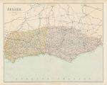
Sussex map, c1867

Sussex map, c1867.
"Sussex" by J.Bartholomew, published by George Philip & Son in a county atlas, about 1867. Early colour lithographic map with centrefold as published, slight soiling in sea area and the reverse has several pasted down descriptions of WW2 aircraft, this not affecting the map as it is on thick paper. Size 42 x 33.5 cms plus margins. Ref H5757

 
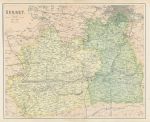
Surrey map, c1867

Surrey map, c1867.
"Surrey" by J.Bartholomew, published by George Philip & Son in a county atlas, about 1867. Early colour lithographic map with centrefold as published, very slight soiling and the reverse has several pasted down descriptions of WW2 aircraft, this not affecting the map as it is on thick paper. Size 41.5 x 34 cms plus margins. Ref H5756

 
« Previous | ...370 | 371 | 372 | 373 | 374 | 375 | 376 | 377 | 378 | 379 | 380... | Next »


© 2003 - 2020 Website copyright Steve Bartrick
Royalty free stock images of antique prints of interest to historians, students and family history researchers