Home » Antique maps » Europe maps >>> » Ireland antique maps

 
Ireland, the Sligo to Castlebar route, 1783

Ireland, the Sligo to Castlebar route, 1783.
[ Start of the Sligo to Castlebar route ] engraved by G.Terry and published in Taylor and Skinner's Maps of the Roads of Ireland, (2nd edition), 1783. Includes Sligo, Balcarra and Tobercorry. On the verso is the next part of this route, with Ballaghy, Swineford Foxford and Ballylaghan. Copper engraved map. Size 12 x 21.5 cms plus good margins. Ref F6197

 
Ireland, the Dunmore to Ballinrobe and Clare route, 1783

Ireland, the Dunmore to Ballinrobe and Clare route, 1783.
[ The Dunmore to Ballinrobe and Clare route ] engraved by G.Terry and published in Taylor and Skinner's Maps of the Roads of Ireland, (2nd edition), 1783. Also includes Ballindine and Hollymount. On the verso is the Tuam to Sligo route. Copper engraved map. Size 12 x 21.5 cms plus good margins. Ref F6196

 
Ireland, end of the Dublin to Ennis route, 1783

Ireland, end of the Dublin to Ennis route, 1783.
[ End of the Dublin to Ennis route ] engraved by G.Terry and published in Taylor and Skinner's Maps of the Roads of Ireland, (2nd edition), 1783. Includes Tullo and Ennis. On the verso is the Limerick to Callaghans Mills route. Copper engraved map. Size 12 x 21.5 cms plus good margins. Ref F6195


Ireland, route map from Dromore to Newtownards, 1783

Ireland, route map from Dromore to Newtownards, 1783.
[ The Dromore to Newtownards route ] engraved by G.Terry and published in Taylor and Skinner's Maps of the Roads of Ireland, (2nd edition), 1783. Also includes Ballynahinch, Saintfield and Cumber. On the verso is the Dromore to Castlewellan route, and Clough to Ballynahinch route. Copper engraved map. Size 12 x 21.5 cms plus good margins. Ref F6194

 
Ireland, route map with Armagh, Richill and Loughbrickland, 1783

Ireland, route map with Armagh, Richill and Loughbrickland, 1783.
[ The Armagh to Gillford, Banbridge and Loughbrickland route ] engraved by G.Terry and published in Taylor and Skinner's Maps of the Roads of Ireland, (2nd edition), 1783. On the verso is the Killough to Belfast route, via Downpatrick. Copper engraved map. Size 12 x 21.5 cms plus good margins. Ref F6193

 
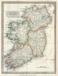
Ireland, 1828

Ireland, 1828.
"Ireland" published in Kelly's ... Geography, 1828. Copper engraved antique map with recent hand colouring. Size 18 x 24.5 cms including text, plus margins. Ref F6074


Ireland, route map with Dublin and the Dublin Bay and Killiney Bay coast, 1783

Ireland, route map with Dublin and the Dublin Bay and Killiney Bay coast, 1783.
[ The Dublin to Black Rock, Dunleary, Bullock, Dalkey & Bray route, and Mount-Charles to Shallagan Bridge route ] engraved by G.Terry and published in Taylor and Skinner's Maps of the Roads of Ireland, (2nd edition), 1783. The verso is blank. Copper engraved map. Size 12 x 21.5 cms plus good margins. Ref F5975

 
Ireland, route map with Rostrevor, Rathfriland, Dromore, Moira and Lurgan, 1783

Ireland, route map with Rostrevor, Rathfriland, Dromore, Moira and Lurgan, 1783.
[ The Rostrevor to Moira and Lurgan route, via Rathfriland and Dromore ] engraved by G.Terry and published in Taylor and Skinner's Maps of the Roads of Ireland, (2nd edition), 1783. On the verso is the Newry to Ballyboy route, via Baleektown, Newtown Hamilton and Castleblaney. Copper engraved map. Size 12 x 21.5 cms plus good margins. Ref F5974

 
Ireland, route map with Headford, Tuam, Castlebar and Partree, 1783

Ireland, route map with Headford, Tuam, Castlebar and Partree, 1783.
[ The Headford to Tuam route, and start of the Castlebar to Galway route, as far as Partree ] engraved by G.Terry and published in Taylor and Skinner's Maps of the Roads of Ireland, (2nd edition), 1783. On the verso is the Westport to Partree route. Copper engraved map. Size 12 x 21.5 cms plus good margins. Ref F5973


Ireland, route map with Ballinrobe, Shrule and Cong, 1783

Ireland, route map with Ballinrobe, Shrule and Cong, 1783.
[ The Ballinrobe to Shrule route ] engraved by G.Terry and published in Taylor and Skinner's Maps of the Roads of Ireland, (2nd edition), 1783. On the verso is the end of the Castlebar to Galway route, including Headford, Gregg, Clare Galway and Galway. Copper engraved map. Size 12 x 21.5 cms plus good margins. Ref F5972

 
Ireland, route map with Castlebar, Killala and Castle Lachen, 1783

Ireland, route map with Castlebar, Killala and Castle Lachen, 1783.
[ The Castlebar to Killala and Castle Lachen route ] engraved by G.Terry and published in Taylor and Skinner's Maps of the Roads of Ireland, (2nd edition), 1783. On the verso is the start of the Ballinrobe to DSligo via Ball route (Sligo not on this map). Copper engraved map. Size 12 x 21.5 cms plus good margins. Ref F5971

 
Ireland, route map with Sligo, Ballisidere and on towards Esky Bridge, 1783

Ireland, route map with Sligo, Ballisidere and on towards Esky Bridge, 1783.
[ The start of the Sligo to Esky Bridge route ] engraved by G.Terry and published in Taylor and Skinner's Maps of the Roads of Ireland, (2nd edition), 1783. On the verso is the end of the Sligo to Castlebar route, and the Castlebar to Westport route. Copper engraved map. Size 12 x 21.5 cms plus good margins. Ref F5970


Ireland, route map from Sligo to Ballyshannon, 1783

Ireland, route map from Sligo to Ballyshannon, 1783.
[ The Sligo to Ballyshannon route ] engraved by G.Terry and published in Taylor and Skinner's Maps of the Roads of Ireland, (2nd edition), 1783. On the verso is the end of the Sligo to Esky Bridge and Ballina route, including Esky Bridge & Ballina. Copper engraved map. Size 12 x 21.5 cms plus good margins. Ref F5969

 
Ireland, route map with Ballintra, Donegal, Towardly and Ballybosey, 1783

Ireland, route map with Ballintra, Donegal, Towardly and Ballybosey, 1783.
[ Part of the Sligo to Ballyshannon & Londonderry route ] engraved by G.Terry and published in Taylor and Skinner's Maps of the Roads of Ireland, (2nd edition), 1783. This map includes Ballintra, Donegal, Towardly and Ballybosey. On the verso is the continuation of this route, including Convoy, Castlefin, Lifford, Strabane, Johnstown and Londonderry. Copper engraved map. Size 12 x 21.5 cms plus good margins. Ref F5968

 
Ireland, route map with Dunsanaghy, Ballybosey and Fin Town, 1783

Ireland, route map with Dunsanaghy, Ballybosey and Fin Town, 1783.
[ The end of the Killybeggs to Dunsanaghy route, and Ballybosey to Fin Town route ] engraved by G.Terry and published in Taylor and Skinner's Maps of the Roads of Ireland, (2nd edition), 1783. On the verso is the start of the same route including Killybeggs, Ardra, Sahalagn Bridge and Mulloghdearg. Copper engraved map. Size 12 x 21.5 cms plus good margins. Ref F5967


Ireland, route map with Londonderry, Letterkenny and Dunsanagby, 1783

Ireland, route map with Londonderry, Letterkenny and Dunsanagby, 1783.
[ The Londonderry to and Dunsanagby route, via Letterkenny ] engraved by G.Terry and published in Taylor and Skinner's Maps of the Roads of Ireland, (2nd edition), 1783. On the verso is the Carrick to Killesandra and Swanlinbar route via Leitrim. Copper engraved map. Size 12 x 21.5 cms plus good margins. Ref F5966

 
Ireland, route map with Granard, Swanlinbar, Edgworthstown and Ballymahon, 1783

Ireland, route map with Granard, Swanlinbar, Edgworthstown and Ballymahon, 1783.
[ The Granard to Ballymahon route ] engraved by G.Terry and published in Taylor and Skinner's Maps of the Roads of Ireland, (2nd edition), 1783. On the verso is the Carrick to Ballyshannon route including Carrick, Leitrim and Manor Hamilton. Copper engraved map. Size 12 x 21.5 cms plus good margins. Ref F5965

 
Ireland, route map with Roscommon, Mt.Talbot, Ballinamore and Ballinasloe, 1783

Ireland, route map with Roscommon, Mt.Talbot, Ballinamore and Ballinasloe, 1783.
[ The Roscommon to Ballinasloe, Eyrecourt and Portumna route ] engraved by G.Terry and published in Taylor and Skinner's Maps of the Roads of Ireland, (2nd edition), 1783. On the verso is the Carrick to Ballyshannon route and the Drumahare to Coloony route. Copper engraved map. Size 12 x 21.5 cms plus good margins. Ref F5964

 
« Previous | 1 | 2 | 3 | 4 | 5 | 6 | 7 | 8 | 9 | 10... | Next »


© 2003 - 2020 Website copyright Steve Bartrick
Royalty free stock images of antique prints of interest to historians, students and family history researchers