Home » All prints and maps

 
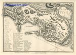
Italy, Genoa city plan, 1776 / 1800

Italy, Genoa city plan, 1776 / 1800.
"A Plan of the City of Genoa" by John Andrews, detailed copper engraved city plan published by John Stockdale in A .. Description of the Empire of Germany, Holland, the Netherlands ..., 1800. This plan was first published in 1776. Very good condition with good margins and full plate mark. Size 25.5 x 18.5 cms. Ref F5893

 
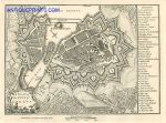
Switzerland, Geneva city plan, 1800

Switzerland, Geneva city plan, 1800.
"A Plan of the City of Geneva" by John Andrews, detailed copper engraved city plan published by John Stockdale in A .. Description of the Empire of Germany, Holland, the Netherlands ..., 1800. This plan was first published in 1776. Very good condition with good margins and full plate mark. Size 24 x 18 cms. Ref F5892

 
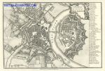
Germany, Dresden city plan, 1800

Germany, Dresden city plan, 1800.
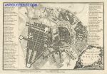
"A Plan of the City of Dresden" by John Andrews, detailed copper engraved city plan published by John Stockdale in A .. Description of the Empire of Germany, Holland, the Netherlands ..., 1800. This plan was first published in 1776. Very good condition with good margins and full plate mark. Size 26 x 18 cms. Ref F5891


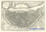
Germany, Cologne city plan, 1800

Germany, Cologne city plan, 1800.
"A Plan of the City of Cologne" by John Andrews, detailed copper engraved city plan published by John Stockdale in A .. Description of the Empire of Germany, Holland, the Netherlands ..., 1800. This plan was first published in 1776. Very good condition with good margins and full plate mark. Size 23.5 x 16.5 cms. Ref F5890

 
France, Cassel city plan, 1800

France, Cassel city plan, 1800.
"A Plan of the City of Cassel" by John Andrews, detailed copper engraved city plan published by John Stockdale in A .. Description of the Empire of Germany, Holland, the Netherlands ..., 1800. This plan was first published in 1776. Very good condition with good margins and full plate mark. Size 24.5 x 17 cms. Ref F5889

 
Switzerland, Berne (Bern) city plan, 1800

Switzerland, Berne (Bern) city plan, 1800.
"A Plan of the City of Bern" by John Andrews, detailed copper engraved city plan published by John Stockdale in A .. Description of the Empire of Germany, Holland, the Netherlands ..., 1800. This plan was first published in 1776. Very good condition with good margins and full plate mark. Size 25.5 x 16.5 cms. Ref F5888


Germany, Berlin city plan, 1800

Germany, Berlin city plan, 1800.
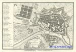
"A Plan of the City of Berlin" by John Andrews, detailed copper engraved city plan published by John Stockdale in A .. Description of the Empire of Germany, Holland, the Netherlands ..., 1800. This plan was first published in 1776. Very good condition with good margins and full plate mark. Size 25.5 x 17.5 cms. Ref F5887

 
Germany, Augsburg city plan, 1800

Germany, Augsburg city plan, 1800.
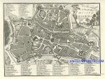
"A Plan of the City of Augsburg" by John Andrews, detailed copper engraved city plan published by John Stockdale in A .. Description of the Empire of Germany, Holland, the Netherlands ..., 1800. This plan was first published in 1776. Extremely slight foxing, otherwise very good condition with good margins and full plate mark. Size 21.5 x 16.5 cms. Ref F5886

 
Malta, Valletta city plan, 1786 / 1800

Malta, Valletta city plan, 1786 / 1800.
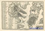
"A Plan of the City of Malta" by John Andrews, detailed copper engraved city plan published by John Stockdale in A .. Description of the Empire of Germany, Holland, the Netherlands ..., 1800. This plan was first published in 1776. Very good condition with good margins and full plate mark. Size 26 x 17.5 cms. Ref F5885


Ireland, route map from Loughrea to Bruss, 1783

Ireland, route map from Loughrea to Bruss, 1783.
[ The end of the Loughrea to Bruss route ] engraved by G.Terry and published in Taylor and Skinner's Maps of the Roads of Ireland, (2nd edition), 1783. Includes Killaloe, Tullow, and Bruss. On the verso is the start of the same route, with Loughrea, and the road past the Shannon River. Copper engraved map. Size 12 x 21.5 cms plus good margins. Ref F5884

 
Ireland, route map from Galway to Ballinamore, 1783

Ireland, route map from Galway to Ballinamore, 1783.
[ The start of the Galway to Ballinamore route ] engraved by G.Terry and published in Taylor and Skinner's Maps of the Roads of Ireland, (2nd edition), 1783. Includes Galway, Monivea and castle Blakeney. On the verso is the Galway to Tuam & Dunmore route. Copper engraved map. Size 12 x 21.5 cms plus good margins. Ref F5883

 
Ireland, route map from Birr to Killenaule, 1783

Ireland, route map from Birr to Killenaule, 1783.
[ The end of the Birr to Killenaule route ] engraved by G.Terry and published in Taylor and Skinner's Maps of the Roads of Ireland, (2nd edition), 1783. The route is via Thurles and Shanbally. On the verso is the start of this route, with Birr, Roserea and Clonakilly. Copper engraved map. Size 12 x 21.5 cms plus good margins. Ref F5882


Ireland, route map from Portumna to Gort, 1783

Ireland, route map from Portumna to Gort, 1783.
[ The Portumna to Gort route ] engraved by G.Terry and published in Taylor and Skinner's Maps of the Roads of Ireland, (2nd edition), 1783. On the verso is the Kilfenora to Kilrush route, via Innistymond. Copper engraved map. Size 12 x 21.5 cms plus good margins. Ref F5881

 
Ireland, route map from Birr to Loughrea, 1783

Ireland, route map from Birr to Loughrea, 1783.
[ The Birr to Loughrea route ] engraved by G.Terry and published in Taylor and Skinner's Maps of the Roads of Ireland, (2nd edition), 1783. The route passes through Portumna and Tynagh. On the verso is the Philipstown to Naas via Kildare and through the Curragh route, via Edenderry and Rathangan and Clonbullock. Copper engraved map. Size 12 x 21.5 cms plus good margins. Ref F5880

 
Ireland, route map from Clare to Kilrush, 1783

Ireland, route map from Clare to Kilrush, 1783.
[ The Clare to Kilrush route ] engraved by G.Terry and published in Taylor and Skinner's Maps of the Roads of Ireland, (2nd edition), 1783. Route includes Clare, Redgate Inn, Kilmurry and Kilrush. On the verso is the Ennis to Innistymond and to Kilsenora route, via Corrosin. Copper engraved map. Size 12 x 21.5 cms plus good margins. Ref F5879


Ireland, route map from Nenagh to Portumna, 1783

Ireland, route map from Nenagh to Portumna, 1783.
[ The Nenagh to Portumna route ] engraved by G.Terry and published in Taylor and Skinner's Maps of the Roads of Ireland, (2nd edition), 1783. On the verso is the Charleville to Rathkeale route, and the Tipperary to Kilmallock route. Copper engraved map. Size 12 x 21.5 cms plus good margins. Ref F5878

 
Ireland, route map from Callen to Fethard and to Cashell, 1783

Ireland, route map from Callen to Fethard and to Cashell, 1783.
[ The Callen to Fethard and to Cashell route ] engraved by G.Terry and published in Taylor and Skinner's Maps of the Roads of Ireland, (2nd edition), 1783. On the verso is the Cashell to Callen via Killenaule route. Copper engraved map. Size 12 x 21.5 cms plus good margins. Ref F5877

 
Ireland, route map from Clonmell to Thurles Nenagh & Birr, 1783

Ireland, route map from Clonmell to Thurles Nenagh & Birr, 1783.
[ The end of the Clonmell to Thurles Nenagh & Birr route ] engraved by G.Terry and published in Taylor and Skinner's Maps of the Roads of Ireland, (2nd edition), 1783. Includes Burrosaleigh, Nenagh and Moderenny. On the verso is the continuation to Templemore and to Birr, and the Birr to Burris-a-kane route. Copper engraved map. Size 12 x 21.5 cms plus good margins. Ref F5876

 
« Previous | 1470 | 1471 | 1472 | 1473 | 1474 | 1475 | 1476 | 1477 | 1478 | 1479 | 1480... | Next »


© 2003 - 2020 Website copyright Steve Bartrick
Royalty free stock images of antique prints of interest to historians, students and family history researchers