Home » All prints and maps

 
Ireland, route map with Cahier, Clogheen, Kilkenny, Freshford & Urlingford, 1783

Ireland, route map with Cahier, Clogheen, Kilkenny, Freshford & Urlingford, 1783.
[ Part of the Dublin to Clogheen route ] engraved by G.Terry and published in Taylor and Skinner's Maps of the Roads of Ireland, (2nd edition), 1783. Includes Cahier, Clogheen. Plus the Kilkenny via Freshford to Urlingford route. On the verso is part of the Tipperary & Kilworth route, including Tipperary, Galbally, Mitchellstown & Killworth. Copper engraved map. Size 12 x 21.5 cms plus good margins. Ref F5749

 
Ireland, route map with Cashell, Goolden and Lanesborough, 1783

Ireland, route map with Cashell, Goolden and Lanesborough, 1783.
[ Part of the Dublin to Tipperary route ] engraved by G.Terry and published in Taylor and Skinner's Maps of the Roads of Ireland, (2nd edition), 1783. Includes Cashell, Goolden and Lanesborough. On the verso is part of the Dublin to Kilworth route, including Thurles, Urlingford & Johnstown. Copper engraved map. Size 12 x 21.5 cms plus good margins. Ref F5748

 
Ireland, route map with Maryborough, Ballynakill & Kilkenny, 1783

Ireland, route map with Maryborough, Ballynakill & Kilkenny, 1783.
[ Part of the Dublin to Tipperary route ] engraved by G.Terry and published in Taylor and Skinner's Maps of the Roads of Ireland, (2nd edition), 1783. Includes Maryborough, Ballynakill & Kilkenny. On the verso is part of the Dublin to Dingle route, including Dingle. Copper engraved map. Size 12 x 21.5 cms plus good margins. Ref F5747


Ireland, route map with Tralee, Castle Island & Abbey Feale, 1783

Ireland, route map with Tralee, Castle Island & Abbey Feale, 1783.
[ Part of the Dublin to Tralee route ] engraved by G.Terry and published in Taylor and Skinner's Maps of the Roads of Ireland, (2nd edition), 1783. Includes Tralee, Castle Island & Abbey Feale. On the verso is part of the Dublin to Dingle route, including Dingle. Copper engraved map. Size 12 x 21.5 cms plus good margins. Ref F5746

 
Ireland, route map with Tralee, Ardfert, Listowell & Glynn, 1783

Ireland, route map with Tralee, Ardfert, Listowell & Glynn, 1783.
[ Part of the Dublin to Tralee route ] engraved by G.Terry and published in Taylor and Skinner's Maps of the Roads of Ireland, (2nd edition), 1783. Includes Tralee, Ardfert, Listowell, Shanagolden & Glynn. On the verso is the previous part of this route, including Listowell, Abbydorny and Abbey Feale. Copper engraved map. Size 12 x 21.5 cms plus good margins. Ref F5745

 
Ireland, route map with Askeyton, Rathkeale, Newcastle & Shanagolden, 1783

Ireland, route map with Askeyton, Rathkeale, Newcastle & Shanagolden, 1783.
[ Part of the Dublin to Tralee route ] engraved by G.Terry and published in Taylor and Skinner's Maps of the Roads of Ireland, (2nd edition), 1783. Includes Askeyton, Rathkeale, Newcastle & Shanagolden. On the verso is the start of this route, including Limerick and Adair. Copper engraved map. Size 12 x 21.5 cms plus good margins. Ref F5744


Ireland, route map with Limerick, Newport & Shannon River, 1783

Ireland, route map with Limerick, Newport & Shannon River, 1783.
[ Part of the Dublin to Limerick route ] engraved by G.Terry and published in Taylor and Skinner's Maps of the Roads of Ireland, (2nd edition), 1783. Includes Limerick, Newport & Shannon River. On the verso is part of the Dublin to Ennis route, including Nenagh, and Killaloe. Copper engraved map. Size 12 x 21.5 cms plus good margins. Ref F5743

 
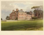
Devon, Pynes house, 1880

Devon, Pynes house, 1880.
"Pynes" colour woodblock print published in Morris's County Seats ..., about 1880. Good condition. Size 19.5 x 15.5 cms plus title and margins. Ref F5742

 
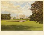
Berkshire, Cliveden, 1880

Berkshire, Cliveden, 1880.
"Cliveden" colour woodblock print published in Morris's County Seats ..., about 1880. Good condition. Size 19.5 x 15.5 cms plus title and margins. Ref F5741


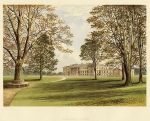
Scotland, Lanarkshire, Hamilton Palace, 1880

Scotland, Lanarkshire, Hamilton Palace, 1880.
"Hamilton Palace" colour woodblock print published in Morris's County Seats ..., about 1880. Good condition. Size 19.5 x 15.5 cms plus title and margins. Ref F5740

 
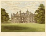
Leicestershire, Willesley Hall, 1880

Leicestershire, Willesley Hall, 1880.
"Willesley Hall" colour woodblock print published in Morris's County Seats ..., about 1880. Good condition. Size 19.5 x 15.5 cms plus title and margins. Ref F5739

 
Durham, Brancepath Castle, 1880

Durham, Brancepath Castle, 1880.
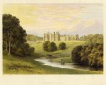
"Brancepath Castle" colour woodblock print published in Morris's County Seats ..., about 1880. Slight foxing in the margins, otherwise good condition. Size 19.5 x 15.5 cms plus title and margins. Ref F5738


Surrey, Bagshot Park, 1880

Surrey, Bagshot Park, 1880.
"Bagshot Park" colour woodblock print published in Morris's County Seats ..., about 1880. Some foxing, otherwise good condition. Size 19.5 x 15.5 cms plus title and margins. Ref F5737

 
Austria, Castle of Durrenstein, 1840

Austria, Castle of Durrenstein, 1840.
"Castle of Durrenstein (Austria)" engraved by J.Cousen after a drawing by W.H.Bartlett, published in The Danube .. Illustrated, about 1840. Steel engraved antique print, good condition. Size 17 x 15.5 cms including title, plus margins. Ref F5736

 
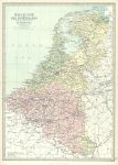
Belgium & the Netherlands, 1885

Belgium & the Netherlands, 1885.
"Belgium and the Netherlands with the Grand Duchy of Luxembourg" by J.Bartholomew, colour lithographic map published in The Popular Atlas of the World, 1885. Centrefold as published, good condition. Size 29 x 41 cms plus good margins. Ref F5735


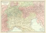
Switzerland and the Alps, 1885

Switzerland and the Alps, 1885.
"Switzerland and the Alps" by J.Bartholomew, colour lithographic map published in The Popular Atlas of the World, 1885. Centrefold as published, good condition. Size 41 x 29 cms plus good margins. Ref F5734

 
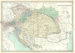
Austria-Hungary, 1885

Austria-Hungary, 1885.
"Austria-Hungary" by J.Bartholomew, colour lithographic map published in The Popular Atlas of the World, 1885. Centrefold as published, good condition. Size 41 x 29 cms plus good margins. Ref F5733

 
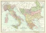
Italy, Greece & Balkans, 1885

Italy, Greece & Balkans, 1885.
"Italy, Turkey in Europe, Greece, Roumania, Servia &c." by J.Bartholomew, colour lithographic map published in The Popular Atlas of the World, 1885. Centrefold as published, good condition. Size 41 x 30 cms plus good margins. Ref F5732

 
« Previous | ...1470 | 1471 | 1472 | 1473 | 1474 | 1475 | 1476 | 1477 | 1478 | 1479 | 1480... | Next »


© 2003 - 2020 Website copyright Steve Bartrick
Royalty free stock images of antique prints of interest to historians, students and family history researchers