Please see my main site ANTIQUEPRINTS.COM For original antique prints and maps
Charing Cross - 1837
Home » Antique maps » All prints and maps
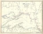
North America, Lake Superior map, 1832. "North America Sheet IV, Lake Superior " engraved by J. & C. Walker, published by The Society for the Diffusion of Useful Knowledge (SDUK), 1832. Steel engraved map with original hand colour. Right margin close trimmed. Size 39 x 30.5 cms. Ref F5222
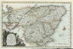
Northern Scotland map, Conder, 1785. "A New Map of the Counties of Orkney, Cathness, Sutherland, Ross & Cromarty ..." together with small maps of the Shetland and Orkney Isles. engraved by T.Conder and published by Alex Hogg, London, about 1785. Copper engraved antique map with recent hand colouring. Lower margin close trimmed, otherwise good condition.Size 32 x 20 cms plus margins. Ref F5221
Central Scotland map, Conder, 1785. "A New Map of the Middle Part of Scotland ..." engraved by T.Conder and published by Alex Hogg, London, about 1785. Copper engraved antique map with recent hand colouring. Lower margin close trimmed, otherwise good condition.Size 33 x 21.5 cms plus margins. Ref F5220
The World in Hemispheres, 1827. "The World" drawn and engraved by Sidney Hall, published in A general Atlas of Ancient & Modern Geography, 1827. Steel engraved antique map with original hand colouring. Centrefold as published. Size 38.5 x 21 cms plus margins. Ref F5219
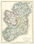
Ireland map, 1827. "Ireland" drawn and engraved by Sidney Hall, published in A general Atlas of Ancient & Modern Geography, 1827. Steel engraved antique map with original hand colouring. Size 18.5 x 24.5 cms plus margins. Ref F5218
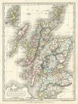
Scotland, 1827. "Scotland" drawn and engraved by Sidney Hall, published in A general Atlas of Ancient & Modern Geography, 1827. Steel engraved antique map with original hand colouring. Size 18.5 x 25 cms plus margins. Ref F5217
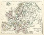
Europe, 1827. "Europe" drawn and engraved by Sidney Hall, published in A general Atlas of Ancient & Modern Geography, 1827. Steel engraved antique map with original hand colouring. Size 24 x 18.5 cms plus margins. Ref F5216
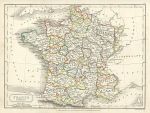
France in Provinces, 1827. "France in Provinces" drawn and engraved by Sidney Hall, published in A general Atlas of Ancient & Modern Geography, 1827. Steel engraved antique map with original hand colouring. Size 23.5 x 18 cms plus margins. Ref F5215
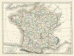
France in Departments, 1827. "France in Departments" drawn and engraved by Sidney Hall, published in A general Atlas of Ancient & Modern Geography, 1827. Steel engraved antique map with original hand colouring. Size 24 x 18 cms plus margins. Ref F5214
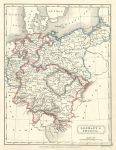
Germany & Prussia, 1827. "Germany & Prussia" drawn and engraved by Sidney Hall, published in A general Atlas of Ancient & Modern Geography, 1827. Steel engraved antique map with original hand colouring. Size 18 x 24 cms plus margins. Ref F5213
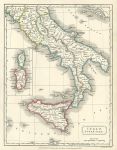
South Italy, 1827. "Italy, South Part" drawn and engraved by Sidney Hall, published in A general Atlas of Ancient & Modern Geography, 1827. Steel engraved antique map with original hand colouring. Size 18.5 x 24.5 cms plus margins. Ref F5212
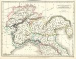
North Italy & Switzerland, 1827. "North Italy and Switzerland" drawn and engraved by Sidney Hall, published in A general Atlas of Ancient & Modern Geography, 1827. Steel engraved antique map with original hand colouring. Size 24.5 x 19 cms plus narrow margins. Ref F5211
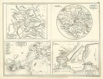
Ancient Rome, Athens & Syracuse, 1827. "Chorographia Romana", "Vicinia Romana" , "Chorographia Atheniensis" and "Chorographia Syracusana" (ancient Rome, Athens & Syracuse) drawn and engraved by Sidney Hall, published in A general Atlas of Ancient & Modern Geography, 1827. Steel engraved map. Very slight age browning. Size 24.5 x 18.5 cms plus margins. Ref F5210
Ireland, route map with Toomavara, Nenagh and O'Briens Bridge Road, 1783. [ Part of the Dublin to Limerick route ] engraved by G.Terry and published in Taylor and Skinner's Maps of the Roads of Ireland, (2nd edition), 1783. Includes Toomavara, Nenagh and O'Briens Bridge Road. On the verso is part of the same route, including Maryboro, Montrath, Burros in Ossory and Roserea. Copper engraved map. Size 12 x 21.5 cms plus good margins. Ref F5119
Ireland, route map with Dublin, Racool, Johnstown and Naas, 1783. [ Part of the Dublin to Limerick route ] engraved by G.Terry and published in Taylor and Skinner's Maps of the Roads of Ireland, (2nd edition), 1783. Includes Dublin, Racool, Johnstown and Naas. On the verso is part of the same route, including Naas, Kildare, Monasterevan and Ratheen Common. Copper engraved map. Size 12 x 21.5 cms plus good margins. Ref F5118
Ireland, route map with Dublin, Lucan, Cellbridge and Killybegs, 1783. [ Part of the Dublin to Kildare & Portarlington route ] engraved by G.Terry and published in Taylor and Skinner's Maps of the Roads of Ireland, (2nd edition), 1783. Includes Dublin, Lucan, Cellbridge and Killybegs. On the verso is part of the same route, including Grand Canal, Kildare and Portarlington. Copper engraved map. Size 12 x 21.5 cms plus good margins. Ref F5117
Ireland, route map with Dublin, Leixlip, Maynooth and Trim, 1783. [ The Dublin to Trim route via Killcock ] engraved by G.Terry and published in Taylor and Skinner's Maps of the Roads of Ireland, (2nd edition), 1783. Includes Dublin, Leixlip, Maynooth and Trim. On the verso is part of the Dublin to Ennis route, including Loughrea, Gort, Crusheen and Ennis. Copper engraved map. Size 12 x 21.5 cms plus good margins. Ref F5116
Ireland, route map with Loughrea and Athenry, 1783. [ Part of the Dublin to Birr route ] engraved by G.Terry and published in Taylor and Skinner's Maps of the Roads of Ireland, (2nd edition), 1783. Includes Loughrea and Athenry. On the verso is part of the Dublin to Galway route, including Oranmore, Galway and Barracks on Lough Corrib. Copper engraved map. Size 12 x 21.5 cms plus good margins. Ref F5115
© 2003 - 2020 Website copyright Steve Bartrick Royalty free stock images of antique prints of interest to historians, students and family history researchers