Please see my main site ANTIQUEPRINTS.COM For original antique prints and maps
Charing Cross - 1837
Home » Antique maps » All prints and maps
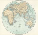
Eastern Hemisphere, 1878. "Eastern Hemisphere" colour lithographic map published in Illustrated History of The British Empire in India and the East, 1878. Centrefold as published, close cropped to upper and lower margins. Size 25 x 25 cms, plus margins. Ref F5105
Ireland, route map with Birr, Banagher & Eyre Court, 1783. [ Part of the Dublin to Galway & Birr route ] engraved by G.Terry and published in Taylor and Skinner's Maps of the Roads of Ireland, (2nd edition), 1783. Includes Birr, Banagher & Eyre Court. On the verso is part of the same route, including Heronsbrooke and Ballydugan. Copper engraved map. Size 12 x 21.5 cms plus good margins. Ref F5103
Ireland, route map with Balliboy, Frankford & Cloghan, 1783. [ Part of the Dublin to Galway & Birr route ] engraved by G.Terry and published in Taylor and Skinner's Maps of the Roads of Ireland, (2nd edition), 1783. Includes Balliboy, Frankford & Cloghan. On the verso is part of the same route, including Philipstown, Ballinagar, Killeigh and Tullamore. Copper engraved map. Size 12 x 21.5 cms plus good margins. Ref F5103
Ireland, route map with Dublin, Leixlip and Maynooth, 1783. [ Part of the Dublin to Galway route ] engraved by G.Terry and published in Taylor and Skinner's Maps of the Roads of Ireland, (2nd edition), 1783. Includes Dublin, Pulmers Town, Leixlip and Maynooth. On the verso is part of the same route, including Kilcock, Cloncurry, Johnston Bridge, Castlecarbery and Edenderry. Copper engraved map. Size 12 x 21.5 cms plus good margins. Ref F5102
Ireland, route map with Kilbeggan, Clara, and Fearbane, 1783. [ Part of the Dublin to Loughrea route ] engraved by G.Terry and published in Taylor and Skinner's Maps of the Roads of Ireland, (2nd edition), 1783. Includes Kilbeggan, Clara, Ballycumber and Fearbane. On the verso is part of the same route, including Ballinasloe, Aghrim and Loughrea. Copper engraved map. Size 12 x 21.5 cms plus good margins. Ref F5101
Ireland, route map with Newtown Bellew, Tuam & Hollymount, 1783. [ Part of the Dublin to Castlebar route ] engraved by G.Terry and published in Taylor and Skinner's Maps of the Roads of Ireland, (2nd edition), 1783. Includes Newtown Bellew, Tuam & Hollymount. On the verso is part of the same route, including Athlone, Balliforan and Mt. Bellew. Copper engraved map. Size 12 x 21.5 cms plus good margins. Ref F5100
Ireland, route map with Castlebar, Balcarra & Newport, 1783. [ Part of the Dublin to Castlebar and Newport route ] engraved by G.Terry and published in Taylor and Skinner's Maps of the Roads of Ireland, (2nd edition), 1783. Includes Castlebar, Balcarra and Newport. On the verso is part of a route from Dublin to Dunmore, including Ballinamore, Ahascragh, Newtown Bellew and Dunmore. Copper engraved map. Size 12 x 21.5 cms plus good margins. Ref F5099
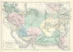
Iraq, Iran, Afghansitan & Pakistan, 1856. "Persia and Afghanistan" engraved by Sidney Hall, published in Black's General Atlas, 1856. Lithographic map with original hand colouring. Good condition. Size 37.5 x 26 cms plus margins. Ref F5058
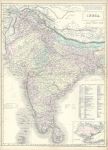
Large map of India, with Singapore, 1856. "India" (with inset of Singapore) engraved by Sidney Hall, published in Black's General Atlas, 1856. Double page lithographic map with original hand colouring. centrefold as published. Split in fold to left side of about 2 cms, just into neatline (no loss), narrow right margin and very slight browning to page edges. Size 42 x 57 cms plus margins. Ref F5057
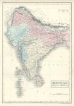
India, 1856. "Hindustan, with Part of Cabul" engraved by Sidney Hall, published in Black's General Atlas, 1856. Lithographic map with original hand colouring. Good condition. Size 26 x 38 cms plus margins. Ref F5056
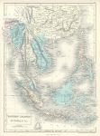
Burma & the Malay Peninsula, 1856. "Eastern Islands, Birmah &c." engraved by Sidney Hall, published in Black's General Atlas, 1856. Lithographic map with original hand colouring. Good condition. Size 28 x 37 cms plus margins. Ref F5055
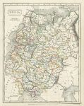
Russia map, 1827. "Russia" drawn and engraved by Sidney Hall, published in General Atlas of Ancient and Modern Geography, 1827. Steel engraved antique map with original outline hand colouring. Size 18.5 x 24 cms plus margins. Ref F5007
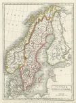
Denmark, Sweden & Norway map, 1827. "Denmark, Sweden & Norway" drawn and engraved by Sidney Hall, published in General Atlas of Ancient and Modern Geography, 1827. Steel engraved antique map with original outline hand colouring. Size 18 x 24.5 cms plus margins. Ref F5006
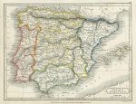
Spain & Portugal map, 1827. "Spain & Portugal" drawn and engraved by Sidney Hall, published in General Atlas of Ancient and Modern Geography, 1827. Steel engraved antique map with original outline hand colouring. Size 24.5 x 18.5 cms plus margins. Ref F5005
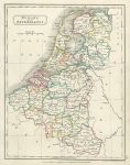
Holland and the Netherlands map, 1827. "Holland and the Netherlands" drawn and engraved by Sidney Hall, published in General Atlas of Ancient and Modern Geography, 1827. Steel engraved antique map with original outline hand colouring. Size 18.5 x 24 cms plus margins. Ref F5004
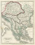
Turkey in Europe & Hungary, 1827. "Turkey in Europe & Hungary" drawn and engraved by Sidney Hall, published in General Atlas of Ancient and Modern Geography, 1827. Steel engraved antique map with original outline hand colouring. Size 19 x 24.5 cms plus margins. Ref F5003
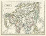
Asia map, 1827. "Asia" drawn and engraved by Sidney Hall, published in General Atlas of Ancient and Modern Geography, 1827. Steel engraved antique map with original outline hand colouring. Size 23.5 x 18.5 cms plus margins. Ref F5002
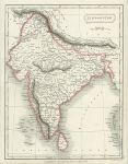
India (Hindoostan) map, 1827. "Hindoostan" (India) drawn and engraved by Sidney Hall, published in General Atlas of Ancient and Modern Geography, 1827. Steel engraved antique map with original outline hand colouring. Size 18.5 x 24.5 cms plus margins. Ref F5001
© 2003 - 2020 Website copyright Steve Bartrick Royalty free stock images of antique prints of interest to historians, students and family history researchers