Please see my main site ANTIQUEPRINTS.COM For original antique prints and maps
Charing Cross - 1837
Home » Antique maps » World and other maps
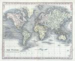
The World on Mercator's Projection, 1850. "The World on Mercator's Projection" drawn and engraved by Jojn Dower, published about 1850. Steel engraved map with recent hand colour. Faults - two folds as published, the centrefold having splits to the upper and lower 2 cms with a small amount of loss to upper tear. Size 26 x 21 cms plus margins. Ref F1102
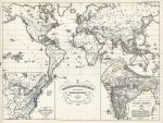
British Empire, published 1846. "Grossbritannien's saemmtliche Besitzungen mit Angabe ihrer Erwerbungszeit" (British Empire) published in Spruner's Historisch-Geographischer hand-Atlas, 1846. Detailed steel engraved map with original hand colouring. Insets - North America in 1783 and India in 1760. Narrow left margin of about 1cm. Size 42 x 31 cms plus margins. Ref F927
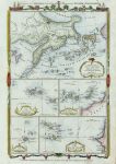
North Pacific and several Atlantic Islands, 1782. "Chart of the New Northern Archipelago; discover'd by the Russians in the seas of Kamtschatka & Anadir" with "Chart of the Canary Isles &c.", "Chart of the Cape Verd Isles", "Chart of the Madera Isles" and "Chart of the Azores or Western Isles". Five maps on one sheet published in Millar's New Complete & Universal System of Geography, about 1782. Good condition with plate mark and good margins. Size 20 x 30.5 cms plus margins. Ref F903
Asia, 1770. "A Map of Asia from the Sieur Robert ..." wngraved by J.Lodge and published in Brooke's Gazetteer, about 1770. Copper engraved map with recent hand colouring. Two vertical folds as published, creasing parallel to the folds and noticeable soiling to the right side, narrow upper margin. Size 29.5 x 19 cms plus margins. Ref F902
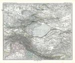
North India and Central Asia, 1879. "Indien & Inner-Asien. Nordliches Blatt" (centered on old Turkestan) published in Adolf Stieler's Hand Atlas Uber Alle Theile Der Erde ..., 1879. Extremely detailed steel engraved map with original hand colour, centrefold as published. Good condition with good margins. Size 40.5 x 33 cms, plus margins. Ref F748
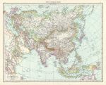
Asia, 1895. "Asia (general map)" colour lithographic map published in The Times Atlas, 1895. Centrefold as published. Size 47 x 38 cms plus margins. Ref F584
China & Japan, 1895. "China & Japan" colour lithographic map published in The Times Atlas, 1895. Inset maps of the Tokyo and peking areas. Size 36.5 x 24 cms plus margins. Ref F582
Japan, 1895. "Japan" colour lithographic map published in The Times Atlas, 1895. Inset maps of several small islands. Size 25 x 37 cms plus margins. Ref F581
Burma & the Malay Peninsula, 1895. "Burma and the Malay Peninsula" colour lithographic map published in The Times Atlas, 1895. Size 24 x 37.5 cms plus margins. Ref F575
Siam and the Malay Archipelago, 1895. "Siam and the Malay Archipelago" (East Indies) colour lithographic map published in The Times Atlas, 1895. Inset map of Java. Size 37 x 24 cms plus margins. Ref F573
The World in Hemispheres, 1842. "The Western Hemisphere" and "The Eastern Hemisphere" engraved and published by G.F.Cruchley in Cruchley's Improved Atlas for Schools and Families, 1841. Pair of lithographic maps with full original hand colouring. Centrefolds as published, slight foxing and some age browning to fold areas. Close trimmed to lower margin, almost to image edge. Size 35.5 x 36 cms each, plus margins. Ref F471
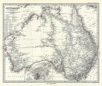
Australia, 1879. "Australien" (Australia) published in Adolf Stieler's Hand Atlas Uber Alle Theile Der Erde ..., 1879. Very detailed steel engraved map with original hand colour, centrefold as published. Inset plan of Sydney and Port Jackson. Good condition. Size 41 x 33.5 cms, plus margins. Ref F412
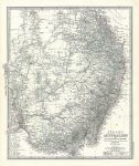
South East Australia, 1879. "Sud-Ost Australien" (Australia) published in Adolf Stieler's Hand Atlas Uber Alle Theile Der Erde ..., 1879. Extremely detailed steel engraved map with original hand colour, centrefold as published. Very good condition. Size 34.5 x 41cms, plus margins. Ref F411
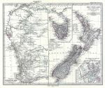
New Zealand & Western Australia, 1879. "Neu-Seeland" and "West-Australien" published in Adolf Stieler's Hand Atlas Uber Alle Theile Der Erde ..., 1879. Extremely detailed steel engraved map with original hand colour, centrefold as published. Insets showing Tasmania and Isthmus of Auckland. Very good condition. Size 41 x 34 cms, plus margins. Ref F410
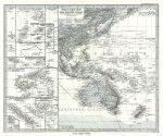
Pacific Ocean (Western half), 1879. "Polynesien und der Grosse Ocean ..." published in Adolf Stieler's Hand Atlas Uber Alle Theile Der Erde ..., 1879. Extremely detailed steel engraved map with original hand colour, centrefold as published. Many insets showing Pacific Islands including Samoa, Fiji, New Caledonia etc. Very good condition. Size 40.5 x 33 cms, plus margins. Ref F409
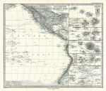
Pacific Ocean (Eastern half), 1879. "Polynesien und der Grosse Ocean" published in Adolf Stieler's Hand Atlas Uber Alle Theile Der Erde ..., 1879. Detailed steel engraved map with original hand colour. Many insets showing Pacific Islands including Tahiti, Hawaii, Galapagos etc. Centrefold as published, good condition with plate mark and good margins. Size 40 x 33.5 cms plus margins. Ref F408
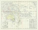
Oceania, 1830. "Carte de L'Oceanie ou 5e Partie du Monde" by L.HacBette, published by H.Selves, Paris, 1830. Interesting early lithographic map with original hand colouring. Centrefold as published. Good condition. Size 41.5 x 32.5 cms plus good margins. Ref F378
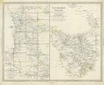
Western Australia & Tasmania, SDUK, 1844. "Western Australia" and "Van Diemen Island" engraved by J & C Walker, published by The Society for the Diffusion of Useful Knowledge (SDUK), 1844. Steel engraved map with original hand colour. Very slight soiling near the edges, otherwise good condition with good margins. Size 39 x 31 cms plus margins. Ref F376
© 2003 - 2020 Website copyright Steve Bartrick Royalty free stock images of antique prints of interest to historians, students and family history researchers