Please see my main site ANTIQUEPRINTS.COM For original antique prints and maps
Charing Cross - 1837
Home » Antique maps » Europe maps >>> » UK, antique maps
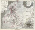
British Isles & North Sea, 1869. "Die Britischen Inseln und das Umliegende Meer" published in Adolf Stieler's Hand Atlas Uber Alle Theile Der Erde ..., 1869. Extremely detailed steel engraved map with original hand colour, centrefold as published. Inset plans of London and Crystal Palace, also small inset map of Helgoland and view of Rockall. Soiling upper left, otherwise good condition with good margins. Size 40.5 x 35 cms, plus margins. Ref E4338
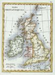
British Isles, Levasseur miniature map, 1830. " Iles Britanniques " by V.Levasseur, published in Levasseur's pocket Atlas Classique Universel de Geographie ..., about 1835. Small copper engraved map with recent hand colour. Good condition with good margins. Size 8.5 x 12.5 cms. Ref E2516
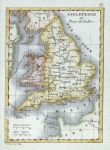
England and Wales, Levasseur miniature map, 1830. " Angleterre et Pays de Galles " by V.Levasseur, published in Levasseur's pocket Atlas Classique Universel de Geographie ..., about 1835. Small copper engraved map with recent hand colour. Good condition with good margins. Size 8.5 x 12.5 cms. Ref E2515
© 2003 - 2020 Website copyright Steve Bartrick Royalty free stock images of antique prints of interest to historians, students and family history researchers