Home » Antique maps » All prints and maps

 
Caspian Sea map, 1838

Caspian Sea map, 1838.
"Littoral de la Mer Caspienne" (Caspian Sea) steel engraved antique map with recent hand colouring, published in a volume of L'Univers, Paris, about 1838. Slight age browning. Size 11 x 18 cms including title plus margins. Ref F6179

 
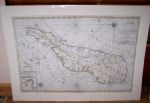
Madagascar, large map by Mortier, 1720

Madagascar, large map by Mortier, 1720.
" Carte particuliere de L'Isle Dauphine ou Madagascar..." by P. Mortier, published in his Neptune François, Amsterdam about 1720. With east to the top, includes the islands of I. De Bourbon, Santa Apolonia, I. De Ioan de Lisboa and Isles de Comorre. Lower left hand corner has an inset map of Bay St.Augustin. Click here to see further images of this map.Copper engraved map or sea chart, with recent outline hand colour. Several small closed edge tears (no loss), larger professional repair to the lower part of the centrefold, including replacement of very small area of the map (1.5 x 0.5cm) in the sea area lower centre. Size 85 x 57 cms plus good margins with full plate mark. (NOTE - my images are from a digital camera and the map is no longer in a mount.) Ref F6125

 
The Red Sea, by Niebuhr, 1772

The Red Sea, by Niebuhr, 1772.
"Mare Rubrum seu Sinus Arabicus ad observationes maximam partem ab Auctore annis MDCCLXII et MDCCLXIII institutas delineatus a C. Niebuhr" long copper engraved map of the Red Sea by Carsten Niebuhr, published about 1772 in Niebuhr's account of the Royal Danish Expedition (1761-1767) to the Middle East, Egypt, Persia and India. Recent hand colour. Several folds as this long map was originally folded into the book. Lower 14 cms detached and re-joined at some time in the past (old repair to the verso.) A scarce and interesting map. Size 21 x 77 cms plus narrow margins of about 1cm or more. Ref F6096


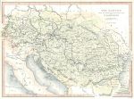
Austria, map of the Danube, 1840

Austria, map of the Danube, 1840.
"The Danube, from it's Source to the Black Sea with the adjacent Countries" drawn and engraved by W.Hughes, published in The Danube .. Illustrated, about 1840. Steel engraved antique map with recent hand colouring, narrow margins, otherwise good condition. Size 26 x 19 cms including title, plus margins. Ref F6095

 
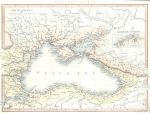
The Black Sea, 1840

The Black Sea, 1840.
"The Black Sea" drawn and engraved by W.Hughes, published in The Danube .. Illustrated, about 1840. Steel engraved antique map with recent hand colouring, narrow margins, otherwise good condition. Size 26 x 19 cms including title, plus margins. Ref F6094

 
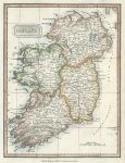
Ireland, 1828

Ireland, 1828.
"Ireland" published in Kelly's ... Geography, 1828. Copper engraved antique map with recent hand colouring. Size 18 x 24.5 cms including text, plus margins. Ref F6074


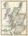
Scotland, 1828

Scotland, 1828.
"Scotland" published in Kelly's ... Geography, 1828. Copper engraved antique map with recent hand colouring. Size 19 x 24.5 cms including text, plus margins. Ref F6073

 
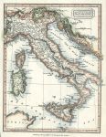
Italy, 1828

Italy, 1828.
"Italy" published in Kelly's ... Geography, 1828. Copper engraved antique map with recent hand colouring. Size 19 x 24.5 cms including text, plus margins. Ref F6072

 
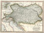
Austrian Dominions, 1828

Austrian Dominions, 1828.
"Austrian Dominions" published in Kelly's ... Geography, 1828. Copper engraved antique map with recent hand colouring. Right and lower margins close cropped to about 5mm of neatline. Size 25.5 x 18.5 cms including text, plus margins. Ref F6071


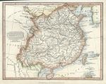
China map, 1828

China map, 1828.
"China" published in Kelly's ... Geography, 1828. Copper engraved antique map with recent hand colouring. Upper margin close cropped to about 5mm of neatline. Size 24 x 18.5 cms including text, plus margins. Ref F6070

 
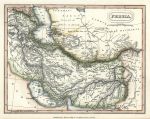
Persia map, 1828

Persia map, 1828.
"Persia" published in Kelly's ... Geography, 1828. Copper engraved antique map with recent hand colouring. Size 24 x 18.5 cms including text, plus margins. Ref F6069

 
Ireland, route map with Dublin and the Dublin Bay and Killiney Bay coast, 1783

Ireland, route map with Dublin and the Dublin Bay and Killiney Bay coast, 1783.
[ The Dublin to Black Rock, Dunleary, Bullock, Dalkey & Bray route, and Mount-Charles to Shallagan Bridge route ] engraved by G.Terry and published in Taylor and Skinner's Maps of the Roads of Ireland, (2nd edition), 1783. The verso is blank. Copper engraved map. Size 12 x 21.5 cms plus good margins. Ref F5975


Ireland, route map with Rostrevor, Rathfriland, Dromore, Moira and Lurgan, 1783

Ireland, route map with Rostrevor, Rathfriland, Dromore, Moira and Lurgan, 1783.
[ The Rostrevor to Moira and Lurgan route, via Rathfriland and Dromore ] engraved by G.Terry and published in Taylor and Skinner's Maps of the Roads of Ireland, (2nd edition), 1783. On the verso is the Newry to Ballyboy route, via Baleektown, Newtown Hamilton and Castleblaney. Copper engraved map. Size 12 x 21.5 cms plus good margins. Ref F5974

 
Ireland, route map with Headford, Tuam, Castlebar and Partree, 1783

Ireland, route map with Headford, Tuam, Castlebar and Partree, 1783.
[ The Headford to Tuam route, and start of the Castlebar to Galway route, as far as Partree ] engraved by G.Terry and published in Taylor and Skinner's Maps of the Roads of Ireland, (2nd edition), 1783. On the verso is the Westport to Partree route. Copper engraved map. Size 12 x 21.5 cms plus good margins. Ref F5973

 
Ireland, route map with Ballinrobe, Shrule and Cong, 1783

Ireland, route map with Ballinrobe, Shrule and Cong, 1783.
[ The Ballinrobe to Shrule route ] engraved by G.Terry and published in Taylor and Skinner's Maps of the Roads of Ireland, (2nd edition), 1783. On the verso is the end of the Castlebar to Galway route, including Headford, Gregg, Clare Galway and Galway. Copper engraved map. Size 12 x 21.5 cms plus good margins. Ref F5972


Ireland, route map with Castlebar, Killala and Castle Lachen, 1783

Ireland, route map with Castlebar, Killala and Castle Lachen, 1783.
[ The Castlebar to Killala and Castle Lachen route ] engraved by G.Terry and published in Taylor and Skinner's Maps of the Roads of Ireland, (2nd edition), 1783. On the verso is the start of the Ballinrobe to DSligo via Ball route (Sligo not on this map). Copper engraved map. Size 12 x 21.5 cms plus good margins. Ref F5971

 
Ireland, route map with Sligo, Ballisidere and on towards Esky Bridge, 1783

Ireland, route map with Sligo, Ballisidere and on towards Esky Bridge, 1783.
[ The start of the Sligo to Esky Bridge route ] engraved by G.Terry and published in Taylor and Skinner's Maps of the Roads of Ireland, (2nd edition), 1783. On the verso is the end of the Sligo to Castlebar route, and the Castlebar to Westport route. Copper engraved map. Size 12 x 21.5 cms plus good margins. Ref F5970

 
Ireland, route map from Sligo to Ballyshannon, 1783

Ireland, route map from Sligo to Ballyshannon, 1783.
[ The Sligo to Ballyshannon route ] engraved by G.Terry and published in Taylor and Skinner's Maps of the Roads of Ireland, (2nd edition), 1783. On the verso is the end of the Sligo to Esky Bridge and Ballina route, including Esky Bridge & Ballina. Copper engraved map. Size 12 x 21.5 cms plus good margins. Ref F5969

 
« Previous | ...100 | 101 | 102 | 103 | 104 | 105 | 106 | 107 | 108 | 109 | 110... | Next »


© 2003 - 2020 Website copyright Steve Bartrick
Royalty free stock images of antique prints of interest to historians, students and family history researchers