Please see my main site ANTIQUEPRINTS.COM For original antique prints and maps
Charing Cross - 1837
Home » Antique maps » All prints and maps
Ireland, route map with Trim, Kells, Slane and Navan, 1783. [ The Trim to Kells route and Slane to Navan and Kells route, via Navan ] engraved by G.Terry and published in Taylor and Skinner's Maps of the Roads of Ireland, (2nd edition), 1783. On the verso is the start of the Lisburn to Charlemont route, with Lisburn, Moira, Magheralin and Ballinderry. Copper engraved map. Size 12 x 21.5 cms plus good margins. Ref F5950
Ireland, route map with Charlemont, Armagh, Tynan and Keady, 1783. [ The end of the Lisburn to Charlemont & Keady route ] engraved by G.Terry and published in Taylor and Skinner's Maps of the Roads of Ireland, (2nd edition), 1783. Includes Charlemont, Keady, Armagh and Tynan. On the verso is the Lurgan to Loughgall route, via Portadown and Richill. Copper engraved map. Size 12 x 21.5 cms plus good margins. Ref F5949
Ireland, route map with Coote Hill, Ballyhays, Cavan & Clones, 1783. [ The Rockcorry to Cavan and Clones route ] engraved by G.Terry and published in Taylor and Skinner's Maps of the Roads of Ireland, (2nd edition), 1783. Includes Rockcorry, Coote Hill, Ballyhays, Cavan and Clones. On the verso is the route from Callidon and Aughnacloy to Middleton, Monaghan and Castle Shane. Copper engraved map. Size 12 x 21.5 cms plus good margins. Ref F5948
Ireland, route map with Clogh, Ballymoney and Ballycastle, 1783. [ End of the Belfast to Ballymoney and Ballycastle route ] engraved by G.Terry and published in Taylor and Skinner's Maps of the Roads of Ireland, (2nd edition), 1783. Includes Clogh, Ballymoney and Ballycastle. On the verso is the start of the same route, including Belfast, Ballyclare, Kells and Ballymena. Copper engraved map. Size 12 x 21.5 cms plus good margins. Ref F5947
Ireland, route map with Colerain, Bushmills and Dervock, 1783. [ Route map with Colerain, Bushmills and Dervock ] engraved by G.Terry and published in Taylor and Skinner's Maps of the Roads of Ireland, (2nd edition), 1783. On the verso is the start of the Londonderry to Glenarm route, including Londonderry, Ballykelly and Newtown Lamavady. Copper engraved map. Size 12 x 21.5 cms plus good margins. Ref F5946
Ireland, route map with Ballycastle, Newtownglens & Glenarm, 1783. [ Route map with Ballintoy, Ballycastle, Newtownglens & Glenarm ] engraved by G.Terry and published in Taylor and Skinner's Maps of the Roads of Ireland, (2nd edition), 1783. On the verso is the start of the Newtown Limavady to Ballymoney, Kilrea, Portglenone and New Ferry route, including Garvagh. Copper engraved map. Size 12 x 21.5 cms plus good margins. Ref F5945
Ireland, route map with Kilrea, Portglenone, Dunymanagh & Clady, 1783. [ Route map with Kilrea, Newferry, Portglenone, Strabane Dunymanagh & Clady ] engraved by G.Terry and published in Taylor and Skinner's Maps of the Roads of Ireland, (2nd edition), 1783. On the verso is the Dungannon to Callidon, Aughnacloy & Ballygawly route. Copper engraved map. Size 12 x 21.5 cms plus good margins. Ref F5944
Ireland, route map with Downpatrick, Lisburn & Stoneyford, 1783. [ Start of the Downpatrick to Anrim route ] engraved by G.Terry and published in Taylor and Skinner's Maps of the Roads of Ireland, (2nd edition), 1783. Includes Downpatrick, Ballynahinch, Lisburn and Stoneyford. On the verso is the continuation, via Crumlin to Antrim, also the Dungiven to Maghera route. Copper engraved map. Size 12 x 21.5 cms plus good margins. Ref F5943
Ireland, route map with Killyleagh, Downpatrick, Ballyclare, Carrickfergus, 1783. [ The Killyleagh, Downpatrick route and Ballyclare to Carrickfergus route via Ballynure ] engraved by G.Terry and published in Taylor and Skinner's Maps of the Roads of Ireland, (2nd edition), 1783. On the verso is the Moira to Killyleagh route, via Hillsborough and Ballynahinch. Copper engraved map. Size 12 x 21.5 cms plus good margins. Ref F5942
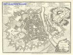
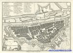
Germany, Wurtzburg (Würzburg) city plan, 1776 / 1800. "A Plan of the City of Wurtzburg" (Würzburg) by John Andrews, detailed copper engraved city plan published by John Stockdale in A .. Description of the Empire of Germany, Holland, the Netherlands ..., 1800. This plan was first published in 1776. Very good condition with good margins and full plate mark. Size 24 x 18.5 cms. Ref F5904
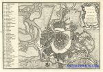
Austria, Vienna city plan, 1776 / 1800. "A Plan of the City of Vienna" by John Andrews, detailed copper engraved city plan published by John Stockdale in A .. Description of the Empire of Germany, Holland, the Netherlands ..., 1800. This plan was first published in 1776. Very good condition with good margins and full plate mark. Size 25 x 17.5 cms. Ref F5903
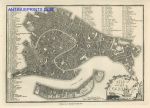
Italy, Venice city plan, 1776 / 1800. "A Plan of the City of Venice" by John Andrews, detailed copper engraved city plan published by John Stockdale in A .. Description of the Empire of Germany, Holland, the Netherlands ..., 1800. This plan was first published in 1776. Very good condition with good margins and full plate mark. Size 24.5 x 18 cms. Ref F5902
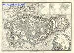
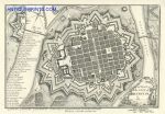
Italy, Turin city plan, 1776 / 1800. "A Plan of the City of Turin" by John Andrews, detailed copper engraved city plan published by John Stockdale in A .. Description of the Empire of Germany, Holland, the Netherlands ..., 1800. This plan was first published in 1776. Very good condition with good margins and full plate mark. Size 24.5 x 18 cms. Ref F5901
Germany, Ratisbon city plan, 1776 / 1800. "A Plan of the City of Ratisbon" by John Andrews, detailed copper engraved city plan published by John Stockdale in A .. Description of the Empire of Germany, Holland, the Netherlands ..., 1800. This plan was first published in 1776. Very good condition with good margins and full plate mark. Size 23 x 16.5 cms. Ref F5900
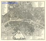
France, Paris city plan, 1776 / 1800. "A Plan of the City of Paris" by John Andrews, detailed copper engraved city plan published by John Stockdale in A .. Description of the Empire of Germany, Holland, the Netherlands ..., 1800. This plan was first published in 1776. One fold as published, otherwise very good condition with good margins and full plate mark. Size 26 x 23 cms. Ref F5899
Germany, Munich city plan, 1776 / 1800. "A Plan of the City of Munich" by John Andrews, detailed copper engraved city plan published by John Stockdale in A .. Description of the Empire of Germany, Holland, the Netherlands ..., 1800. This plan was first published in 1776. Very good condition with good margins and full plate mark. Size 23 x 17 cms. Ref F5898
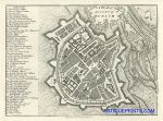
Italy, Mantua city plan, 1776 / 1800. "A Plan of the City of Mantua" by John Andrews, detailed copper engraved city plan published by John Stockdale in A .. Description of the Empire of Germany, Holland, the Netherlands ..., 1800. This plan was first published in 1776. Very good condition with good margins and full plate mark. Size 23.5 x 17 cms. Ref F5897
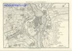
Germany, Manheim city plan, 1776 / 1800. "A Plan of the City of Manheim" by John Andrews, detailed copper engraved city plan published by John Stockdale in A .. Description of the Empire of Germany, Holland, the Netherlands ..., 1800. This plan was first published in 1776. Very good condition with good margins and full plate mark. Size 25.5 x 18 cms. Ref F5896
© 2003 - 2020 Website copyright Steve Bartrick Royalty free stock images of antique prints of interest to historians, students and family history researchers