Home » Antique maps » All prints and maps

 
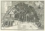
Netherlands (Holland), Amsterdam city plan, 1800

Netherlands (Holland), Amsterdam city plan, 1800.
"A Plan of the City of Amsterdam" detailed copper engraved city plan published by John Stockdale in A .. Description of the Empire of Germany, Holland, the Netherlands ..., 1800. Very good condition with good margins and full plate mark. Size 25.5 x 17.5 cms. Ref F5859

 
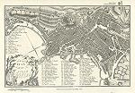
Italy, Naples city plan, 1800

Italy, Naples city plan, 1800.
"A Plan of the City of Naples" detailed copper engraved city plan published by John Stockdale in A .. Description of the Empire of Germany, Holland, the Netherlands ..., 1800. Very good condition with good margins and full plate mark. Size 25 x 16.5 cms. Ref F5858

 
The World on Sir J. Hershel's Projection, 1885

The World on Sir J. Hershel's Projection, 1885.
"The World on Sir J. Hershel's Projection" by J.Bartholomew, colour lithographic map published in The Popular Atlas of the World, 1885. With small inset maps showing distribution of Human Races, temperature and Religions. Also shows the Ocean Currents as then known. Centrefold as published, creasing to lower corners (outside map area), otherwise good condition. Size 41 x 29 cms plus good margins. Ref F5809


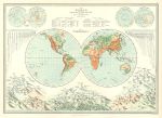
The World in hemispheres (physical), 1885

The World in hemispheres (physical), 1885.
"The World illustrating the Distribution of Land and Water with the countour of Comparative Relief of the Land" by J.Bartholomew, colour lithographic map published in The Popular Atlas of the World, 1885. With comparative views of the lengths of principal rivers and tallest mountains. Centrefold as published, creasing to lower corners (outside map area), otherwise good condition. Size 42 x 30 cms plus good margins. Ref F5808

 
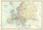
Europe, 1885

Europe, 1885.
"Europe" by J.Bartholomew, colour lithographic map published in The Popular Atlas of the World, 1885. Centrefold as published, good condition. Size 41 x 29 cms plus good margins. Ref F5807

 
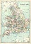
England & Wales, 1885

England & Wales, 1885.
"England & Wales" by J.Bartholomew, colour lithographic map published in The Popular Atlas of the World, 1885. Centrefold as published, very slight soiling, otherwise good condition. Size 29 x 41 cms plus good margins. Ref F5806


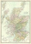
Scotland, 1885

Scotland, 1885.
"Scotland" by J.Bartholomew, colour lithographic map published in The Popular Atlas of the World, 1885. Centrefold as published, good condition. Size 29 x 41 cms plus good margins. Ref F5805

 
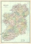
Ireland, 1885

Ireland, 1885.
"Ireland" by J.Bartholomew, colour lithographic map published in The Popular Atlas of the World, 1885. Centrefold as published, good condition. Size 29 x 41 cms plus good margins. Ref F5804

 
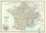
France & Switzerland, 1885

France & Switzerland, 1885.
"France & Switzerland" by J.Bartholomew, colour lithographic map published in The Popular Atlas of the World, 1885. Inset plan of the Paris area. Centrefold as published, good condition. Size 41 x 30 cms plus good margins. Ref F5803


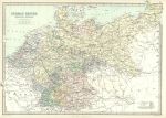
German Empire with Holland & Belgium, 1885

German Empire with Holland & Belgium, 1885.
"German Empire, Holland & Belgium" by J.Bartholomew, colour lithographic map published in The Popular Atlas of the World, 1885. Centrefold as published, good condition. Size 41 x 30 cms plus good margins. Ref F5802

 
Ireland, route map with Athy, Stradbally, Maryborough & Philipstown, 1783

Ireland, route map with Athy, Stradbally, Maryborough & Philipstown, 1783.
[ The Athy to maryborough and Maryborough to Philipstown routes ] engraved by G.Terry and published in Taylor and Skinner's Maps of the Roads of Ireland, (2nd edition), 1783. Includes Athy, Stradbally, Maryborough, Mount-Mallick, Geashill & Philipstown. On the verso is the Maryborough to Tullamore and Athy to Monasterevan routes. Copper engraved map. Size 12 x 21.5 cms plus good margins. Ref F5787

 
Ireland, route map with Leighlin Bridge, Tullow, Hacketstown & Shilelah, 1783

Ireland, route map with Leighlin Bridge, Tullow, Hacketstown & Shilelah, 1783.
[ The Leighlin Bridge, Tullow, Hacketstown & Shilelah route ] engraved by G.Terry and published in Taylor and Skinner's Maps of the Roads of Ireland, (2nd edition), 1783. Includes Leighlin Bridge, Tullow, Hacketstown & Shilelah. On the verso is the Kildare to Athy and Athy to Carlow routes. Copper engraved map. Size 12 x 21.5 cms plus good margins. Ref F5786


Ireland, route map with Carlow, Tullow, Newtown Barry & Enniscorthy, 1783

Ireland, route map with Carlow, Tullow, Newtown Barry & Enniscorthy, 1783.
[ The Carlow to Tullow and Enniscorthy to Newtown Barry routes ] engraved by G.Terry and published in Taylor and Skinner's Maps of the Roads of Ireland, (2nd edition), 1783. Includes Carlow, Tullow, Newtown Barry & Enniscorthy. On the verso is the Enniscorthy to Burris route. Copper engraved map. Size 12 x 21.5 cms plus good margins. Ref F5785

 
Ireland, route map with New-Ross, Fetland, Clomines & Tintern, 1783

Ireland, route map with New-Ross, Fetland, Clomines & Tintern, 1783.
[ The New-Ross to Fethard & Wexford to Tintern routes ] engraved by G.Terry and published in Taylor and Skinner's Maps of the Roads of Ireland, (2nd edition), 1783. Includes New-Ross, Fetland, Clomines & Tintern. On the verso is the Enniscorthy to New-Ross route. Copper engraved map. Size 12 x 21.5 cms plus good margins. Ref F5784

 
Ireland, route map with Wexford & New-Ross, 1783

Ireland, route map with Wexford & New-Ross, 1783.
[ The Wexford to New-Ross & Waterford route ] engraved by G.Terry and published in Taylor and Skinner's Maps of the Roads of Ireland, (2nd edition), 1783. Includes Wexford, Taghmon & New-Ross. On the verso is the Wexford to Waterford route. Copper engraved map. Size 12 x 21.5 cms plus good margins. Ref F5783


Ireland, route map with Dublin & Howth, 1783

Ireland, route map with Dublin & Howth, 1783.
[ The Dublin to Howth route ] engraved by G.Terry and published in Taylor and Skinner's Maps of the Roads of Ireland, (2nd edition), 1783. Includes Dublin & Howth. On the verso is part of the Dublin to Powerscourt & Rathdrum route, including Dublin, Enniskerry & Rathdrum. Copper engraved map. Size 12 x 21.5 cms plus good margins. Ref F5782

 
Ireland, route map with Rathdrum, Aghrim, Shilelagh & Clonegall, 1783

Ireland, route map with Rathdrum, Aghrim, Shilelagh & Clonegall, 1783.
[ Part of the Dublin to Clonegall & Carnew route ] engraved by G.Terry and published in Taylor and Skinner's Maps of the Roads of Ireland, (2nd edition), 1783. Includes Rathdrum, Aghrim, Shilelagh & Clonegall. On the verso is part of the Dublin to Hacketstown and Carnew to Gorey routes, including Ballybeg, Hacketstown, Carnew & Gorey. Copper engraved map. Size 12 x 21.5 cms plus good margins. Ref F5781

 
Ireland, route map with Enniscorthy, Wexford & Taghmon, 1783

Ireland, route map with Enniscorthy, Wexford & Taghmon, 1783.
[ Part of the Dublin to Wexford & Taghmon route ] engraved by G.Terry and published in Taylor and Skinner's Maps of the Roads of Ireland, (2nd edition), 1783. Includes Enniscorthy, Wexford & Taghmon. On the verso is part of the Dublin to Wexford route, including Neville Court & Wexford. Copper engraved map. Size 12 x 21.5 cms plus good margins. Ref F5780

 
« Previous | ...100 | 101 | 102 | 103 | 104 | 105 | 106 | 107 | 108 | 109 | 110... | Next »


© 2003 - 2020 Website copyright Steve Bartrick
Royalty free stock images of antique prints of interest to historians, students and family history researchers